
Some tabloid news stories appearing that suggest Hurricane Dorian is heading towards the UK next week, is there any truth in the stories?
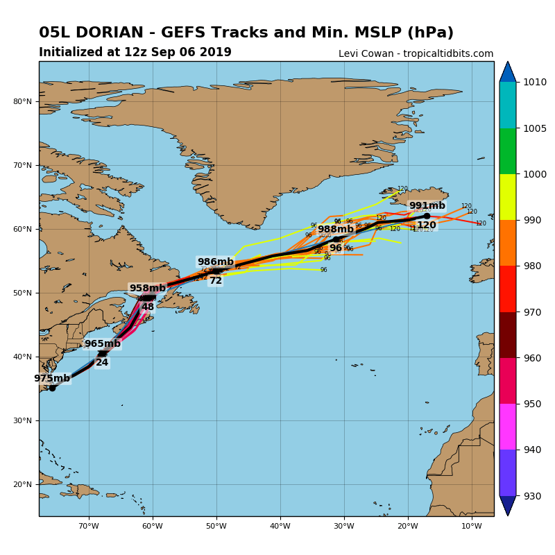
Hurricane Dorian has made the headlines this past week, following its slow rampage across the Bahamas earlier in the week as a category 5 storm during its strongest phase, leaving 30 dead and flattening entire communities on the islands. The last few days has seen Dorian take aim at the southeast U.S. coastline as it finally picked up forward speed and headed north, bringing flooding to downtown Charleston in South Carolina. Dorian made landfall over Cape Hatteras in the Outer Banks of North Carolina’s Atlantic coast today, where hurricane force winds have been felt and also a storm surge bringing flooding to low lying areas.
Dorian will exit stage right, before continuing northeast off the eastern seaboard, bringing Tropical Storm impacts to coastal northeast U.S., before paying a visit along Canada’s Atlantic coastal areas, bringing strong winds, heavy rain and rough seas to Nova Scotia and Prince Edward Island on Saturday, then affecting New Foundland Saturday night into Sunday.
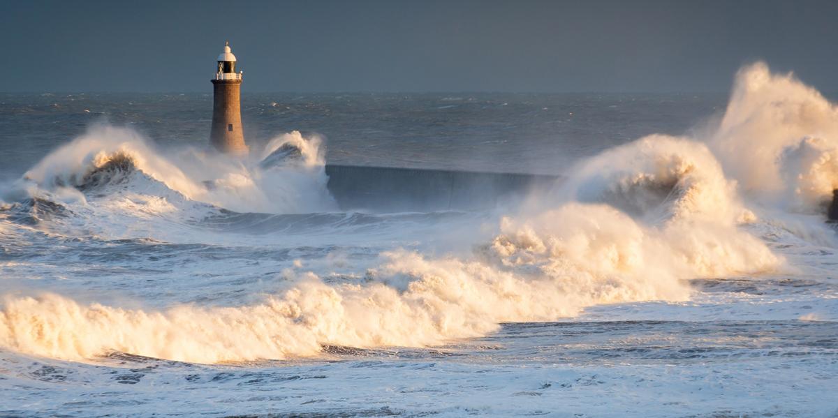
Dorian will then lose its tropical characteristics as it then moves out over the far North Atlantic ocean, the low pressure remnants of ex-Dorian tracking northeast between Iceland and Scotland later on Tuesday, but forecast as a normal and not particularly deep low pressure system, bringing some wet and windy conditions across northern Britain on Tuesday night, perhaps some large rainfall totals on western slopes given the appreciable tropical moisture wrapping up into this low off the Atlantic. The rain reaching southern areas on Wednesday morning.
Track of Dorian over the weekend and into early next week as it crosses the far North Atlantic
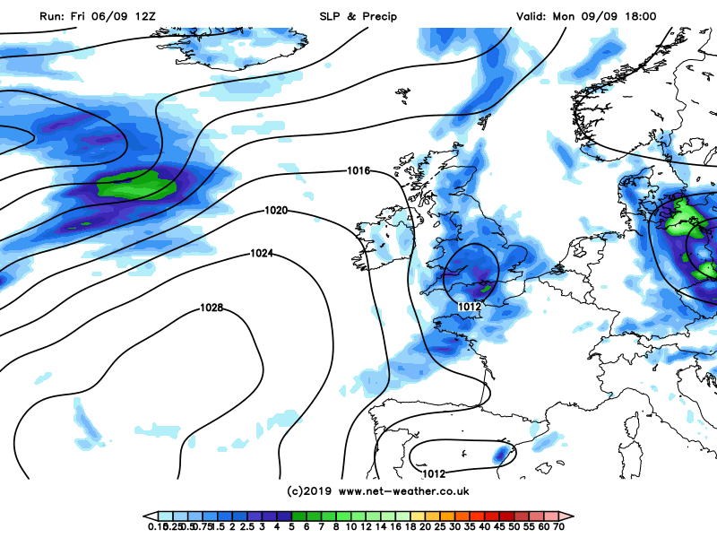
The Daily Express yesterday had a story that Dorian is headed for the UK, well it looks to pass to the north, but will bring some wet and windy conditions, but not likely “…heading to Britain to unleash storm hell...” as the story mentions.
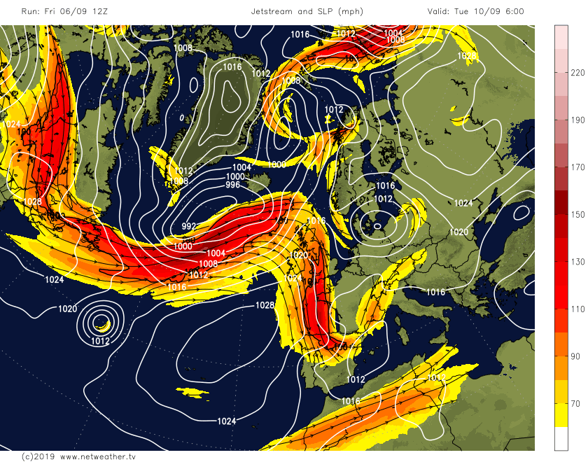
There is also another tropical storm in the tropical North Atlantic forecast to head towards the NE Atlantic to perhaps bring impacts to the UK and Ireland by Thursday. Tropical Storm Gabrielle in the mid-tropical North Atlantic is expected to become a Hurricane for a time, as the storm moves into a lower shear environment and moves over warmer waters. The storm is then expected to move quickly northeastward early next week as it's picked up by the polar front jet stream on Tuesday before heading towards the northeast Atlantic and NW Britain.
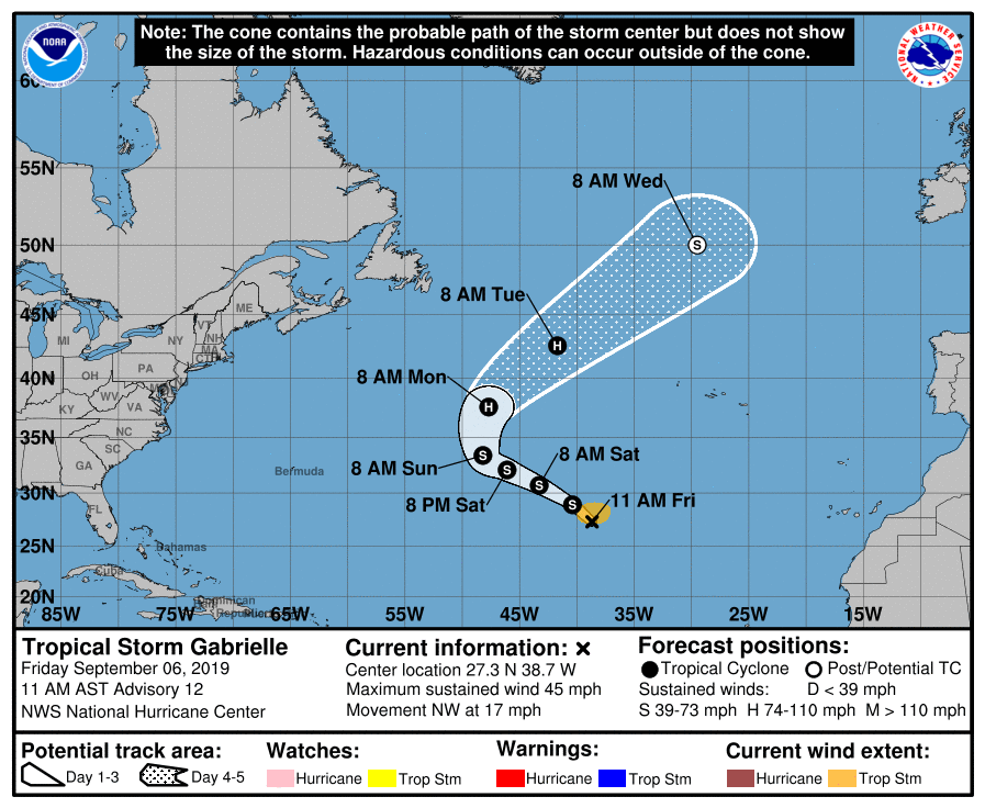
Gabrielle gets picked up the jet stream next Tuesday then drawn towards the NW of Britain.
Current models forecast the low to move northeast somewhere between Scotland and Iceland on Thursday, but track and depth is varying from run to run for now. But a low worth keeping an eye on, depending on how it interacts and phases with the strong jet stream crossing the Atlantic, it could deepen rapidly into an intense depression or may not deepen much. But potential for the ex-tropical system to bring impacts to parts of the UK and Ireland later next week.
Could it be the first named storm of the season? #NameOurStorms collaboration between UK Met Office, Met Eireann and the Netherlands KMNI have together issued a storm name list for the 2019-20 season.


