


After a really wet spell, the rain will clear from the north and west of the country today and slowly fizzle out as it heads southeast. Sunday then brings sunshine and thundery showers.
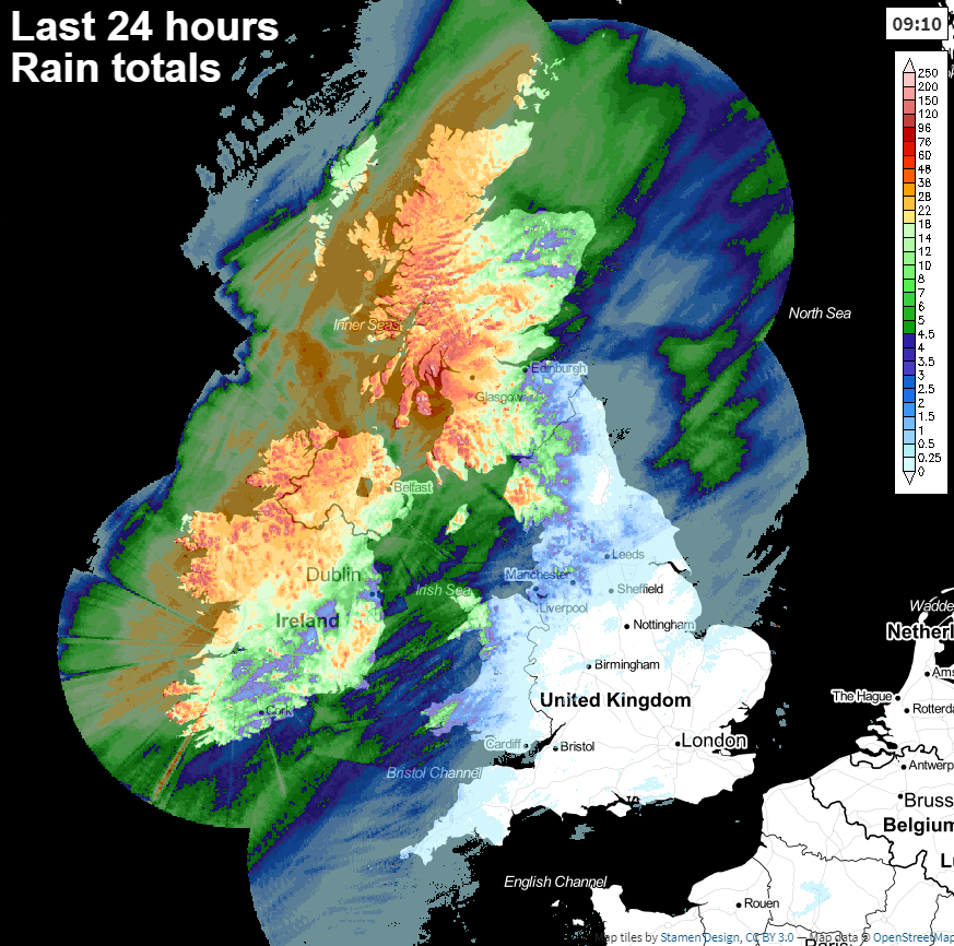
It's been a very wet start to the weekend across the northwest of the UK and much of Ireland, but the rain will clear southeast during today. As the front bringing the rain makes its move, it'll also start to fizzle out. So by the time it reaches the southeast of England later, there'll just be a small amount of showery rain.
Ahead of the wet weather today, there'll be some sunny spells but varying amounts of cloud floating around. It's eastern and southeastern parts which will likely see the best of the sunshine, along with the warmest temperatures - reaching 21-23c typically. For other parts of England and Wales, the high-teens, maybe low twenties are likely, but it's cooler underneath and behind the front bringing the rain. In fact, parts of northern Scotland may struggle to reach 10c today.
Behind the band of rain, which'll reach the southeast into the evening, some sunshine will breakthrough, but there'll also be showers - these most frequent in the north and west.
The winds will be another factor today, with gales in exposed parts of Scotland and the far north of England. The strongest winds will initially affect western parts this morning, before transferring slowly east as low pressure moves through. They'll calm down into this evening though.
Overnight, showers will continue to affect northern and western regions, but elsewhere it'll stay mostly dry once any residual rain has cleared the southeast. It'll be a cool, fresh night too, with lows dipping to 6-12c typically.
Sunday then brings a day of sunshine and showers. These will initially be mostly limited to the north and west, but they'll soon spread further south and east. Not all will catch them though, with the far south of England best placed to avoid the vast majority. Where you do see a shower though, they're liable to be heavy with hail and thunder mixed in too.

Temperatures on Sunday won't be anything like they were last week, typically ranging from 14-18c. The southeast will be a bit warmer at 19-21c though.
Meanwhile this weekend, Hurricane Dorian is menacing out in the Atlantic and threatening the Bahamas and then potentially Florida. You can keep track of and join the latest discussions on the community.
Back to the UK, and Monday is set to bring another spell of wind and rain across the northern half of the country. Further south, there'll be a scattering of showers, and a fair amount of cloud but it'll be the north which again sees the bulk of the unsettled conditions.


