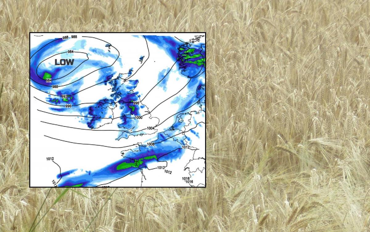
Improvements today with bright or sunny weather appearing. A dominating low pressure will bring blustery weather for Friday and the weekend with rain at times. More settled next week.
August has already given the UK a lot of rain. Yesterday was no different with the first day of the 2nd test being rained off. Today will be a better day. Already there is a lot of fine, bright weather around although western Britain still has low cloud and some rain. This cloud will lift and break toady as things dry up. For Friday and the weekend, there is a new low pressure bringing windy weather and more rain but next week looks more settled, finally.
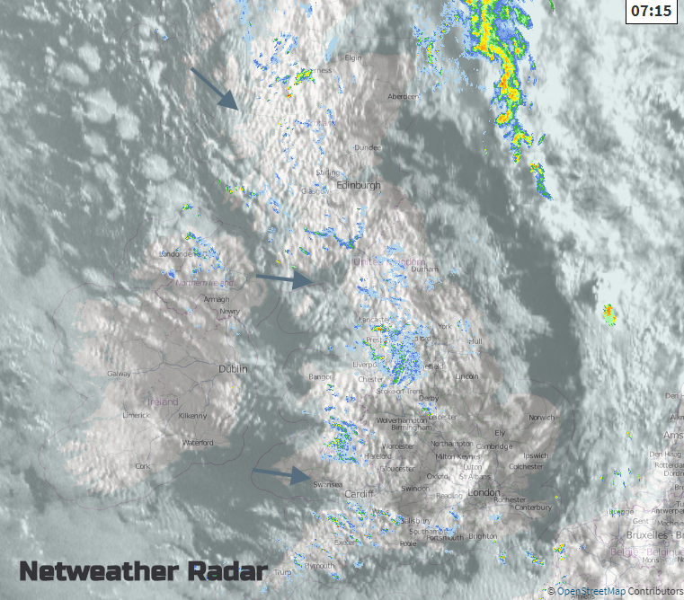
there could be a few light showers over Grampian this morning and then SE Britain around the middle of the day, clearing away over the North Sea. There is a brisk westerly wind moving everything along today, it’s bringing the moisture onto western coasts. It will be a cool feeling day, unless you are in a sheltered sunny spot, when you’ll still need your sunscreen. Temperatures today in the mid to high teens but that doesn’t affect the August UV.
Over the next few days as this low pressure heads it will be windy everywhere with the chance of rain but western Scotland, NW England, western Wales and Northern Ireland will see the most rain. SE and eastern England seeing less, so the Lord’s cricket shouldn’t be a complete washout .
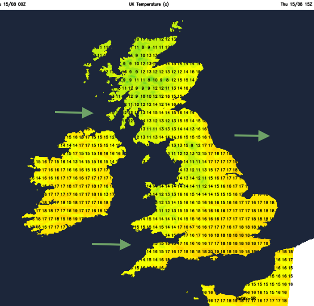
This evening the winds ease a bit and it turns cooler for northern Britain, before the cloud piles in from the west and the rain starts for western Scotland and Northern Ireland by midnight. In the small hours, eastern England will also see temperatures dip into single figures with very light winds.
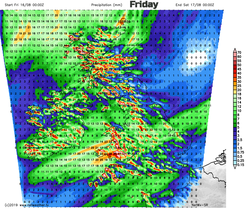
For Friday morning the southerly winds will be picking up, strengthening through the Irish Sea and North Channel If you have an end of the week ferry journey. The UK will be within a wide warm sector and the air will feel warmer. Northern Scotland could see temperatures into the twenties along the Moray coast. A band of rain moves over Wales, NW England and SW England on Friday morning, bringing another soaking. All this rain is already affecting the UK harvest.
The rain creeps eastwards over more of the West Country, into the Midlands in the afternoon and more of England, although the far SE should escape the rain until teatime. Behind the main rain band, will be heavy showers with the risk of hail and thunder. These will affect Northern Ireland, Scotland and northern England, with eastern areas always being a bit more sheltered. The winds veer to the SE but it stays blustery all day.
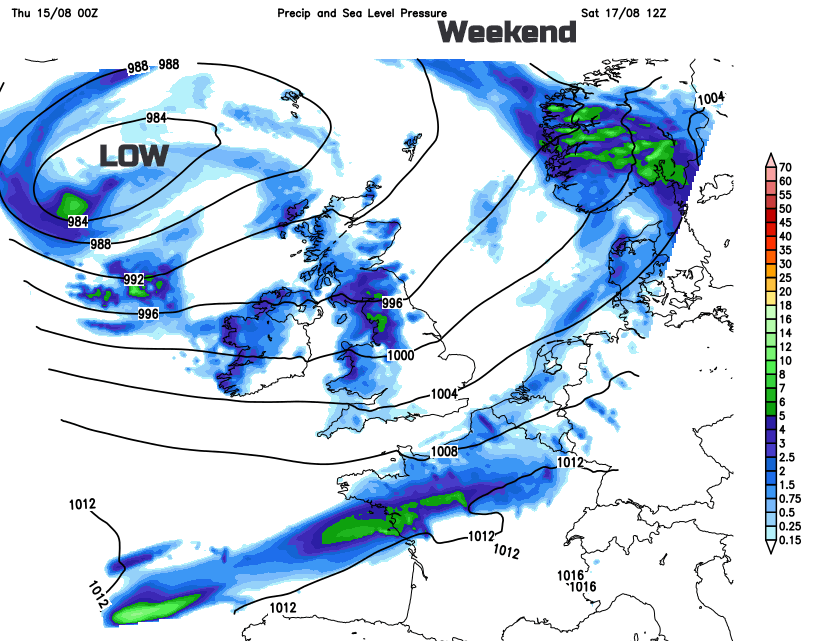
Weekend
Saturday plenty of hefty showers from the west but some warm sunshine further east for Britain. Chilly overnight if you are camping this weekend. For Sunday as the low moves over Scotland, there will be heavier showers, hail, thunder and more downpours for Northern Ireland, Scotland, Cumbria and western Wales. It will be windy everywhere. NW UK, in particular, could have a wild start early Sunday morning and the strong winds around the low may need monitoring on Sunday. Do keep an eye on the wind forecast if you are heading to the hills or have coastal activities.
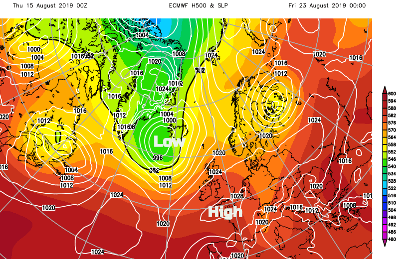
The charts for next week aren’t overly reassuring but there are signs that more settled conditions could take hold later in the week. More so in the south than for the far north but it is a Bank holiday weekend for some, and that usually dooms the UK weather. Come on high pressure help out the farmers and the holidaymakers.