It's been very wet and soggy so far this August. Records might be broken, we'll have to wait and see, but is it time we gave up hope in August holidays. Is July any better or do we just have short memories?
It has been a soggy August. We’ll have to wait until the end of the month to see how the rainfall figures truly compare to the monthly average and long term records but there is already chat about "wettest August on record" in various areas. When wet weather hits the main part of the UK summer holidays, family plans are affected, outdoor fun can become harder work and if you do have some time off you may be disappointed at the lack of warm sunshine and outdoor living.
Since 2003, August was the month of the UK highest ever temperature, a record of 38.5C. However this year, July took the crown with 38.7C in Cambridge. There was a lengthy spell of fine, dry and hot weather in July which probably, by comparison, makes this wet August seem even worse. Maybe Augusts aren’t really that awful in weather terms, it’s just if there is a lot of rain, we notice it more. Thinking back to last summer, 2018 was so different, remember the heat and drought conditions. Is it just our weather memories are short?
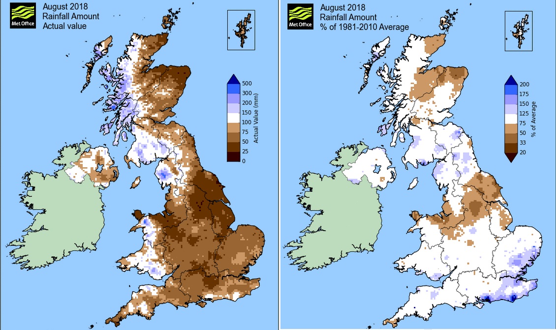
Last August :Met Office
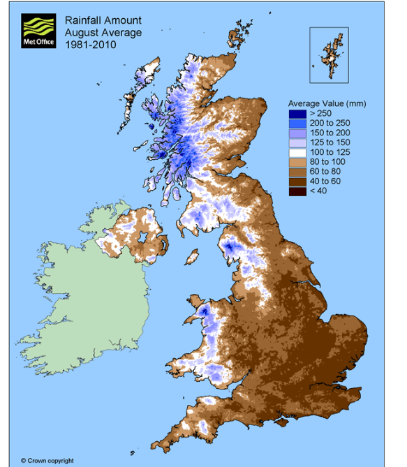
Generally, August is quite dry with most of the UK only expecting 50 to100 mm of rain. If high pressure builds in, there will be long, settled and drier spells of weather. If the heat intensifies, we can get heavy, thundery showers set off and the thunderstorms can bring torrential downpours with the risk of flash flooding. These small scale but intense incidents result in localised, very high rainfall totals. Summer rain showers are often quite different to autumn/winter frontal rains.
Highest 5 minute rain total - 32mm -10 August 2893 Preston, Lancs
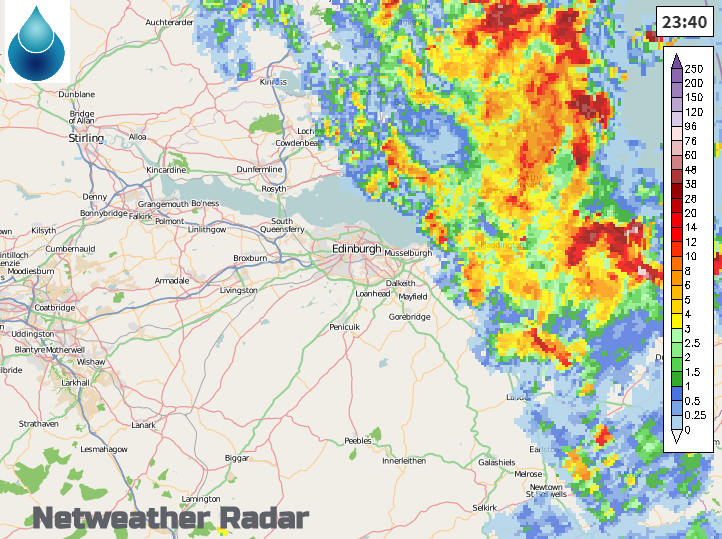
Thunderstorms clearing the Edinburgh Festival, August 2019 Netweather Radar
Looking at rainfall totals in summer for specific locations can be a bit misleading. For example, Edinburgh has a few rain gauge sites around the city area but a heavy shower might hit or miss the recording spot. In autumn and winter, heavy rainfall comes from large frontal bands linked to low pressures which reach right across the counties or even the UK. The average maps use radar data along with rain gauge measurements so provide a better, wider picture. The chart below shows what to expect, on average, for August rainfall.
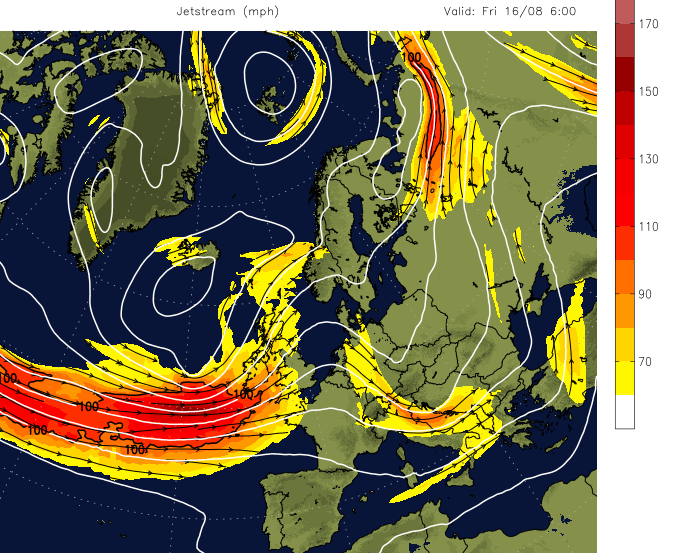
The jetstream gets blamed in these unseasonal weather set ups. It’s been powering straight across the Atlantic recently high up in the atmosphere, barrelling low pressures at the UK and so plenty of rain bands. For a more settled summer, we need a more amplified pattern where the jetstream is interrupted and forced north in big whirls. Pressure at the surface builds and 'summer proper' takes hold.
There are some signs that this could happen later in August, but will it be just in time for #Backtoschool*. Before we set up plans to shift (*English and Welsh) school holidays earlier into July, do remember back to the infamous 2009 ‘BBQ summer’. When the longer-term, technical Contingency Planning Forecast was given a throw-away line in a Met Office press release, which the media ran away with and then it rained a lot. Even then, August was okay for much of the UK. Western Scotland, Northern Ireland and Cumbria did have twice their monthly rainfall, but it was July 2009 that produced the wettest UK July on record.