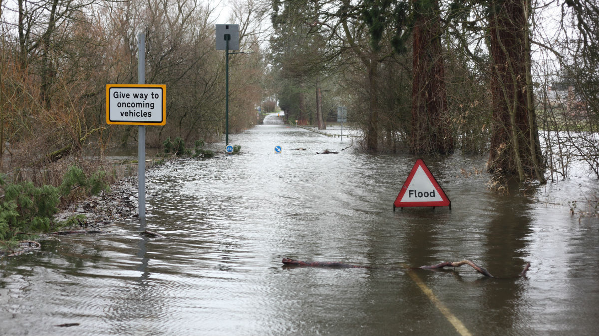
After the flooding in recent days, the good news is that there will be fewer showers around as we end the week. But the bad news is that it's only a temporary respite.
After the flooding in recent days, the good news is that there will be fewer showers around as we end the week. But the bad news is that it's only a temporary respite, as low pressure will be nearing from the southwest during the weekend, and will be with staying nearby through next week.
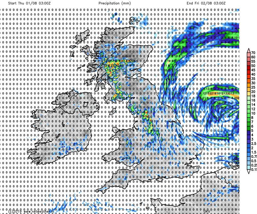
Today will still see some sharp downpours and the odd thunderstorm in places though. These chiefly in western, central and southern Scotland, then becoming increasingly scattered the further south you are in England and Wales. The rainfall total forecast for the next 24 hours shows where the majority will be.
Away from, and between the showers there'll be broken cloud with some reasonably long sunny spells breaking through. Apart from the east coast, winds will be lighter than they've been over the last couple of days too, so temperatures of 19-23c will feel quite warm.
The low pressure which has been responsible for all the showers this week will slip further away into Friday. There will be some showers, but they'll be more isolated than they'll have been during today. Winds will be lighter along much of the east coast, but East Anglia and the southeast will keep a more noticeable breeze. Temperatures will be very similar to today, perhaps squeezing a touch higher in the south though, with 25-26c likely locally.
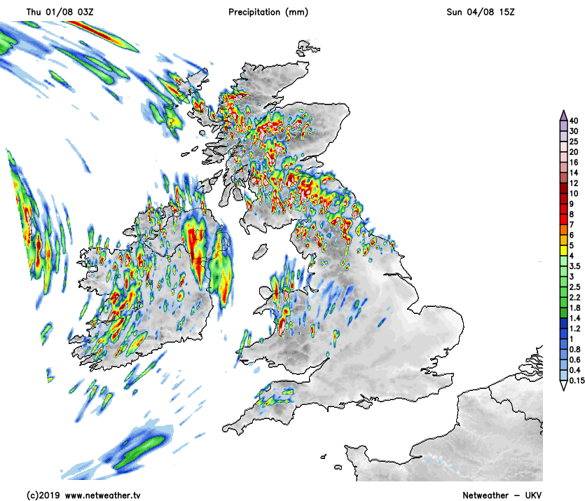
Just as one low is finally out of the way, the next one will be nearing from the Atlantic as we move into the weekend. For Saturday that means some more cloud, and some further, increasingly widespread showers. These will be most frequent and heavy in the north and west, with much of eastern, southern and central England avoiding them. It'll be another warm day, with highs again into the low, perhaps mid-twenties.
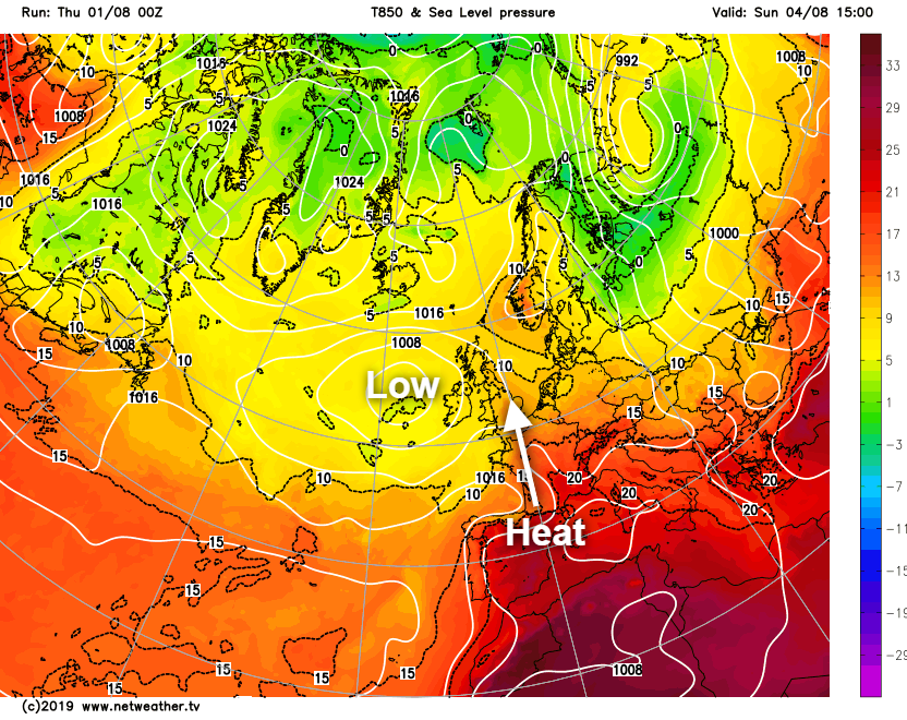
Sunday will have two-faces, both brought by low pressure to our west. The first and most obvious one is that there'll be more heavy showers - these again mainly in the north and west. They'll potentially be up a degree in intensity and numbers, with some high rain totals in a short period possible.
Further south and east it's another story, with the low pressure pulling up some heat from the south temporarily. Temperatures are set to climb quite widely into the mid-high twenties in central and eastern England, perhaps even the low-thirties in the southeast. The heat may help trigger some heavy showers and storms later on though.
Next week, with low pressure generally stationed just out to the west and potentially moving over the British Isles at times, we're set for another unsettled one. There'll be spells of rain, especially in the west and north, with sunshine and often widespread showers in between. The best of the warmer, drier spells are likely to be reserved for those who are further south and east but even here won't be immune from the generally unsettled theme.