
High pressure retreats next few days and low pressure takes over, so showers, perhaps thundery, increasingly likely for many, but it will be warm and humid for most too.

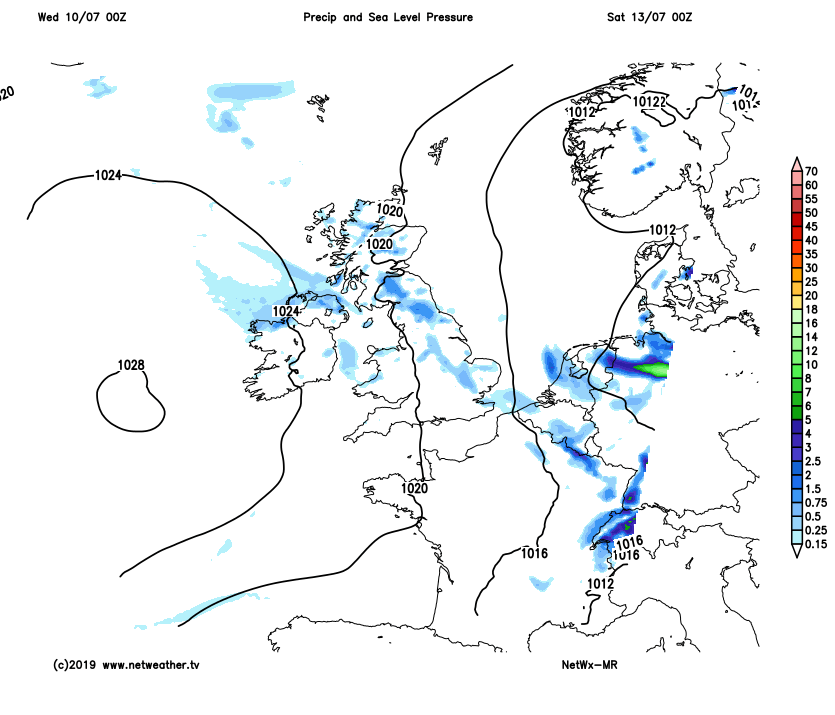
Low pressure will increasingly come into play over the next few days, particularly across the northern half of the UK, where it will be largely cloudy with rain or showers, some of which will be thundery. High pressure will cling on across the south today, though even here we can’t rule out the odd shower, then on Thursday there will be a greater risk of showers as low pressure wins out across the north. Friday will see showers become confined to eastern areas, as low pressure across the north moves away to the east. Then high pressure looks to build back in from the west for the weekend, so the weather settling down again by Sunday for most, after some showers again in the east on Saturday, temperatures around average for July generally, locally very warm in the south.
For now, much of the UK has woken up to extensive cloud cover along with outbreaks of showery rain affecting mostly northern areas. There are some breaks in the cloud across southern England though, which is allowing some sunny spells through. It’s generally a warm and muggy start though, after a humid night, particularly across central and southern areas, where temperatures are already 16-19C before 7am.
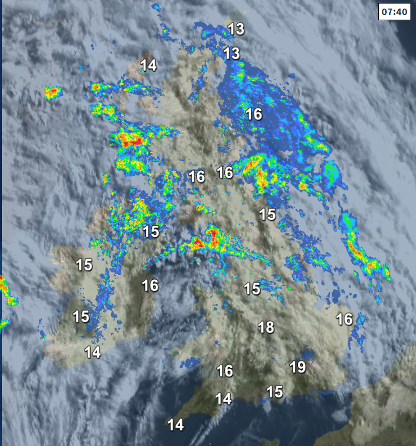
It will remain largely cloudy across the north today, with showery outbreaks of continuing. Showers perhaps easing for a time across Scotland this morning, perhaps some bright spells developing, before heavy showers and thunderstorms develop this afternoon – particularly towards the east. Wales, The Midlands, East Anglia and southern England seeing fewer showers, best of the sunshine and higher temperatures towards SE England and East Anglia – where most will remain dry and warm, though the odd shower can’t be ruled out even here. It should remain mostly dry for outdoor play at Wimbledon.
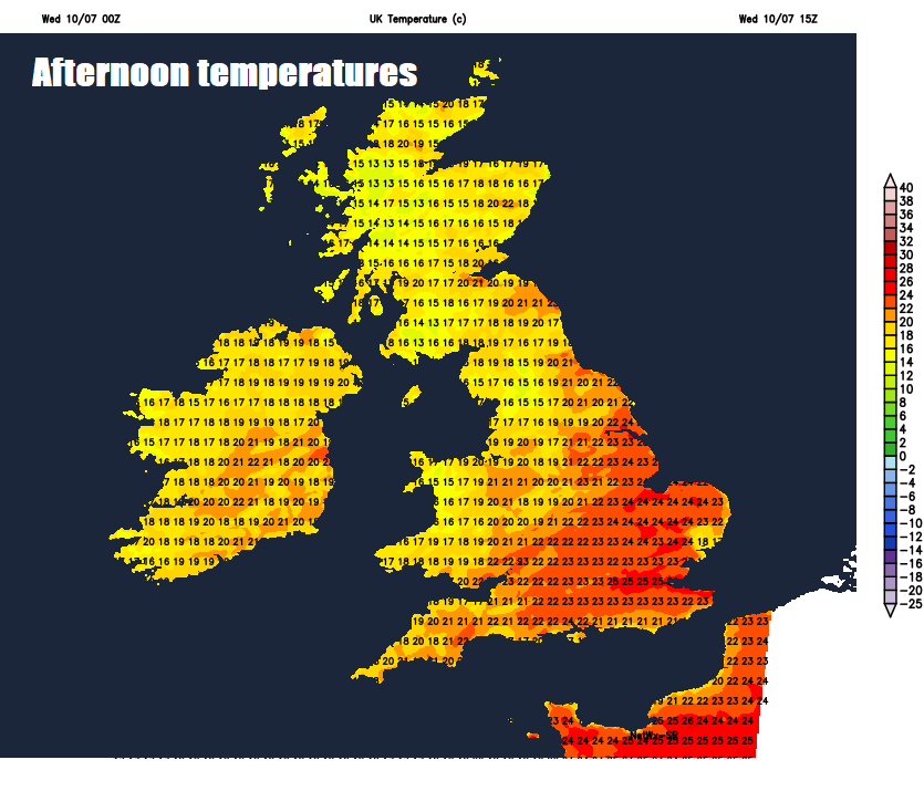
Quite warm in the south where the sun comes out, temperatures reaching 25C in London, generally reasonable temperatures and muggy for the rest of England and Wales too, reaching 21-24C generally. Temperatures across Scotland and N. Ireland reaching 16-20C, but muggy here too in the southwesterly breeze.
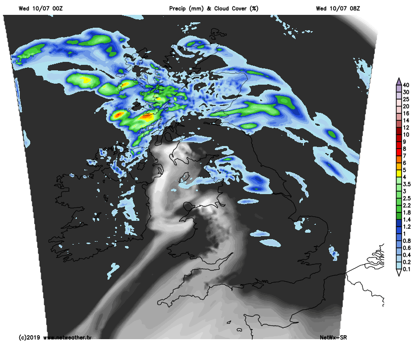
Some more organised showery rain moving in across Ireland this evening will continue to spread east across northern, western and central areas later this evening and overnight, heavy in places, with perhaps the odd rumble of thunder. Drier across southern England, with clear spells. Everywhere warm and muggy overnight, temperatures no lower than 13-16C generally.
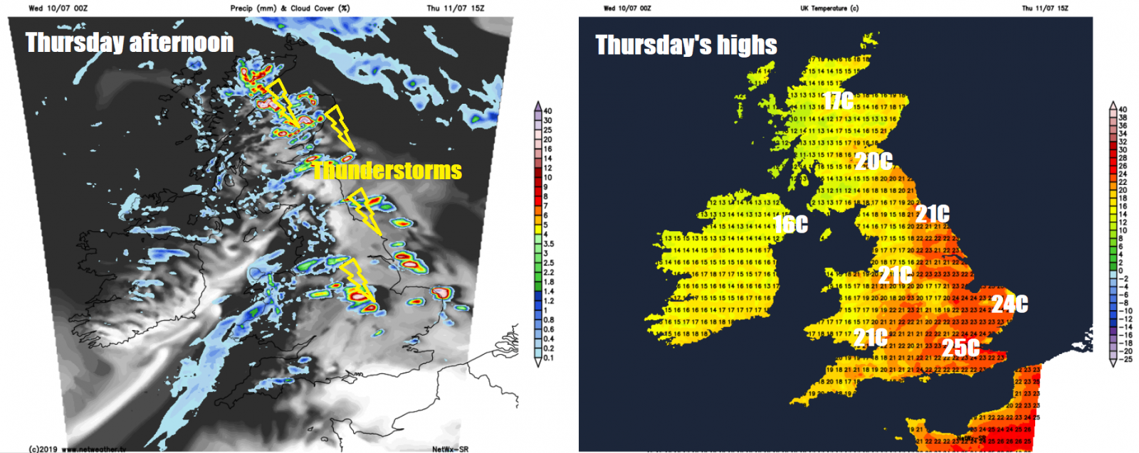
A warm and humid day on Thursday, rather cloudy across northern areas again, with scattered slow-moving heavy showers and thunderstorms developing into the afternoon across eastern Scotland and northeast England. Elsewhere, scattered showers almost anywhere, perhaps locally heavy and thundery towards the east. But some will stay dry, particularly across central and southern areas – where there will be some warm sunny spells. Temperatures widely reaching 20-22C and feeling rather muggy too in light winds, perhaps 23-24C across SE England and East Anglia. Cooler across the far northwest.
Low pressure across the north on Thursday will tend to move away to the east of the UK on Friday, but will exert enough of an influence to allow further scattered heavy and perhaps thundery showers to develop across eastern areas of Scotland and England, drier and sunnier towards the west. Temperatures reaching 17-21C in the north, 21-23C in the south.
High pressure builds in from the west on Saturday, the centre of the high moving in close to Ireland, so many areas are looking largely dry and fine with variable cloud and sunny spells, cloud bubbling up across northern, central and eastern areas to allow a few showers, perhaps heavy, to develop into the afternoon.
Sunday is looking largely dry with sunny spells for most, as high pressure drifts east across the UK, though the odd shower can’t be ruled out across central areas. Temperatures both days ranging from 19-21C in the north to 22-25C in the south.


