


With high pressure centred over the Atlantic but extending east at times, most will stay dry, sunny & settled this week, but cooler than last week. Risk of rain in the far north Thursday.
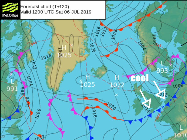
Like through much of last week, this week sees high pressure in control, but the position of high pressure in relation to the UK can make a difference to temperatures, even if it remains dry and sunny. Last week saw high pressure sat over the near continent, pulling very warm and humid air north across Spain and France. However, this week, high pressure has shifted west and is now sitting over the Atlantic, pulling cooler and fresher air than last week over the top of the high from the northwest off the Atlantic, with temperatures closer to average. High pressure will be close to the west for the rest of the week, so it will remain largely dry with sunny spells and average temperatures. Though on Thursday Scotland may see some rain, especially further north. Friday will bring a stronger northwesterly breeze, which will blow in some showers in places.
For now, Tuesday morning is being blessed with blue skies across large parts of England and Wales away from north Wales and NW England – where the northwesterly breeze is bringing more in the way of cloud off the Irish Sea along with a few scattered mainly light showers. A fair bit of cloud this morning across Scotland and Northern Ireland, with scattered mainly light showers towards the north and west, however, there are some clearer skies and sunshine to be had across eastern parts of Scotland with shelter of higher ground to the west.
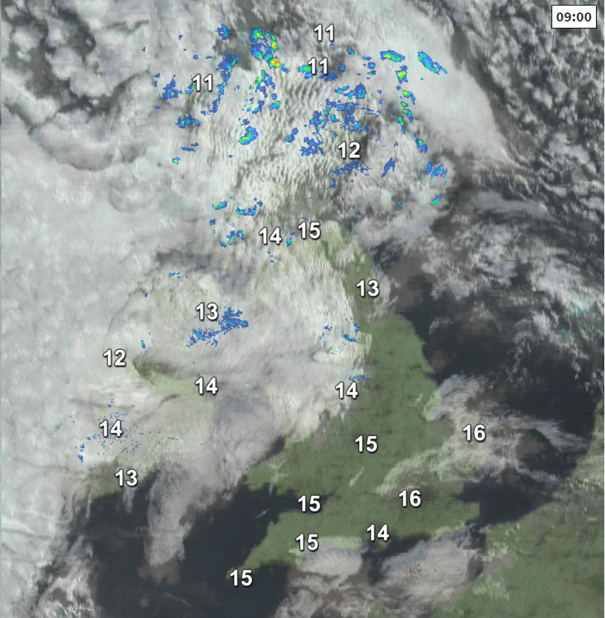
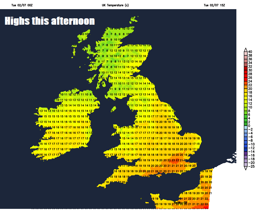
Not a great deal of change into the afternoon, always more in the way of cloud across northern and western Scotland, Northern Ireland, NW England and north Wales – which will be thick enough to bring the odd mainly light shower, mostly dry and sunny with patchy fair weather cloud developing further south and east across southern, central and eastern England. Temperatures this afternoon reaching 14-17C across Scotland, N. Ireland and the far north of England, further south temperatures reaching 19-20C in Manchester and Cardiff, 22C in London. A fresh northwesterly breeze across most areas keeping it comfortable.
Any showers in the north and northwest should generally fade this evening to leave a mostly dry night with lengthy clear spells, though there will be thicker cloud at times towards the northwest.
Not a great deal of change through Wednesday, if anything, high pressure over the Atlantic will extend further east relaxing the isobars, so winds lighter and perhaps more in the way of sunshine across the board. Most will have another fine and dry day with plenty of sunshine. Thicker cloud spilling down across northern and western Scotland through the afternoon, which could bring the odd spot of rain to NW Scotland by the evening. Temperatures maybe a degree or two higher than today, reaching 18C in Glasgow and Belfast, 21C in Manchester, 22C in Cardiff, 23C in London.
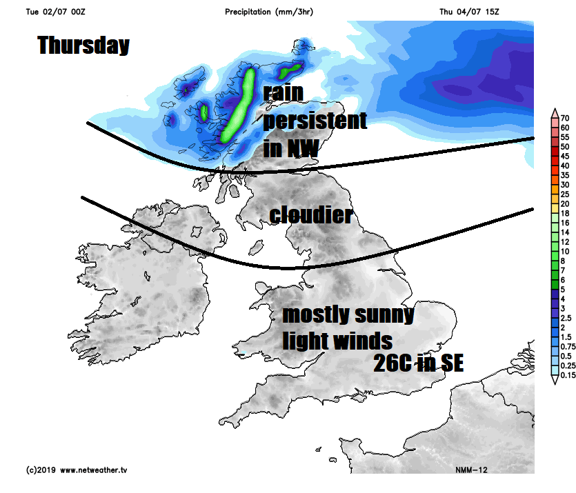
On Thursday high pressure relaxes from the north allowing Atlantic weather fronts to move across Scotland, bringing cloudier skies and outbreaks of heavy and persistent rain across northern Scotland during the day, turning more showery as it reaches central and southern Scotland in the evening, after mostly dry but increasingly cloudy day here. For England, Wales and N. Ireland – another mostly fine, dry and sunny day again, prolonged sunshine across central and southern parts, increasing cloud for northern areas. A cooler day across Scotland, reaching 14-16C, England, Wales and N. Ireland reaching 19-23C generally, but we could reach 26C in the southeast thanks to light winds.
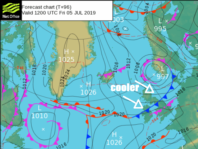
A cooler day on Friday for all, as the northwesterly wind strengthens and cold front sweeps southeast, which could bring some scattered showers almost anywhere as it moves south, however, there will be some dry and bright or sunny weather ahead and following the front, with many missing the showers. Temperatures reaching 14-19C in the north, 20-23C in the south, so average for the time of year.
For the weekend it’s looking mostly dry with sunny spells by day, but on the cool side thanks to high pressure positioned to west and low pressure over Scandinavia pulling down a brisk northerly airstream on Saturday, high pressure building back in from the west on Sunday, so winds easing and more from the northwest, so perhaps feeling a bit warmer. Small chance of a shower in the east both days.


