Temperatures on the rise as hot plume wafts out of France, temperatures could reach 34C in the southeast on Saturday.
Updated Friday 28th June
After cloudy skies for many since the beginning of the week, many will enjoy blue skies and sunshine over the next few days, thanks to an area of high pressure building in. And it will turn very warm for many of us too, with the highest temperatures in the west on Friday, then the east on Saturday – which could see the highest temperatures of the year so far, as the mercury climbs into the low 30s Celsius, perhaps 34C in SE England.
If you don’t like the heat, relief is on the way this weekend, as a cold front clears through Saturday night, introducing cooler and fresher conditions from the west across all parts.
Porthmadog in NW Wales reached 27.1C on Thursday, while Highland Scotland reached 26.9C and Glasgow 26.2C, making it the warmest day of the year so far for Wales and Scotland and Northern Ireland with Co.Tyrone reaching 25.9C.
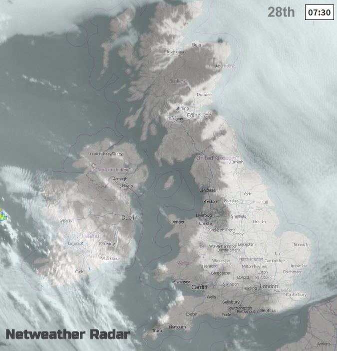
Overnight the brisk northeasterly wind will continue and drag inland low cloud off the North Sea across many eastern and central areas, clearest skies across western areas of mainland Britain and N. Ireland.
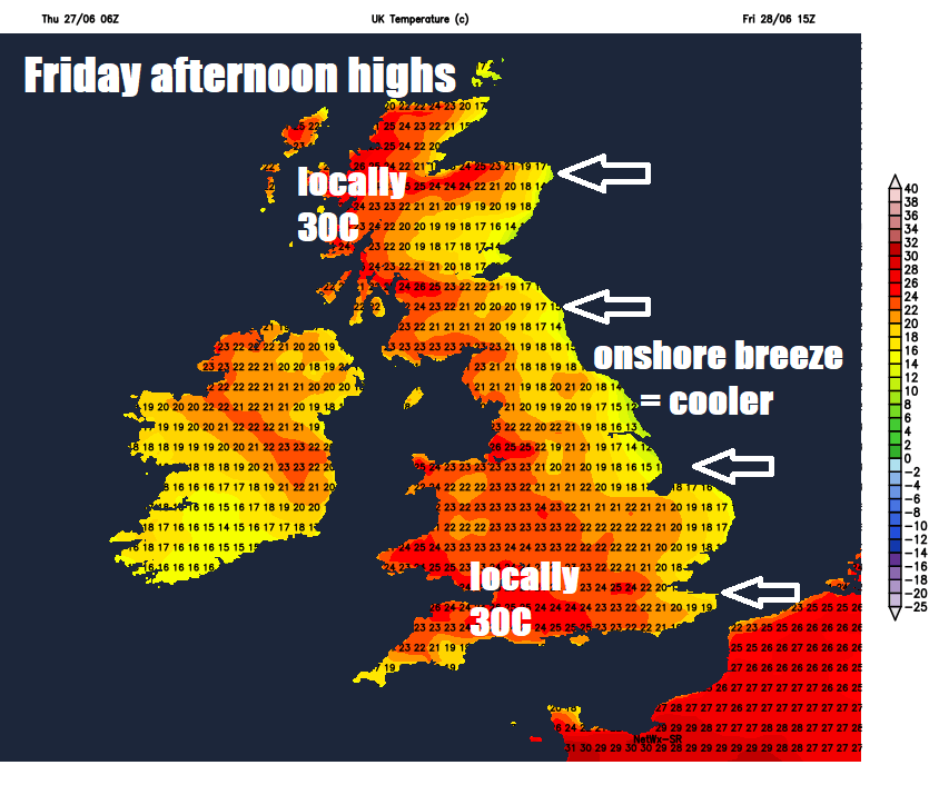
So, a cloudy start across eastern areas of Britain today, but early low cloud here should thin and break through the morning in the strong late June sunshine, then for all it will be another fine day with plenty of sunshine, just a little patchy cloud near eastern coasts and across the far southwest. Winds will be lighter in the south, so warmer, but still cooler along eastern coasts with an onshore breeze. The southeasterly flow will drag in very warm and humid air from France up across more western areas, so here again will see the highest temperatures – higher than Thursday, possibly reaching 29-30C across the Western Highlands and also inland across SW England, elsewhere across the west reaching 25-28C locally. Towards the east, temperatures typically reaching 21-24C, though eastern coasts pegged back to 15-19C by onshore breeze off a cool North Sea.
On Saturday, we see temperatures rise even further, this time towards eastern Britain, as high pressure drifts southeast into Germany allowing a subtle change in wind direction to come from the south off a very hot France – where temperatures are forecast to reach as high as 40C as far north as Paris and maybe as high as 45C across central southern France. England and Wales should see some long spells of sunshine throughout the day, very warm or hot and humid for most, very hot across SE England and East Anglia – where temperatures could reach 33-34C. Elsewhere, temperatures reaching 25-29C inland, cooler towards coasts where there’ll be sea breezes.
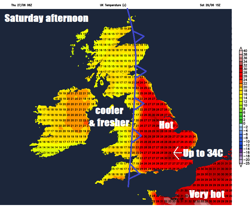
Across Scotland, N. Ireland and the far west of Wales it will be cooler and cloudier with some outbreaks of rain, perhaps thundery, as a cold front moves in from the west, introducing cooler and fresher conditions off the Atlantic. Temperatures reaching 22C across eastern Scotland before rain arrives from the west, high teens further west.
Saturday's heat kicked out by Sunday from the west
Some thundery showers developing across the north and west on Saturday, then showers here on Sunday, south and east stays dry
Then a dramatic change Saturday night, as the cold front in the west during the day moves east across all parts overnight, so we lose the hot and humid southerly flow and instead gain a westerly flow off the Atlantic – bringing in much fresher and cooler air for all on Sunday. Some thundery showers for a time across northern areas, as the cold front clears through, followed by sunshine and showers across northern and western areas during Sunday. Southern, central and eastern England look to stay largely dry, but up to a 10C drop on Saturday’s highs in the afternoon, reaching 20-24C at best, northern and western parts reaching 16-19C.
Next week
Next week, the beginning of July, is looking somewhat more average compared to the end of this week. A northwesterly flow could prevail through much of the week, so no heat on offer, but the south could stay predominantly dry, sunny and comfortably warm throughout, thanks to high pressure ridging in from the west. But northern areas will be windier and prone to Atlantic fronts passing through, bringing cloudier skies with rain or showers at times, but there will be drier weather too.