Fewer showers for most today and tomorrow. But by the end of the week, and particularly into the bank holiday weekend, less settled weather will be trying to take hold.
After quite widespread showers yesterday, today brings a much drier day for much of England, Wales and Northern Ireland. But parts of Scotland - especially the north and east will continue to see some rain.
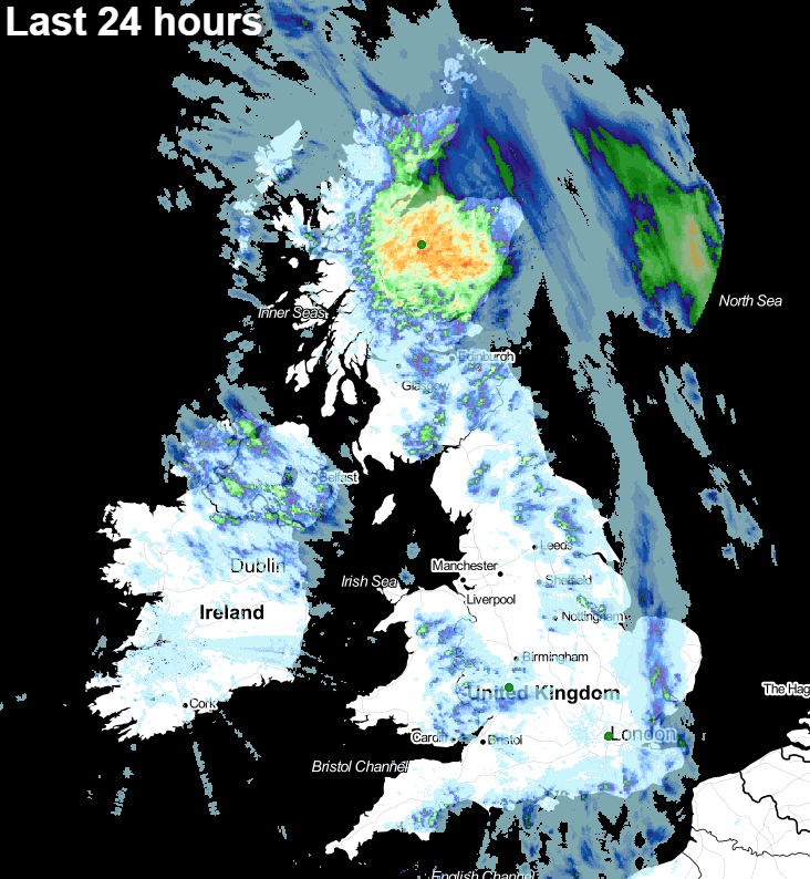
Here's what the last 24 hours have brought - not everyone catching the showers, but plenty about.
The next 24 hours is a different story, with the north and east of Scotland, along perhaps with parts of Northeast England and parts of Ireland in line to see the bulk of any wet weather and showers.

This morning, there's some persistent rain slowly moving away to the east across the northeast of Scotland. As it clears, showers will develop across other parts of Scotland - mostly in the east but not exclusively. A scattering will also get going into northeast England and perhaps across parts of central and eastern Ireland. Some will be heavy and thundery once again. And much as we saw yesterday, they're likely to merge into a more prolonged spell of rain which will affect eastern Scotland into the evening and overnight.
Elsewhere today it's dry with just the outside chance of a shower here or there. There will be some cloud around, so we'll not be seeing endless blue skies everywhere, but there'll still be plenty of sunshine to be had. Temperatures will be warmest in the southeast, peaking at 20-22c, in other parts they'll reach into the mid-high teens.
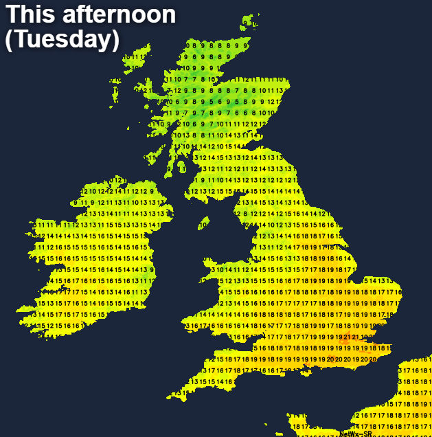
Away from the rain in Scotland, it'll be a mostly dry night, and with clearing skies, there may even be some frost patches in sheltered parts of northern Britain before dawn. Tomorrow (Wednesday) then brings a very similar day across England and Wales, with lots of warm sunshine.
There will be some patchy rain trying to move down into the north of Scotland though, and a few isolated showers may be triggered in Eastern Scotland and the far northeast of England but you will be unlucky to catch one. Temperatures won't be dissimilar to today, but perhaps a touch warmer in southern and central parts of England with more places making it to 20c or so.
Thursday brings a few changes. In eastern and central parts, that change is a step up in temperatures, with 23-24c possible in the southeast and the low-twenties elsewhere.
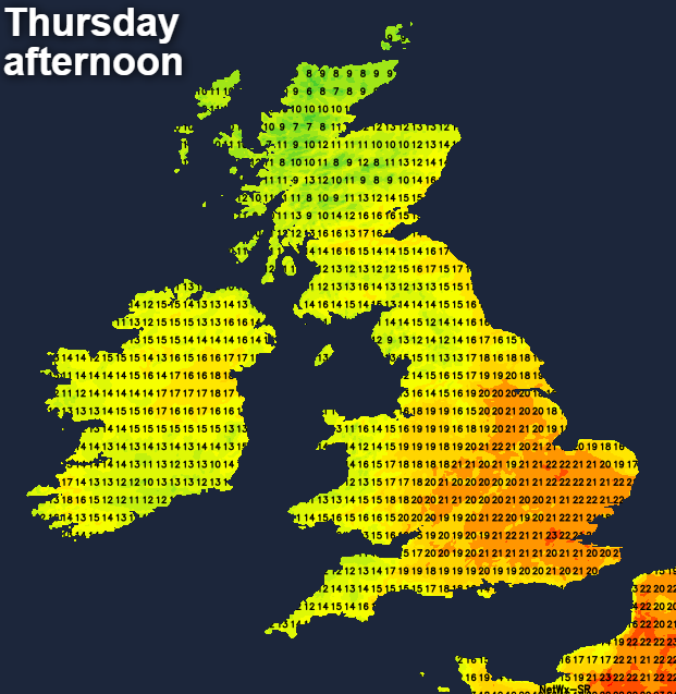
Northern Scotland should see some improvement too, with the showery wet weather clearing. Out west though, patchy rain, along a weather front will be on the way. That'll get into Ireland during the day, potentially triggering a few showers in western Britain ahead of it.
Friday then takes us back full circle, back to where we started this week. Bringing a decent scattering of sharp showers, just about countrywide, but with some warm sunny spells in between.
Then, into the bank holiday weekend, unsettled weather from the west will be trying to run the show. It's not looking like a complete washout, but there will be some rain or showers at times, with persistent rain most likely in the west. Temperatures will generally be cooler than normal for the time of year too, but it should still feel warm enough in the sunnier spells.