Bits are appearing on cars and surfaces over SW Britain and it is has been wild and dusty in the Meditteranean recently. The feed of Saharan dust continues midweek, adding to other pollutants already affecting the UK air quality.
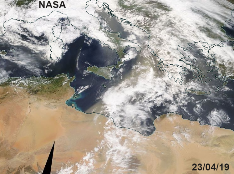
 Through the Mediterranean, particularly southern France and Sicily there have been strong winds and plenty of dust, as a cloud of Saharan dust spread over the area. The high pressure, which was sitting over Scandinavia over Easter bringing the UK all that sunny, dry and warm weather, has now shifted over Russia. This is resulting in strong winds from the south.
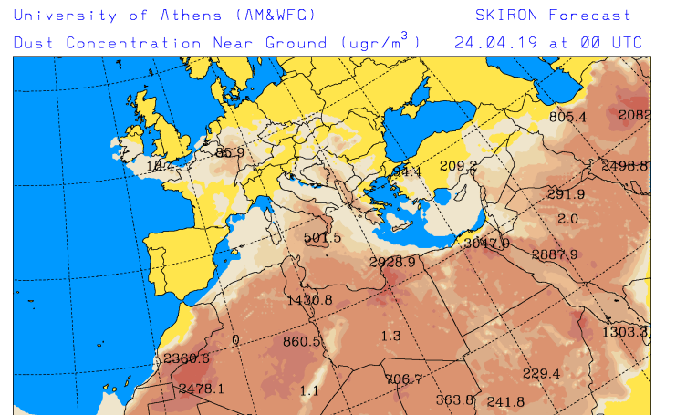
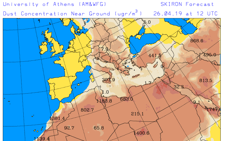
Air over northern Africa is being sucked northwards, through France, over the UK and even up to the Arctic. SW England is already seeing some of the dust at the surface and forecast to reach Ireland too. There is some difference in the concentrations at the surface charts and the load charts.
Up in the atmosphere, these extra particles should enable spectacular sunsets. The short wavelength blue and green rays scatter much more strongly than longer wavelength yellow and red rays, leaving the beautiful skies.
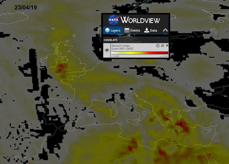
There are many forecasts for the dust, giving intriguing images. The SKIRON forecast from the University of Athens is useful and can show dust moving westwards across the Atlantic towards the Caribbean, or in this case northwards towards the UK.
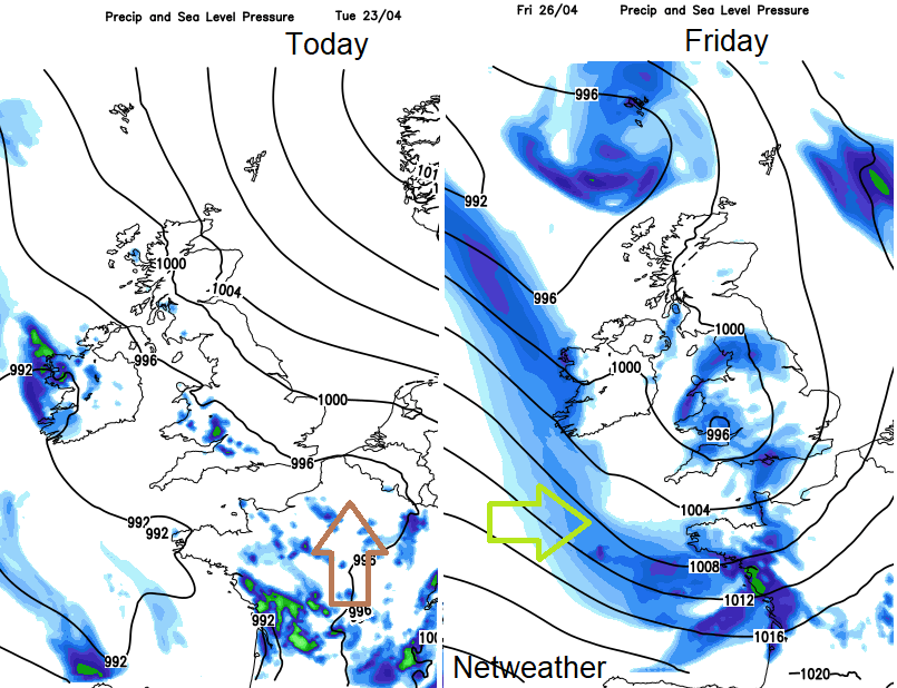
Change in the synoptic pattern, with a westerly flow from the Atlantic, shoves the warm dusty flow away from the UK later this week. Air pollution levels stay at moderate with local pollutants continuing.
The Copernicus output has been stunning as always.
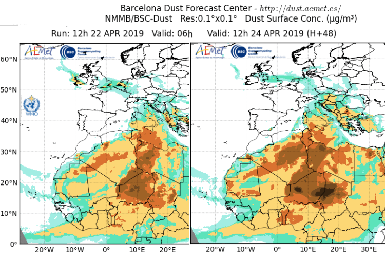
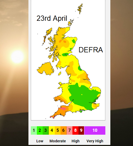
The Saharan dust gets a mention on today's DEFRA air quality forecast, mainly over SW England, SW Wales and Ireland but by Weds 24th there looks to be a plume moving over SE Britain and northwards. Shown on AEMET dust forecast image.
The UK air pollution levels have already been spiking into alert limits due to high or very high particulate readings and Ozone over the sunny weekend. There may have been a lull from the worst of the traffic with school holidays and the Bank holidays but many people are returning now and other pollutant levels will rise as well. There are plenty of local sources affecting our air quality, regardless of these occasional sandy deposits on cars and windows.

BLOG UK Pollution monitoring, types, sources and human effects
More information about the NASA , GMAO and a family of mathematical models GEOS
EUMETcast AEMET dust forecast top image