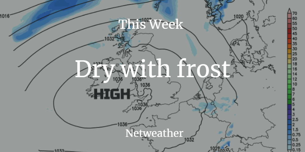
A dry, rather quiet picture for this week with frost by night. HIgh pressure reigns bringing settled and fair conditions.
March "In like a lion out like a lamb". A big tick for that proverb in 2019. The start of March saw a stormy weekend as two low pressures, including Storm Freya, arrived. For this last week of March, we have high pressure over the UK, blocking out any low pressures and so the strong winds and heavy rain, leaving a dry settled picture. This lasts into the start of April, but we will have some frosty nights.
Temperatures will rise a bit this week, especially in the south. We could again see into the high teens although for many 11 to 14C will be the usual daytime temperatures
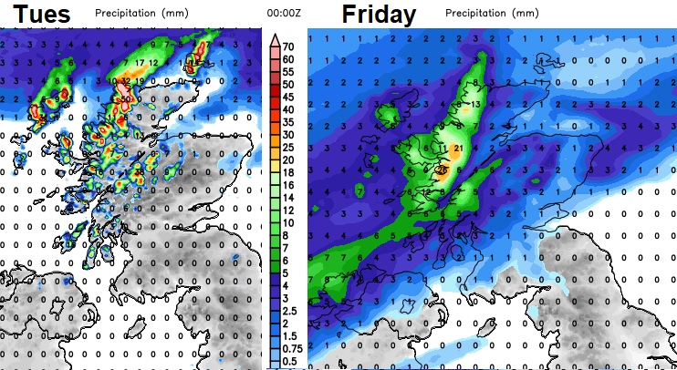
The jet stream is away to the north and as the high pressure stays steady it will only be the far north of Scotland seeing rain from weak weather fronts that brush past with blustery winds. On Friday a cold front manages to move in from the NW as the high slips eastwards over Europe. This will bring more cloud and a band of fading rain but also introduce cooler air. It will feel colder next weekend, like it did during this one, in a more northerly flow. Then the high pressure builds back in ready for the start of April.
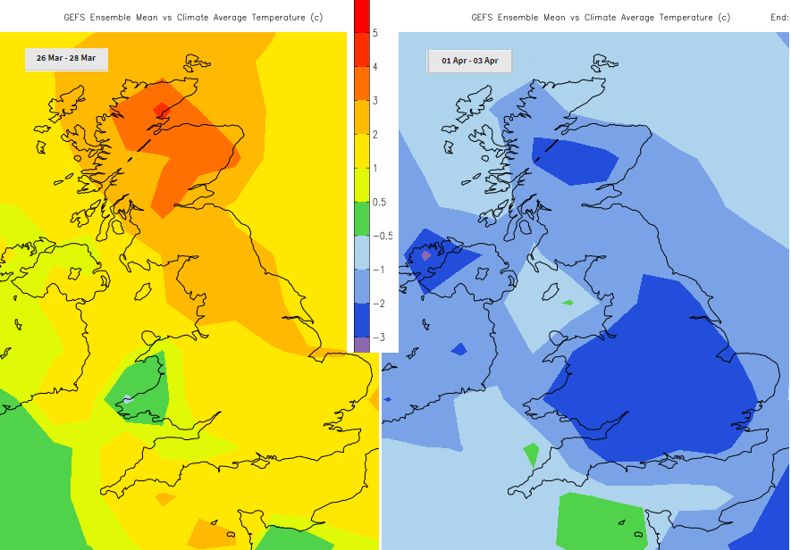
Three day mean of temperatures showing warmer trend midweek and a chillier weekend again.
The top temperature yesterday was +15.1C in London and overnight Scotland, Northern Ireland and Yorkshire have dipped down just below freezing. There is plenty of sunshine about today, just a few lingering showers over Aberdeenshire, but these will clear this morning. The Northern Isles and far NW of mainland Scotland keep the risk of rain this week but for the rest of the UK, it is a dry picture. Today in the sunshine temperatures will be 10 to 12, with a few places in southern England up to 13 or 14C. The brisk NW wind eases quickly for Northern Ireland and this afternoon for western and SW Britain. The moderate north wind will make it feel chilly along North Sea coasts today.
Tonight
There will be more cloud about for northern UK tonight with a westerly breeze. Temperatures will be around zero for southern Britain with very light winds so there could be some patchy fog, not much though.
Tuesday is another fair day but with more cloud about. Southwest Britain keeps more sunshine and there will still be good sunny spells for Wales and parts of central England just more cloud further north. The wind will be from the west on Tuesday, so more of a chill for NW Britain and less so in the east.
As the week progresses day time temperatures will nudge up so 17C is likely by Thursday in the south.
By Friday there will be a SW wind as the front arrives bringing cooler air and the winds turn to the NW then north at the weekend.
To think Northern Ireland had its wettest March on record by the 19th, now it’s looking at a week with hardly any rain. Tree pollen season is about to start so if you have an irritated throat, runny nose it may not be a cold. The sunshine is getting stronger, worth putting sunscreen on before one day catches you out. And air pollution levels are likely to rise as the air stagnates across the UK, with light winds and little movement as the air becomes trapped under the high pressure as the week progresses.
Overall a dry, settled week, cloud amounts and wind direction will vary. Temperatures creeping up until Thursday and then falling away for the weekend.