Heavy rain and gales spreading southeast across England and Wales today, ahead of Storm Gareth which will bring severe gales across the NW later.
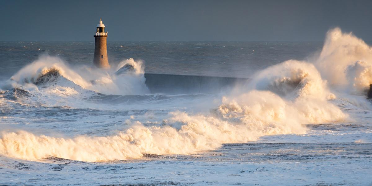
It will be windy for the rest of the week with spells of heavy rain at times, thanks to a strong jet stream running across the UK. Storm Gareth, a deep area of low pressure, rolls in off the Atlantic across the north of Scotland later today, an active frontal system will push southeast across the UK this morning ahead of Gareth bringing heavy rain and gales along it, with gusts of 50-60mph possible. But the strongest winds will develop later today across the northwest as isobars tighten on the southwestern flank of Gareth tracking southeast, with gusts of 60-70mph possible, perhaps 80mph with exposure. So there is a threat of wind damage and travel disruption over the next 24 to 36 hours.
For now, it’s been a rather wet 12 hours across the north, with 30-40mm in places and in a few locations close to 50mm or 2 inches. It’s a windy start to the day too, especially across England and Wales for now, with gusts of 40-50mph inland in places, while across south Wales there’s been gusts of 60mph recently.
A wide swathe of heavy rain has slowly pushed southeast across northern and western areas overnight along a cold front moving ahead of Gareth the northwest. The band of heavy rain and gales currently stretches from southern Scotland southwest across northern England and west Wales, ahead of it across east Wales, central, southern and eastern England it’s grey and rather windy with some patchy light rain or drizzle and gales locally. Behind the rain band it’s brighter across much of Scotland and N. Ireland - but with windy with a scattering of blustery showers – falling as snow over higher ground across Scotland.
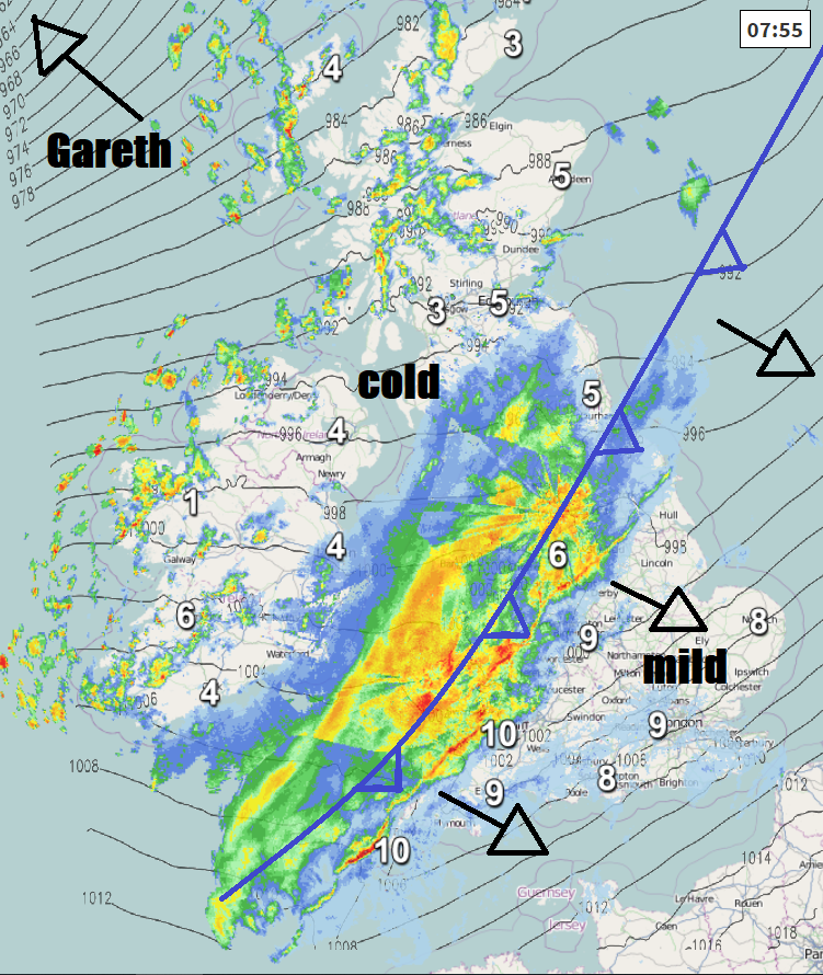
The band of heavy and squally rain across the north and west will continue southeast across England and Wales this morning, reaching SE England and East Anglia early afternoon. Mild with gales along and ahead of this rain band, winds widely gusting to 40-50mph, locally 50-60mph with exposure along southern and western coasts. Sunny spells, blustery showers and colder air across Scotland and N. Ireland today spreading across Wales, northern, central and western England through the afternoon, rain clearing the far southeast by early evening.
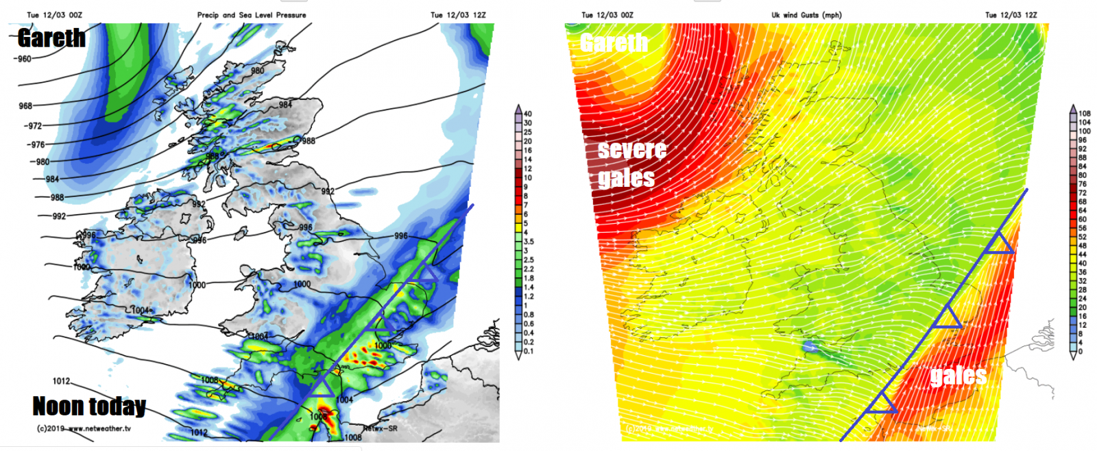
Winds increasing across northern areas, as the centre of Storm Gareth arrives towards northwest Scotland by the evening, severe gales developing towards the west of Scotland and across N. Ireland and gales widely across southern and western Scotland, winds gusting up to 50-60 mph inland, potentially gusts of 70-80mph along western coasts. This likely to bring some wind damage and travel disruption. Showers becoming increasingly frequent and turning to longer spells of rain and hill snow across the west, showers elsewhere heavy with hail and thunder and falling as snow over hills.
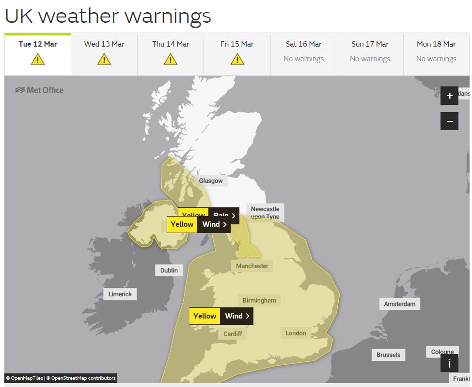
Met Office Yellow Warnings for Wind and Rain Today
Mild to start across southern and eastern England ahead of the rain band, with temperatures reaching 8-11C this morning, colder air behind the rain band, which will spread across all parts by mid-late afternoon, by which time temperatures will be reaching 6-7C at best generally, perhaps 8-9C in the southwest.
Very windy everywhere tonight, with gales widely, severe gales across northern and western areas for a time, with gusts of 60-70mph, elsewhere gusts of 50-60mph possible. Showers or longer spells of rain and hill snow swirling around Gareth will spread southeast across northern and central areas, but southern areas could stay mostly dry with clear spells.
Very windy still at first on Wednesday, with gales, but winds should ease through the day, but remaining windy. There will be spells of sunshine for most, but also plenty of showers, which will be heaviest and most frequent in the north and west, with a risk of hail and thunder. Not as cold as today, temperatures recovering back into double figures, 10-12C generally, perhaps 8-9C in the far north. Cloud and rain arriving across N. Ireland and western Scotland in the evening.
Then the next Atlantic system will spread cloud, rain and strengthening winds southeast across all areas Wednesday night and into Thursday morning, gales developing again, especially across the west. Cloud and outbreaks of rain lingering across England and Wales on Thursday before clearing southeast in the evening, brighter but showery conditions across Scotland and N. Ireland, windy everywhere. Another deep low looks to track northeast to the north on Friday, bringing wet and windy conditions to Scotland and N. Ireland, with gales or severe gales developing. Cloudy with patchy rain spreading southeast across England and Wales. More wet and windy weather developing over the weekend, but we could see the unsettled weather ease into next week, as high pressure builds in from the south.