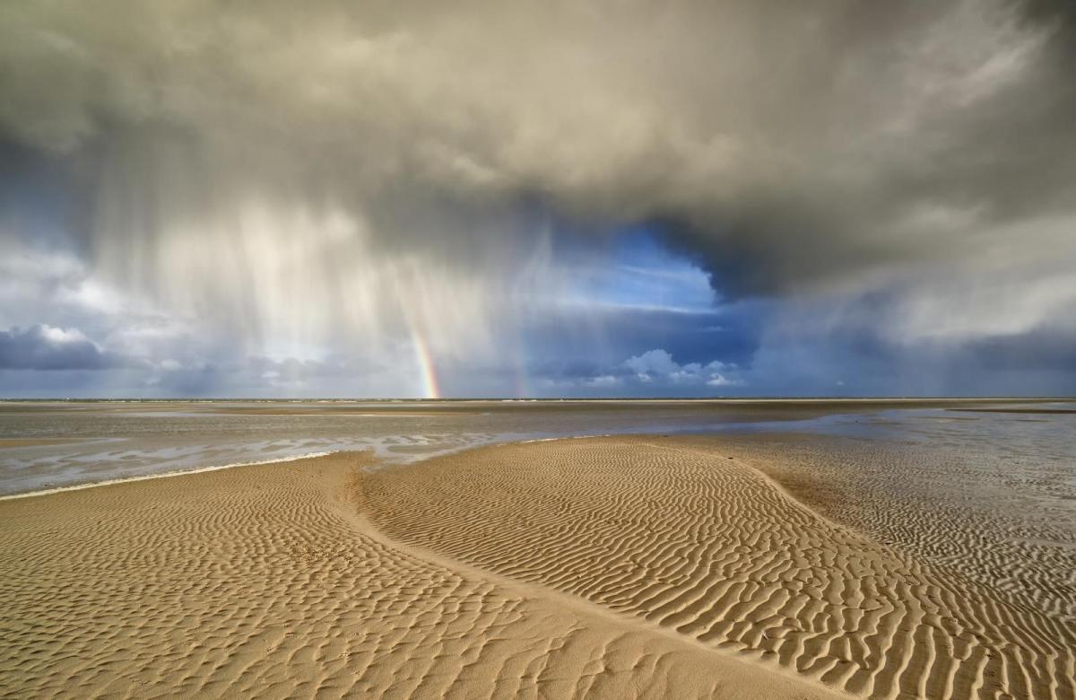
If you are in the strong March sunshine out of the wind it will feel pleasant, however, we have more rain, gusts and some wintry bits to come. Temperatures vary but nothing like last week's warmth.
Quite a change from last week as Storm Freya clears away across the North Sea. This leaves behind sunshine and showers for today. This week temperatures will be around average, still a little above and if you are in the strong sunshine out of the breeze it will feel warm. However, there will be plenty of showers, about some of hail, hill snow with thunder and gusty winds, more Atlantic rain and none of last month’s record-breaking warmth.
A tree fell in the high winds of Storm Freya on Sunday evening in Derby on London Road, blocking a main route in the city.
Storm Freya brought gusts around 70mph for exposed coasts and hills with strong winds across England and Wales. There was heavy rain into extending into Northern Ireland and southern Scotland with hill snow for Cumbria, Northumberland, Newcastle the Scottish Borders and parts of Ireland. It’s still windy this morning for eastern England with a fresh westerly wind and further gusts.
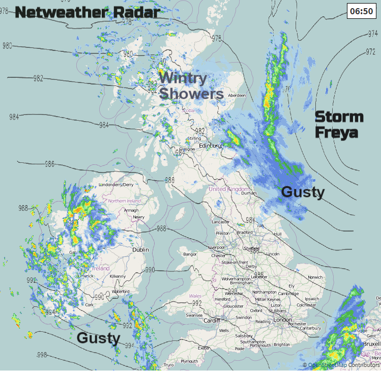
It's windy from the Irish Sea across Lancashire and Greater Manchester, across the Pennines as the winds begin to pick up across more of Britain. It will become gusty again for SW England this morning as a small disturbance runs along the Channel and there will be fresh to strong westerly winds extending into Wales as well by lunchtime.
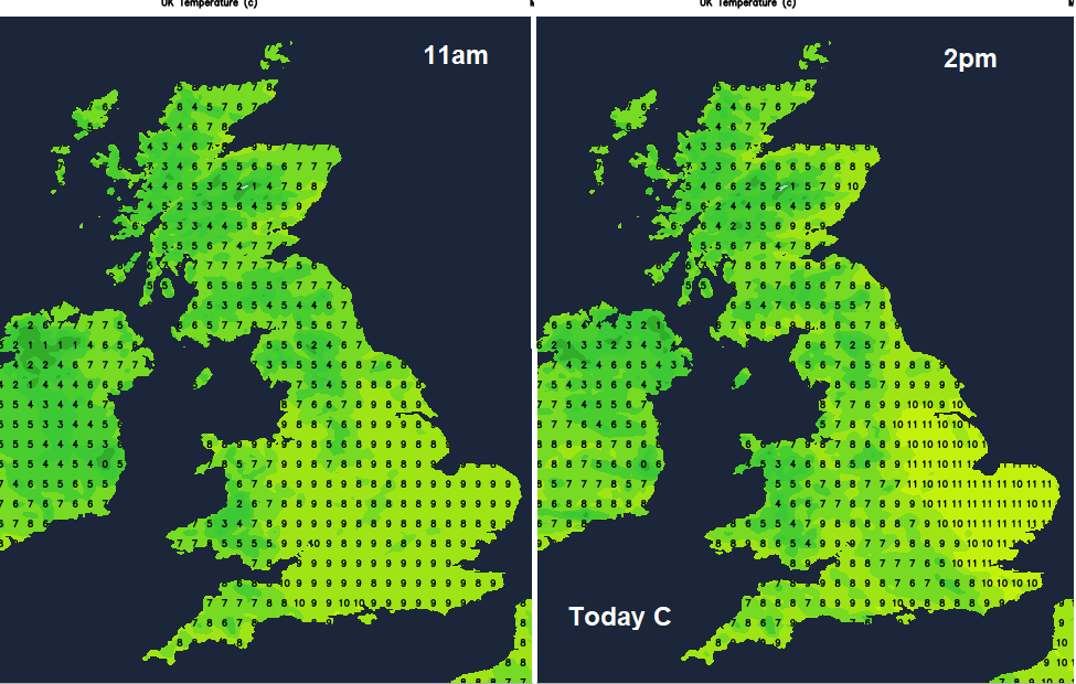
Temperatures have dipped to around zero in Northern Ireland so a cool start here. Yesterday the top temperature was 14C in Cardiff Cornwall and Devon. Today temperatures will be 8 to 12C maybe up to 13C in London.
Accompanying the brisk winds in the SW will be a band of heavy showers. Rain, hail with thunder and lighting as this line moves from Cornwall over SW Britain this morning, into more of Wales and the West Country and Northern Ireland by lunchtime.
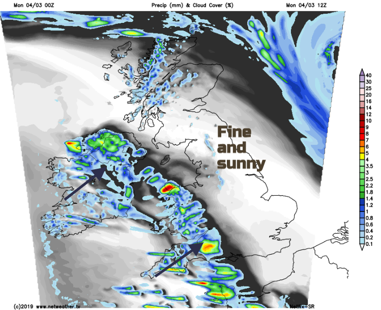
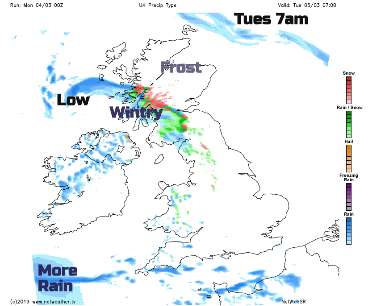
Ahead of this band there will be fine sunshine and out of the breeze it will be a lovely day. The shower risk reaches over more of England during the afternoon with another line of showery rain sticking over the Northern Isles. It turns cool tonight, cold for inland Scotland with a frost as more showers pester southern Britain and small area of low pressure takes a swipe at Northern Ireland bringing more rain and blustery winds. By Tuesday morning a band of rain and hill snow from this low will be over western Scotland, into the Highlands as it comes up against the cold air in the far north. It will be a windy start for Ireland, through the Irish Sea and North Channel too with gusts of 50 to 60mph
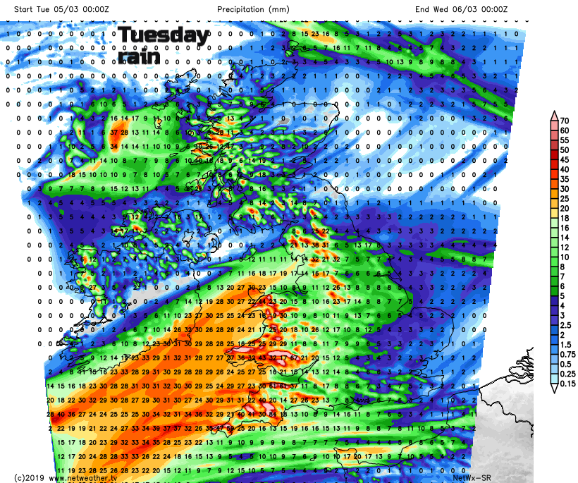
A fair, bright start for many but there will be more cloud and rain, sleet and snow for western Scotland, rain showers for Northern Ireland, Wales and the Channel Islands before a new large area of low pressure heads in from the SW.
Through the afternoon an area of rain and brisk SW winds reaches SW Britain. By the evening the rain will have spread to move of Wale and over England, but not the SE with strengthening S/SW winds and gusts around 60mph for English Channel coasts, Devon and Cornwall and south and west Wales. Under all the cloud it remains mild, to the north it will be chilly again overnight into Wednesday.
By Wednesday morning there will be low pressure centred over the UK, more rain from SE Scotland, over much of England and Wales. Mild air will be caught up with this frontal rain in the morning but that fades and by Thursday the UK will be in a colder north-westerly flow with a few wintry showers in the north and east and a widespread frost on Thursday night.