Last day of sunny & very mild conditions today, as UK falls increasingly under the gun of the southward shifting Atlantic jet stream, so turning unsettled and colder as start March.
The past 7 days has seen some exceptionally mild air pumped north across western and central Europe between a strong and extensive anticyclone centred over central and eastern Europe and an upper trough over the mid-Atlantic. The UK has seen the largest departure from the norm with regards to maximum temperatures during this very mild spell, with overall UK, England, Scotland and Wales records broken for highest temperature for February. It has been very mild over France, Low Countries and Germany, with local records broken in places, though not any national ones like the UK.
However, a big pattern change is on the way, as the blocking area of high pressure over Europe the last 7 days slips south to allow Atlantic lows and frontal systems in from the west across the UK from tomorrow. The change comes as the jet stream, which has diverted well to the north of the UK over the past week, shifts south, strengthens and takes aim at the UK over coming days.


The strengthening of the jet stream is likely linked to an upper ridge pushing north across Alaska into the arctic and NW Canada - kicking out very cold air here and northern Canada southwards across eastern N America later this week. This will in turn cause a steepening thermal gradient across NE USA and out across NW Atlantic strengthening the jet stream across the North Atlantic.
Over the weekend, the models forecast an increasingly disturbed spell, as the developmental left exit of a strong jet streak (where there is strong divergence aloft and convergence at the surface) moves toward the UK/Ireland and will likely to allow rapid cyclogenesis to take place over the Atlantic with a deepening low pressure system headed towards NW UK for Saturday, though GFS, UKMO and EC differ on depth, EC has more of a wave, GFS and UKMO a deeper closed low passing Scotland. Another low looks to develop in its wake in a trough in the jet which looks to move further south across southern Britain for later on Sunday, this could deepen as it approaches the UK too. Potential for a named low if one these lows deepens sufficiently to produce severe gales.
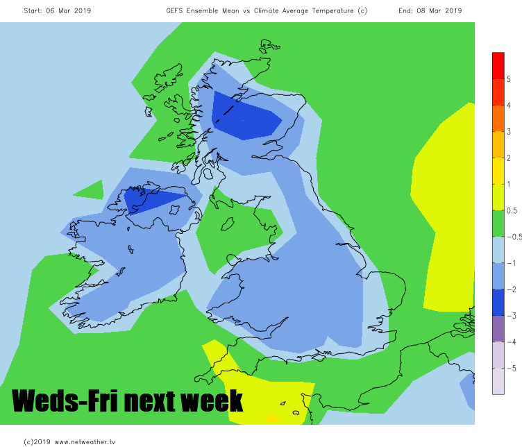
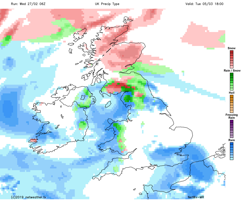
Then the models suggest unsettled cool to sometimes cold zonality next week, as the jet stream shifts south of the UK, the depth of cold of the polar maritime westerly flow differing between 00z GFS and EC, sub -5C 850mb temps spreading east a lot further south than EC, which keeps the sub -5C air generally over northern UK. So, question marks over how far south any wintry precipitation can develop away from northern hills. Even the colder GFS shows little in the way of wintriness away from higher ground in the north and west, though some brief windows of low-level snow possible in the far north and brief/transitory snow cannot be ruled out over higher ground in the south as weather systems clear and colder air undercuts. It will certainly feel a lot colder than it has been though!
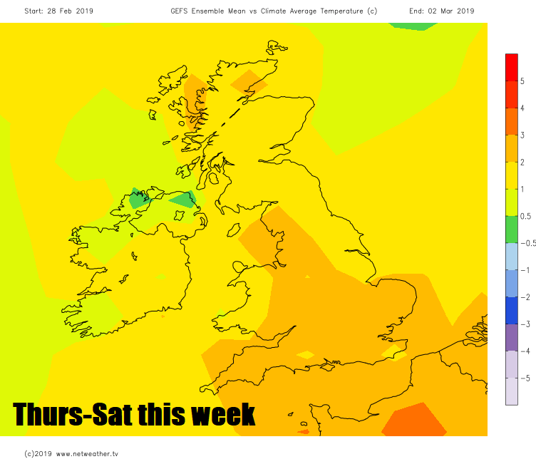
Temperatures taking a tumble after today, by end of next week temperatures could be slightly below average
Potential for snow in the north next week, mostly over the hills but perhaps at lower levels in the far north
 Last day of the unseasonable warmth today, we may perhaps see 20C in a few spots again, though possibly not surpassing yesterday’s record-breaking highs. With air pollution levels rather high today bringing poor air quality to much of England, Wales and southern Scotland, thanks to a high pressure inversion and lack of wind, it may perhaps be some relief to get some clean Atlantic air blowing in by the weekend! Though the unseasonably warm sunshine will probably be missed by some and unlikely to return for a while. The extended outlook out to 15 days suggest Atlantic low pressure will be in control still out to day 15, with the UK often on the cold side of the jet stream tracking to the south, so unsettled with a generally westerly flow outwards mid-March, cold enough at times for snow, but mainly across higher ground in the north.