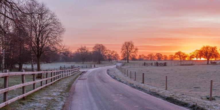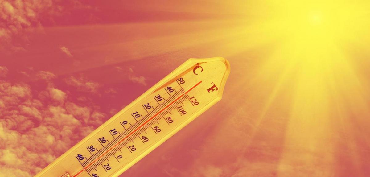
One old weather saying goes ‘The cold grows stronger as the days grow longer’. This may have some credence, as although the sun is at lowest angle in the sky on the shortest day of the year around the 21st December, often the coldest weather in the UK arrives in January and February. This is because our climate is partly moderated by the seas that surround our island and the surface temperature of the sea falls more slowly than the land through autumn and winter, so sea surface temperatures are at their lowest in late February or early March. Averaged over long periods, January is fractionally colder than February over most of Britain. However, Februarys can throw up more in the way of extremes in temperatures at both ends of the scale than January, particularly warmth. Indeed, this time last year we were staring down the barrel at the onset of the Beast From The East, while this year we have seen an exceptionally mild February, which has brought the first 20C ever in February or winter since records begun.
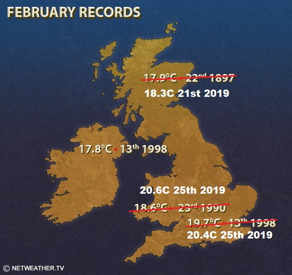
Today’s new UK record high temperature for February was 20.6C at Trawsgoed, Ceredigion, west Wales, while a new England record of 20.4C was set at Northolt in NW London. This new UK record for February beats the previous record of 19.7C at Greenwich, London, set 21 years ago back on 13th February 1998.
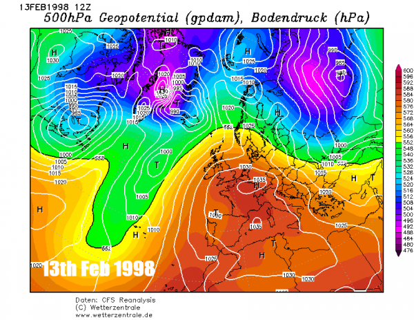
The 1998 record was a peak in temperatures which between the 8th and 26th February 1998 regularly climbed between 12-15C across much of the UK, but on the 13th, 14th and 15th reached the high teens in some spots across southern and western Britain. The exceptionally mild month was the climax of the 1990-99 period - which produced the warmest Februarys in the twentieth century, indeed the Wales February record broken today was previously set at 18.6C in 1990.
The synoptic set-up back in mid-February 1998, when temperatures peaked, was similar to today’s pattern - with a large blocking anticyclonic covering much of Europe a deep trough over the mid-Atlantic drawing warm air from way to the south and southwest.
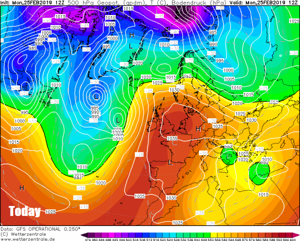
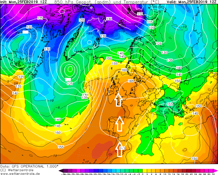
The past few days has seen unusually mild air for the UK dragged all the way up from NW Africa across Spain and France then over the UK, The very mild air flow combined with low humidity/dry air, high low-level thicknesses (probably higher than those seen in 1998) and a little foehn effect of the mountains in the case of west Wales and Urban Heat Island (UHI) effect for London probably led to both record breaking temperatures at Trawsgoed and Northolt today.
What has also been noteworthy during the exceptionally mild weather of the past 5 days is last Friday night Achnagart in northern Scotland recorded the UK's highest February minimum temperature of +13.9C. A few weeks earlier the night of 31st Jan/1st Feb it was -14.5C overnight in northern Scotland.
Also notable is the large diurnal range for February in temperatures between early morning and early afternoon, particularly across southern England. Northolt recorded -1.3C at 7am this morning, then 11 hours later had risen to 20.4C by late afternoon. Bala, Gwynedd was the coldest spot in Wales this morning dipping to -2.3 °C but reached 20.0 °C today; a diurnal range of over 22 degrees.
The cause of these low night time temperatures and high afternoon temperatures probably due to the dry surface air of continental origin which has flooded west across England and Wales from the near continent over the last few days. Similar to deserts, where night time temperatures can fall close to freezing and daytime temperatures reach 40C, the dry air allows much larger diurnal temperature ranges than moist air. Also worth remembering nights are still long in February, so with clear skies and low dew points temperatures will plummet. In summer the highest temperatures the UK has seen has been association with dry air and dry ground. The cause of the dry air is because of subsidence typical of high pressure systems, where air sinks then warms adiabatically at the dry adiabatic lapse rate. This often occurs within a warm core high pressure system such as developed over Europe over the last few weeks, thanks to warm air advection aloft ahead of deep troughing upstream over the Atlantic. The air sinking from aloft is generally very dry. As it sinks, this dry air is brought closer to the surface, thus dewpoints / humidity that is very low.
With high pressure still in control on the near continent on Tuesday, temperatures will likely again reach the mid-to-high teens, with a few spots across England and Wales perhaps again reaching 19-20C. Another very mild day on Wednesday too, though perhaps one or two degrees lower, so the exceptionally mild temperatures perhaps peaking today and Tuesday. Then for the rest of the week, temperatures will begin to lower into the low teens, as the jet stream begins to take more of an aim at the UK, introducing less settled, cooler and windier conditions off the Atlantic, with sets of weather fronts pushing rain eastwards.
Loading recent activity...