


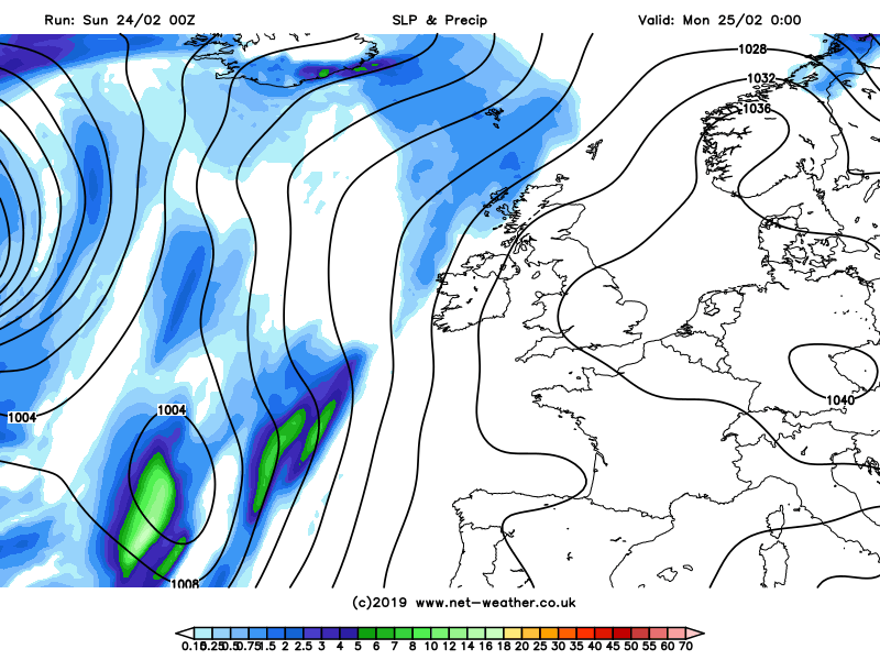
Settled conditions continuing into the new week, very mild and sunny by day, but some chilly and frosty nights, turning unsettled and windier later in the week, as Atlantic systems return
It’s the last weekend of meteorological winter but it feels positively spring-like during the day, with Saturday the third day in a row where somewhere recorded above 17C. Yesterday’s highest temperature was 17.8C at Kew Gardens in west London. But don’t be fooled by the very mild daytime temperatures, because the nights will turn cold and in places frosty. A large area of high pressure centred over Germany will dominate our weather during the first half of next week, continuing the fine, sunny and very mild conditions by day, though nights will turn chilly, more particularly across the south – where we may see a touch of frost and a risk of fog forming during overnight periods. However, from Thursday, high pressure will begin to retreat to allow more unsettled, cooler and windier conditions to move in from the west – reaching all parts by the weekend.
For now, it’s a nippy but dry and sunny start to Sunday for many, however, like previous nights, some patches of fog have formed, this time across parts of the West Country, the Midlands and up through towards Cheshire and Manchester, also further east across Derbyshire, South Yorkshire and up to the Vale of York, where the fog is quite dense in places. The Met Office have a yellow warning out for the fog here in force until 10am this morning.
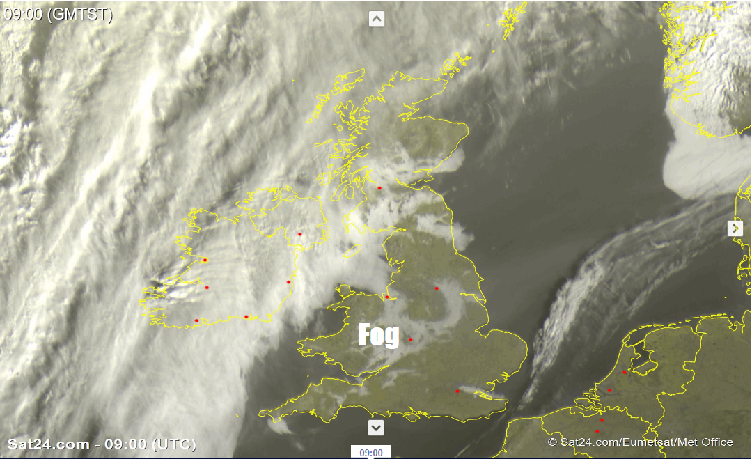
Image credit: Sat24.com
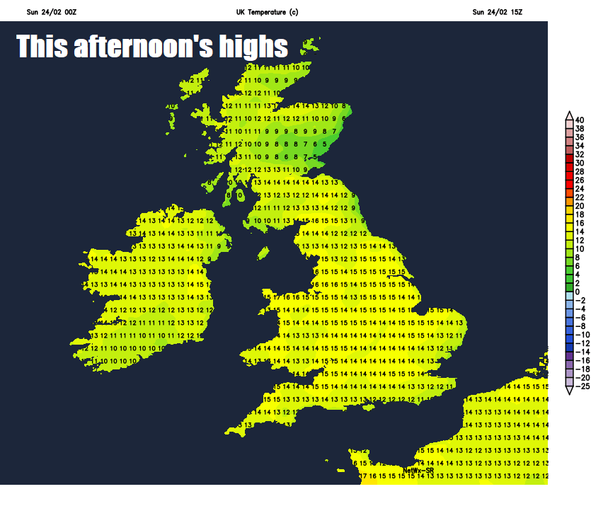
The fog across the west should gradually clear through the morning to join most areas to fine and dry day with plenty of sunshine. Though the fog may linger across parts of Yorkshire, where it does remaining chilly. But for most it will be another very mild day in the sunshine and light winds, sunshine more widespread than yesterday across the north and northwest, though N. Ireland may see more in the way of cloud. Temperatures today reaching 10-13C across Scotland and N. Ireland, 13-15C across England and Wales, perhaps one or two spots in the south reaching 16C.
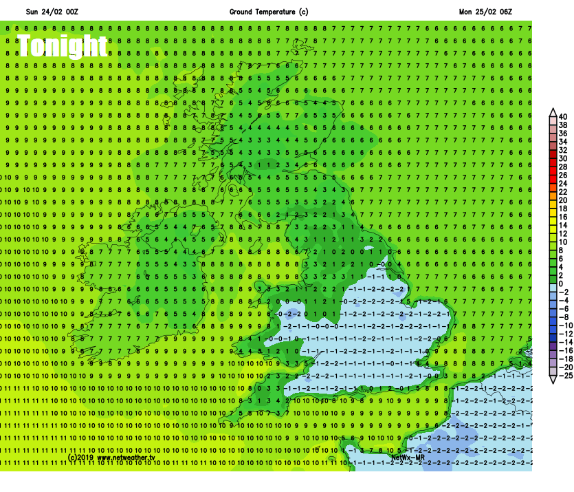
Thicker cloud moving in across NW Scotland tonight could bring some rain here, but elsewhere it will be dry with clear spells, the clearest skies across central, southern and eastern England – where drier air coming off the near continent will allow temperatures to fall to allow a frost to form, with temperatures falling a couple of degrees below freezing in places. There is also a risk again of fog forming across England and Wales, which will be locally dense.
So, a chilly start first thing on Monday, with a frost in the south, early mist and fog should gradually clear to leave most areas with another fine day with plenty of sunshine, though there will be more in the way of cloud with a little rain at first across northern Scotland. Another very mild day, warm in the south, temperatures widely reaching 13-15C, perhaps 16-17C across southern England.
High pressure in control unitl later in the week - when Atlantic systems return to bring more unsettled and cooler conditions
High pressure still in control on Tuesday, a weak weather front bringing more in the way of cloud to northern and western Scotland. But otherwise after a chilly start, foggy in places, most areas seeing another fine day with plenty of sunshine, temperatures reaching 12-14C in the north, 15-17C in the south. Wednesday again dry, sunny and mild for most. Thursday and Friday we start to see temperatures fall away as a southwesterly wind picks up, which will bring more in the way of cloud off the Atlantic, along with some patchy rain and drizzle in places on Thursday, then a more active frontal system possible arriving later on Friday could bring more widespread and heavy rain. Unsettled conditions persisting through next weekend, with spells of wind and rain moving through.


