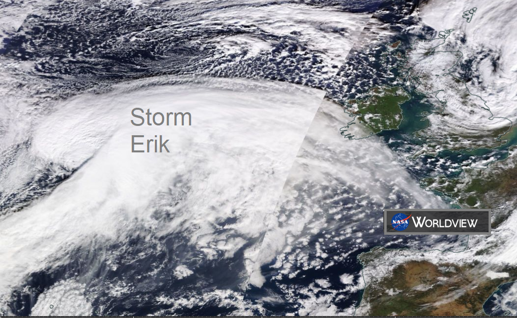
A look at the warnings for Storm Erik on Friday and Saturday, the strong winds, high gusts and flood risk as this powerful Atlantic low moves through.
The fifth named storm of this season will be #StormErik.It's been a while, back in mid December when Storm Deirdre hit bringing not only strong winds but snow and freezing rain to northern Britain and flooding with power outages for Ireland.
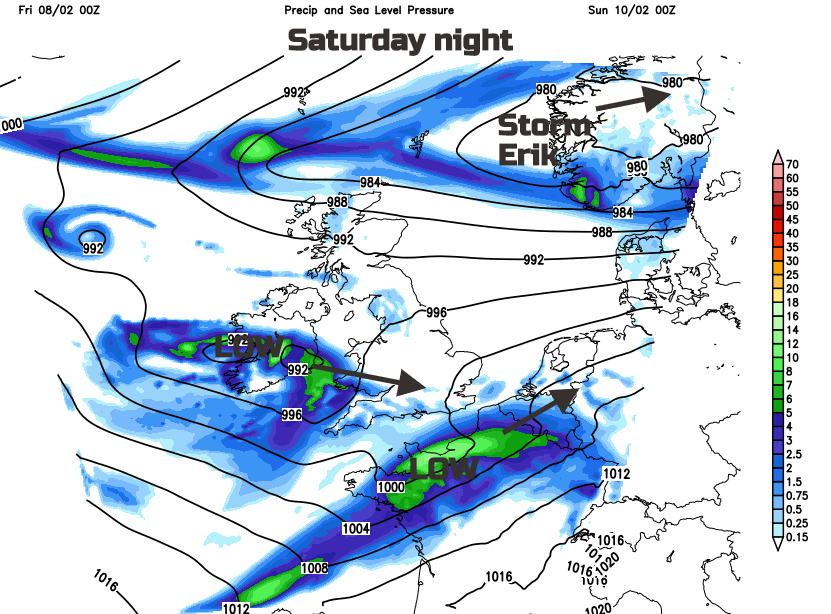
Storm Erik has been named for the strength of the winds during Friday and Saturday by Met Eireann. They have issued yellow and orange wind warnings across Ireland and the UK Met Office has a selection of yellow warnings for wind and also heavy rain. The low pressure is already looking ominous out in the Atlantic and will swirl past Northern Ireland, over mainland Scotland on Friday before heading NE over the Northern Isles early on Saturday. Heavy rain and snow melt could bring flooding and it will; be wintry over the Scottish mountains and Pennines, especially as the low pulls away and a colder northerly flow sets in.
Even outside of the warning areas there will be strong winds and high gusts but the real tuck of stormy conditions starts at lunchtime for NW Ireland.
Wind
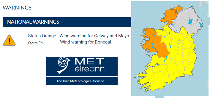
Ireland "Winds will be most severe in Atlantic coastal areas where there will be dangerous sea conditions. The combination of low pressure, high seas and high tides will lead to localised coastal flooding. The Status Orange warning is in operation for Galway and Mayo from 5am to 1pm Friday and for Donegal from 9am Friday to 6am Saturday. Met Eireann"
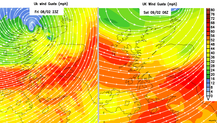
The Irish Sea and North Channel look lively during Friday night too.
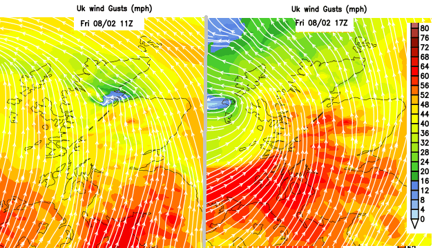
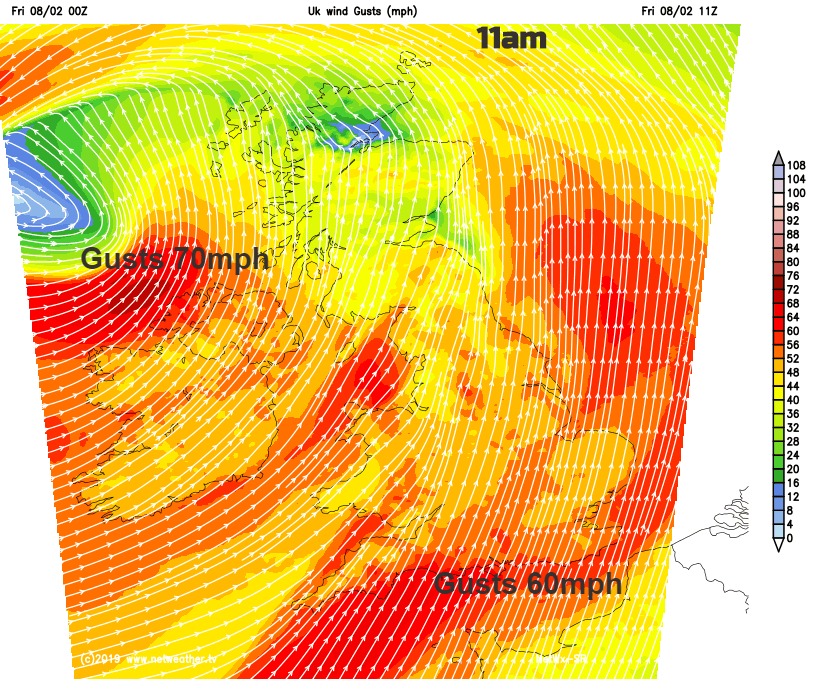
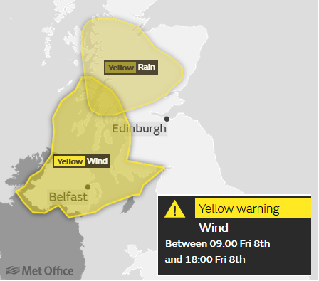
Northern Ireland " Between 09:00 Fri 8th and 18:00 Fri 8th Strong winds will affect Northern Ireland and western Scotland on Friday, with some transport disruption likely. A period of particularly strong winds will affect Northern Ireland and western Scotland on Friday, with gusts of 50 to 60 mph inland and occasionally 70 mph along exposed coasts. Winds will ease slightly on Friday evening."
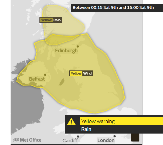
Scotland after the warning from Friday and also northern England, " Between 00:15 Sat 9th and 15:00 Sat 9th. A spell of strong winds will push from west to east through the day, bringing potential travel disruption. Inland gusts of 55 mph are expected quite widely, with some places having gusts to 70 mph, more particularly around exposed coasts and hills.
Rain
As Storm Erik pulls away to the east on Saturday, a colder northerly wind will take hold. There will be wintry showers from the NW, and another low pressure heading towards southern Britain bringing wet weather but linking to potentially wintry conditions from Ireland into Wales and the Midlands. Something to watch after Erik. It will feel noticeably colder on Sunday with a frost by the evening.
Will we get to Freya or Gareth this season, a look at how the names are chosen and when a named storm might be labelled?
Loading recent activity...