Rain and blustery winds race across the UK this week with sunny times in between. A few wintry showers in the north but temperatures are rising in the SW winds.
Any more snow this week? Not really. There will be plenty of rain and blustery winds as low pressures whizz in from the Atlantic and it will be much milder. We could see snow showers and hail over the tops of the Welsh mountains and hills of northern Britain on Thursdays and wintriness as another front comes in later Friday for Northern Ireland and Scotland but nothing like last week.
A much milder start this morning thanks to the cloud and SW then westerly winds. Kent did dip to zero on Sunday evening ahead of the incoming frontal system with clear skies and northern Scotland is chilly with a warning for snow and ice. Inverness, Aviemore and the A9 have had several cms of snow as people woke up in northern Scotland resulting in schools being closed in the Highlands.
It is a wet start for SE Britain with a band of rain edging east, giving tricky conditions on the roads with lots of spray. Several more cms of snow are likely this morning for the Scottish mountains as the band also clears off eastwards.
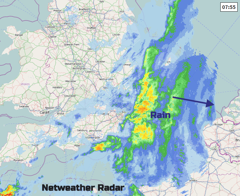
So, there will be some improvement today if you are under either of these areas of precipitation first thing. For many, it’s a fine and bright day but with brisk winds. The main band of wet and windy weather will take until lunchtime to move away from Kent and even then there will be grey skies and dampness lingering into the afternoon. There will be a few showers from the far NW but pressure begins to rise and so there will be a more settled, calmer end to the day.
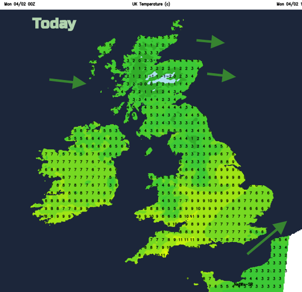
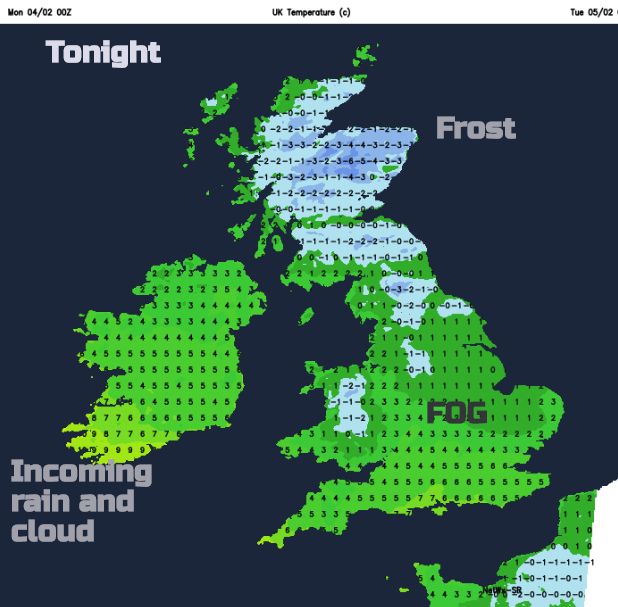
A nippy night with frost in the northeast and also fog for England and Wales by Tuesday morning. Another band for rain with brisk fresh southerly winds will reach Ireland, then move over Wales bringing heavier bursts during the morning. It will turn wet across western Britain. It becomes an unsettled day with rain, blustery winds and temperatures into double figures for Northern Ireland. much of England and Wales will be 7 to 9C and for Scotland, Cumbria and Northumberland around 4C. By the middle of the week som area could see 12 or 13C, quite a change.
This progression of rain bands, brisk winds, sunnier times with a scattering of showers from the west continues through the working week. Low pressures just keep on rattling their way in. There will be a thaw of the lying snow and additional rainfall.
The mild air stays with us, the unsettled theme and a real change from the cold, dry pattern we have been seeing for many weeks. Thursday night into Friday Balmoral, Aberdeenshire has a minimum temperature of -15.3C. We won’t be seeing anything near that cold this week.
Snow roller: South Hams, Devon. The wind starts these bizarre shapes, picking up clumps of snow and they roll down a hill, collecting more snow and enlarging.
If you are hoping for more snow this winter, join the chat and discussion in the Netweather community forum