


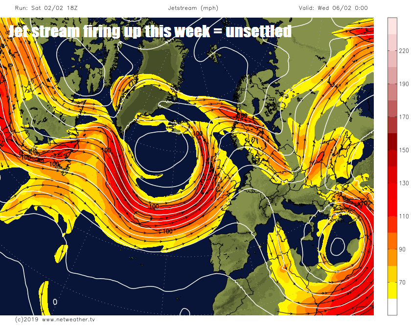
Low pressure systems will roll off the Atlantic through the coming week, bringing spells of wind and rain, hill snow in the north at first, increasingly milder too.

After the chaos and disruption from snow at the end of the week, the weather so far this weekend has been more kind with calm and sunny conditions for many on Saturday. Sunday will see a bright and cold start, but rain will spread east across northern Britain, turning to snow over higher ground, the south stays mostly dry. Another band of rain will spread in across many areas tonight, accompanied by strong winds, before clearing eastern areas Monday morning to brighter but windy conditions from the west. Then generally the weather will remain unsettled and windy at times for the rest of the week, as the Atlantic jet stream returns to full-steam, with spells of rain at times. Becoming milder too, with temperatures reaching double figures across the south from mid-week.
For now, clear skies and wind easing across many areas overnight means a widespread and locally hard frost greets many this morning. England has seen its coldest night of the year so far, with Chillingham Barns (apt name!) in NE England recording -11.7C, Highlands dropping to similar values too early on in the night, before cloud, rain and hill snow rolled in the early hours. In the south temperatures fell to -7C in a few spots. So there is a risk of ice too where snow melt, remnants of snow or wet surfaces from yesterday’s wintry showers have frozen over.
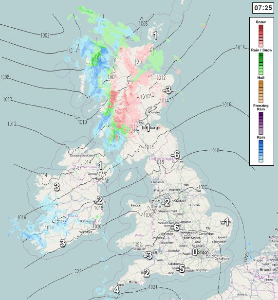
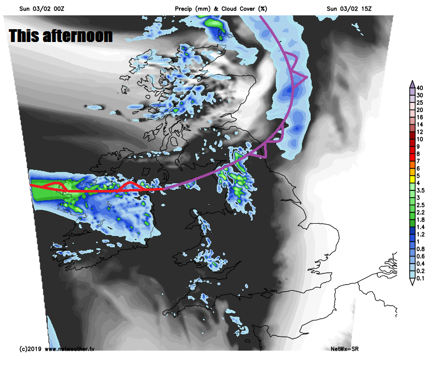
Sunday starts with sunshine for many, but already across the north and west of Scotland and N. Ireland cloud and rain is moving in - turning to snow over higher ground of Scotland, this rain moving east across northern England and north Wales through the morning, preceded by snow over higher ground. It will then brighten up across N. Ireland through the morning, then across Scotland into the afternoon. Though the cloud, rain and hill snow may linger across northern England and north Wales for much of the day, these cloudier skies moving down across southern England and Wales after a sunny morning, but staying mostly dry. Cloud and rain returning to N. Ireland by early evening. Temperatures generally reaching 3-6C, perhaps 7-9C across the far west.
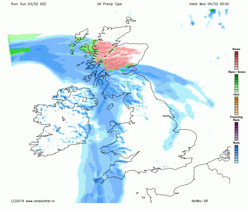
Winds picking up across the west, with a band of wet and windy conditions across Ireland and N. Ireland in the early evening quickly spreading east across many areas by the end of the night, after a dry start in the east. Rain likely to turn to snow across the Pennines, southern Uplands and Highlands as bumps into colder air here. Potential for a further 10-15cm of new snow across the Highlands by the end of night. Gales developing across the northwest too, which could bring blizzard conditions in the mountains.
Monday morning sees a fairly deep area of low pressure cross east over Scotland, pushing away the band of rain across eastern areas, while the low transfers gales across southern Scotland and NE England through the morning. Drier and brighter but windy conditions following from the west after the overnight rain clearing east across most areas, however rain, sleet and hill snow will likely linger across Scotland well into the afternoon, before eventually clearing by evening. Temperatures reaching 5-6C across Scotland, less cold further south, with 7-9C, perhaps 10-12C across the southwest.
With clear skies for many going into Monday night and a ridge of high pressure building in, there will be frost again on Tuesday morning in places. Tuesday itself starting off dry, bright and crisp, but cloud and rain will move in across the west, eastern areas staying mostly dry and bright.
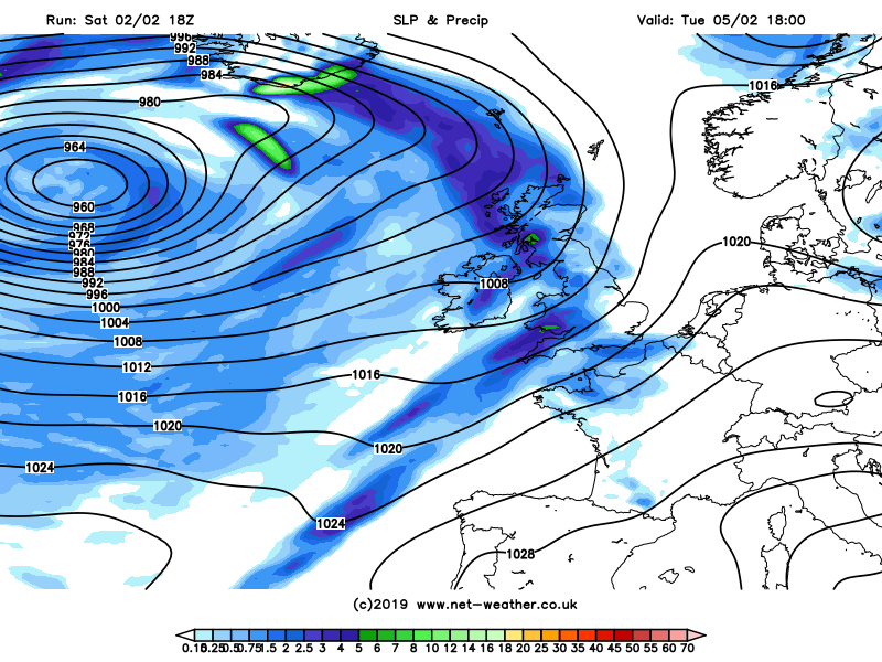
Unsettled and often windy through much of next week, mild from mid-week with winds from the southwest or west
Cloud and rain spreading east across all parts Tuesday night, lingering across southern areas on Wednesday, while clearing and brightening up further north, before more cloud and rain, preceded by hill snow arrives across the northwest by evening accompanied by strengthening winds. Further spells of wet and windy weather crossing all parts on Thursday and Friday, as the Atlantic jet stream cranks up a gear, generally milder across all parts, with temperatures reaching double figures across the south.


