Snow showers across parts of southern England and also across the north and northeast, however these will ease into the weekend, with more in the way sunshine, but staying cold.
There’s certainly plenty of weather to talk about as we start the new month. Outbreaks of snow have swept eastwards across southern Britain since yesterday afternoon, southwest England was initially worst hit, timing with the Thursday evening rush hour, with around 100 drivers left stranded for hours on the A30 in Cornwall.
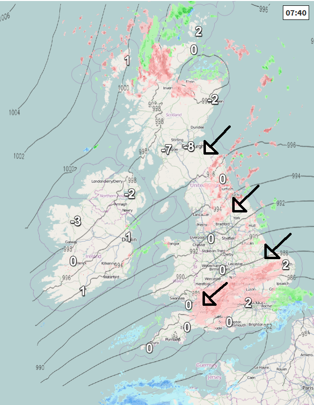
The snow spread further east overnight, bringing up to 5 to 6cm in places, particularly across the Thames Valley to the west of London – where there is an Amber Warning in place to the west of London until 11am this morning, so roads, motorways and railways may see some delays here. The major arteries such as the M4, M40, A48 etc mostly clear, but some more minor routes could see treacherous conditions this morning, as snow continues to fall on what has already settled. Heathrow cancelled some short-haul flights, while Bristol Airport is apparently completely shut for now.
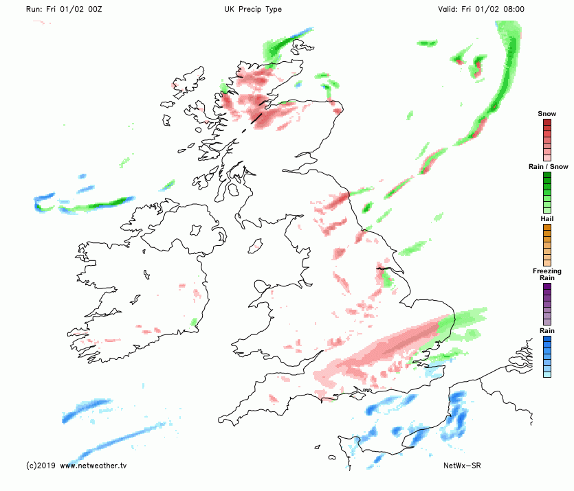
The snow has cleared Devon and Cornwall overnight, but will continue this morning across southeast Wales, West Country, south Midlands, central southern England and the Home Counties to the north and west of London, giving further accumulations of another 2-5cm in places, heaviest snow across Berkshire, Wiltshire, Oxfordshire and Buckinghamshire in particular.
It will be a grey and morning generally across southern England, East Anglia Midlands, south and mid Wales, snow will tend to ease to the north and west of London through the morning, with some snow flurries in places elsewhere, sleet or rain along coasts. Tending to brighten up through the morning across Wales and SW England, but for central, southern and eastern England it will stay rather cloudy for the rest of the day, with further sleet or snow shower feeding in from the northeast.
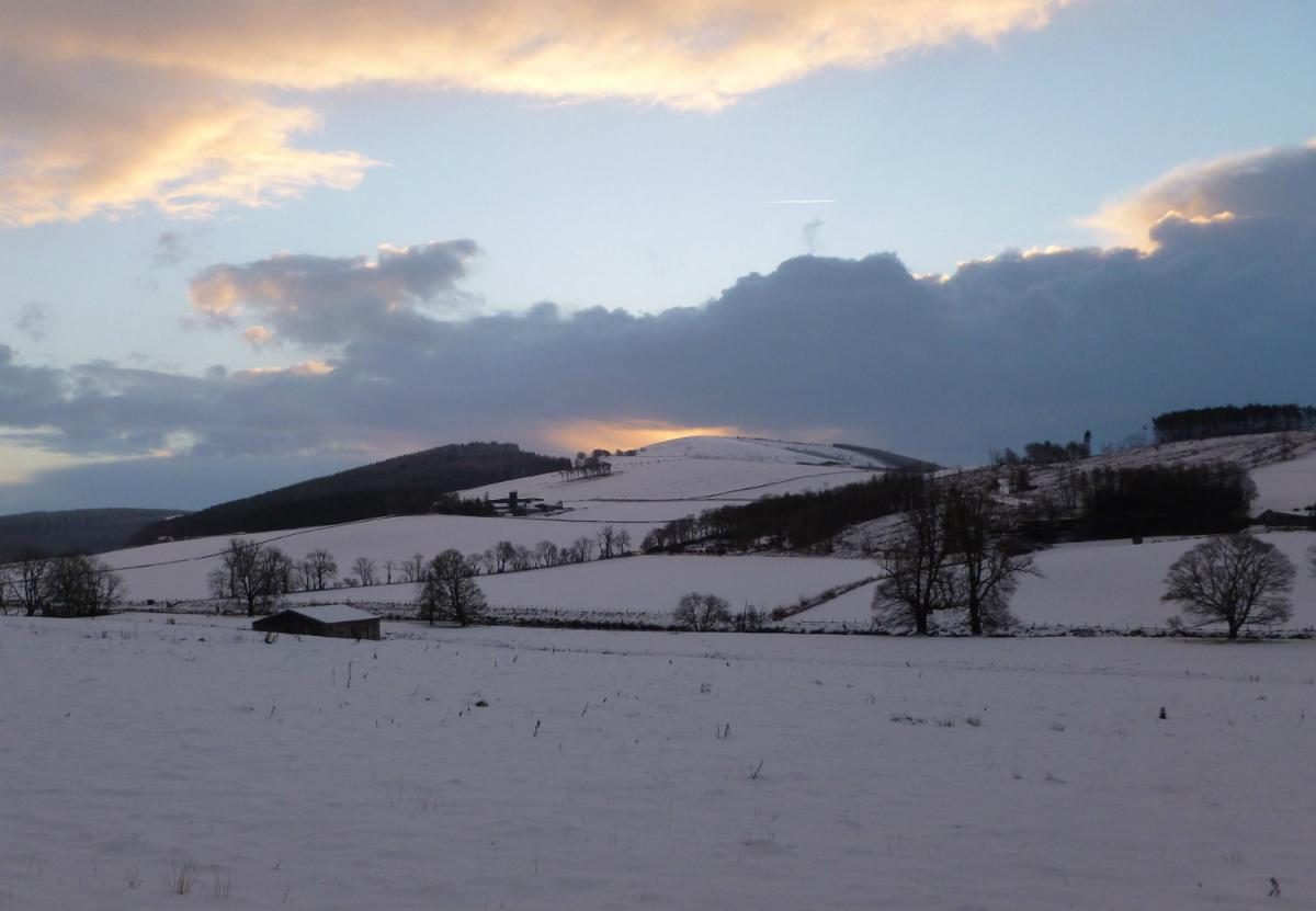
Turning our attention to further north, where there has been a scattering of snow showers feeding in across northern Scotland and also in off the North Sea across northern and eastern England through the night, and here they will continue through the day, giving a further few centimetres in places. Across north Wales, NW England, Northern Ireland and western Scotland it will be a drier and sunnier picture today, after a cold and frosty start, temperatures starting off as low as -15C in the Highlands, making it the coldest night of the winter so far.
A cold day everywhere, temperatures generally reaching 2-4C, perhaps 5C in the far west. A cold northeasterly wind towards eastern coasts making it feel raw here.
Then into tonight, we will continue to see sleet and snow showers coming in across northern and eastern coastal fringes of Scotland and down across eastern England, further west across central and western areas a mostly dry and clear night with a widespread frost developing leading to a risk of ice, perhaps a few wintry showers clipping the far west of Wales and Cornwall running down the Irish Sea, while Northern Ireland could see a fair few sleet and snow showers overnight too. Because temperatures will be close to or below freezing widely, there is a risk of icy patches, particularly where showers fall or there’s already snow cover.
Saturday will have a rather cold and, in places, frosty start – with a risk of icy patches to watch out for, it will be a sunny start though for many and it will stay so with long spells of crisp wintry sunshine. However, there will be further showers, snow showers affecting northern and western Scotland, while wintry showers will run down North Sea coasts and also parts of Wales and SW England. Temperatures reaching 3-5C generally, perhaps 6-7C in the southwest.
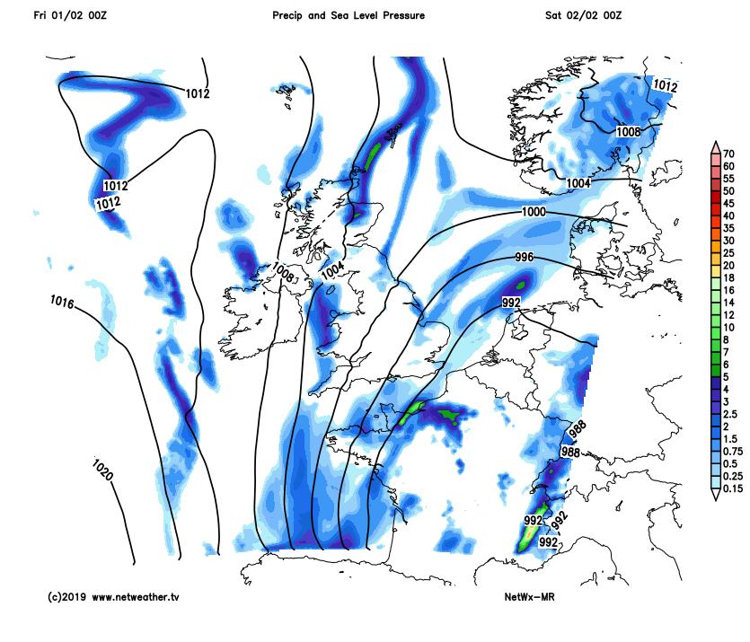
A frosty, dry bright or sunny start on Sunday and for many southern areas it should stay dry and bright or sunny during daylight hours, however, further north an Atlantic frontal system will move in across Scotland, N. Ireland and the far north of England through the morning, bringing a spell of rain, sleet and hill snow.
Wet and windy conditions sweeping in from the west Sunday night across northern and western areas, with hill snow across northern areas. An area of low pressure crossing the north on Monday, spreading wind and rain towards the east in the morning, followed by brighter conditions with showers from the west. Staying generally unsettled next week, with further Atlantic systems moving in from the west at times, bring spells of rain, with hill snow in the north. Turning less cold too, especially in the south. Perhaps turning drier and perhaps colder towards the end of the week.