


Turning wet & windy across most areas by the evening, clearing the east tonight, followed by increasingly cold conditions on Sunday, with coastal gales and wintry showers. Cold next week.

The past working week started cold but ended on a mild note, with many areas seeing temperatures recover into double figures, Cardiff getting as high as 13.9C. Saturday will stay fairly mild and rather cloudy, with rain across Scotland and N. Ireland spreading to Wales and western parts of England too. A fairly deep area of low pressure will move east right across the UK later on Saturday, bring a spell of wet and windy weather across all parts by the end of the day. Windy and showery on Sunday as the low clears east, cold northerly winds developing in the west, with this colder air spreading east overnight into Monday, which will be a cold day for all, with wintry showers. Staying generally cold throughout next week, with a risk of snow, mainly over the north, but perhaps across the south at time too.
For now, a mild and frost-free start for most, though a touch of frost across NE Scotland, otherwise most areas generally cloudy, with rain across or drizzle in the northwest, but much of southern and eastern Britain dry.
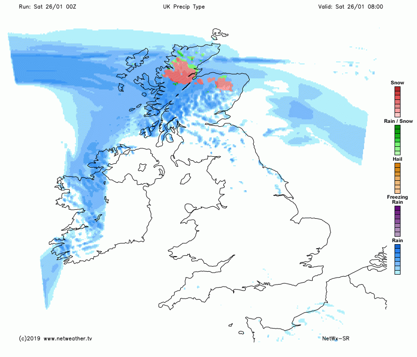
Rain moving in across Scotland and N. Ireland this morning will become increasingly heavy and persistent, turning to snow over northern and western Scotland, initially over higher ground, but perhaps increasingly to lower levels in the far north. All rain for the island of Ireland and this band of rain and strengthening winds will spread east over Irish Sea to affect Wales and the western side of England as we head into the afternoon. Eastern England staying mostly dry but cloudy during daylight, though with the possibility of some patchy drizzle. The rain band will reach eastern England in the evening, clearing elsewhere areas to scattered showers. Rain persisting across northern Scotland, where it will turn increasingly to snow at lower levels. Gales developing across the far west in the evening. Temperatures reaching a mild 9-10C generally, but across northern Scotland perhaps only 5C at best.
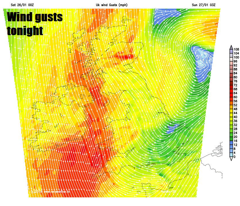
Rain clearing eastern England this evening, then showers following on behind across most parts, showers turning increasingly wintry across northern and western areas, as a cold northerly wind develops down the western side of Britain, snow showers merging across northern Scotland may bring blizzard conditions for a time, as gales develop widely across northern and western areas. Across western Scotland, N. Ireland, Wales and SW England gusts of 60-70mph are possible overnight, which could bring some travel disruption.
Yellow warnings have been issued by the Met Office for snow and ice across northern Scotland and wind across N. Ireland, Wales and SW England.
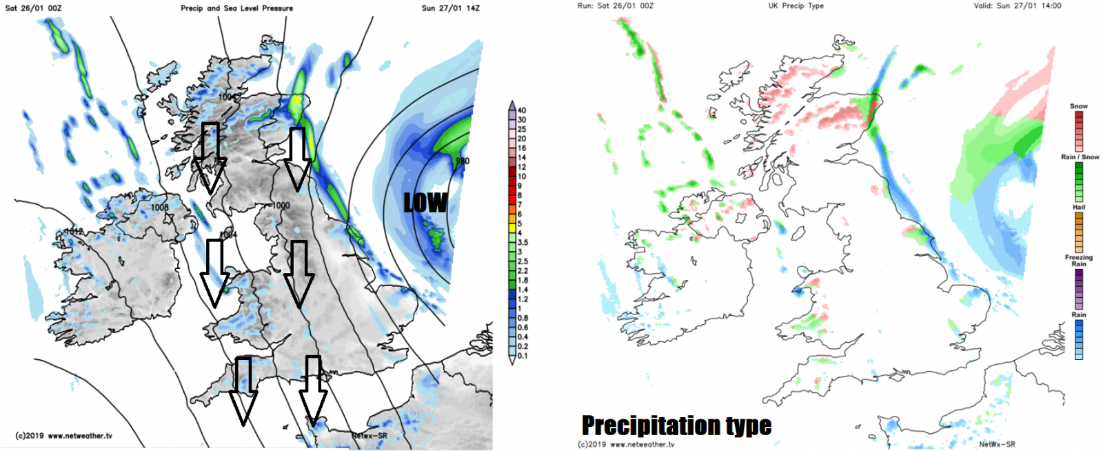
A strong to gale force north to northwesterly wind across all parts on Sunday, strongest gusts in the west at first then transferring to the east, with cold air across northern and western areas gradually working its way further east. Sunny spells and wintry showers easing in the west, areas of rain and hill snow slipping down the eastern side of the UK, followed by wintry showers from the north. Gusts of 35-45mph widely inland, 50-60mph across coasts. Temperatures falling through the day, so colder than Saturday, reaching 4-6C across Scotland, northern and eastern England, 7-9C in the south and west.
The cold air staying with us as we head into next week. Monday a cold and windy day, with scattered wintry showers around western and eastern coastal areas, before an area of more persistent rain, sleet and hill snow spreads southeast across Scotland and N. Ireland in the morning, then further south across England and Wales in the afternoon.
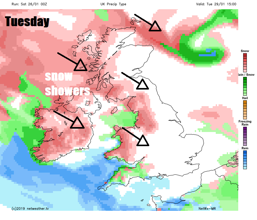
Frequent sleet and snow showers in the northwest on Tuesday, blown through on a strong northwesterly wind, scattered wintry showers penetrating through to southern and western areas too. Wednesday should see winds and wintry showers ease back to coasts, with more in the way of sunshine, but there is potential later in the day for an Atlantic depression to move in across the southwest, bringing heavy rain preceded by snow on its northern flank, but too far off to say where the snow could affect for now.


