A roundup of the UK weekend weather. Quite a storm later Saturday into Sunday with wild winds and rain turning to sleet and snow in a cold North wind.
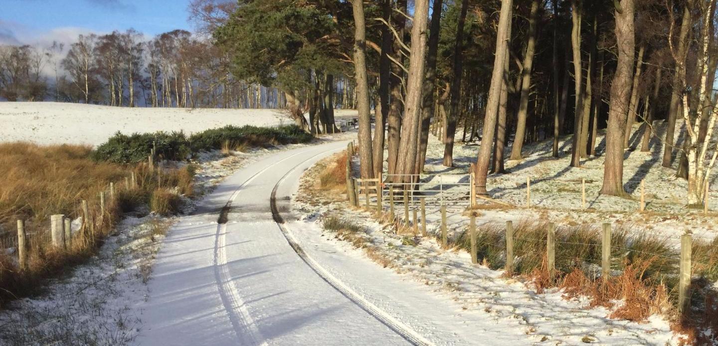
There has been wintry weather this week with snow, frost and ice for the UK, even in southern Britain as temperatures dipped down to -10C in NE Scotland
A brief milder spell has enveloped the UK for the end of the working week and on Saturday, but we’ll be back in the cold air for the new week.
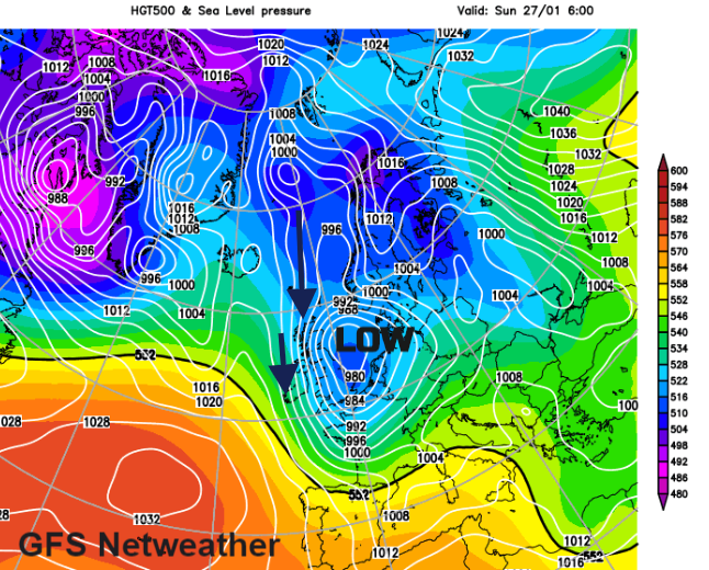
A deepening area of low pressure is heading in from the Atlantic later on Saturday into Sunday and will bring strong winds, high gusts and a real chill as a North wind takes hold. This will bring rain and snow for the second half of the weekend.
So, Saturday will be mild and breezy with rain for Scotland before more rain and hill snow sweep in from the west. The winds strengthen and the mild air is pushed out of the way.
Then we see the likelihood of snow increasing as cold air begins to flow over the UK
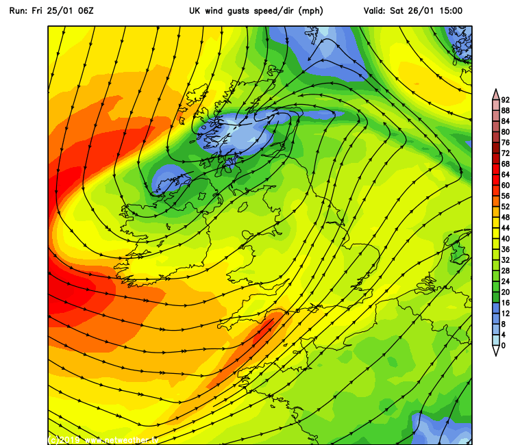
Fresh to strong north then NW winds take hold with coastal gales and gusts up to 60mph. It will feel bitterly cold if you out in that wind Saturday night or on Sunday.
As the frontal rain clears there will be lines of showers running through. These will bring a wintry mix of rain, sleet and snow but once more there could be flurries, a light covering or s few cms falling as the showers move through.
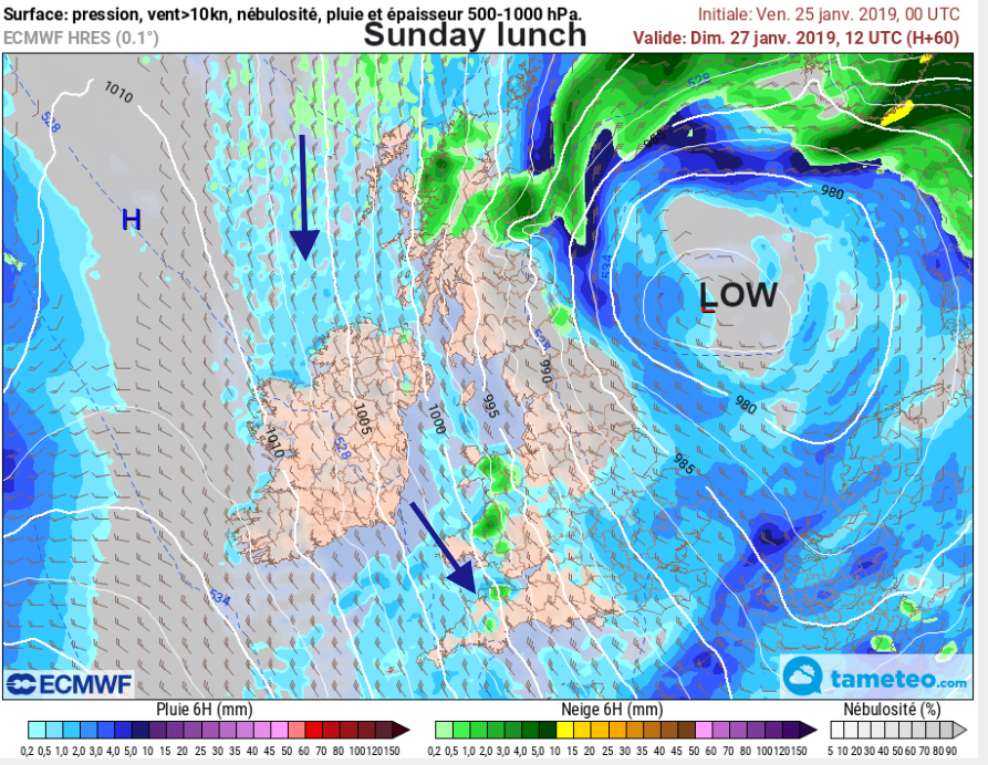
Northern Scotland looks most prone but other areas will see snow showers depending on the wind direction. First from the northwest, into Northern Ireland, Wales and NW England, even Devon and Cornwall and other clusters running through more of Scotland into northern England.
By the end of the weekend, northern Scotland and eastern England look more prone to wintry showers.
There may be disruption from the strong winds and high gusts, along with the brief snowfalls.
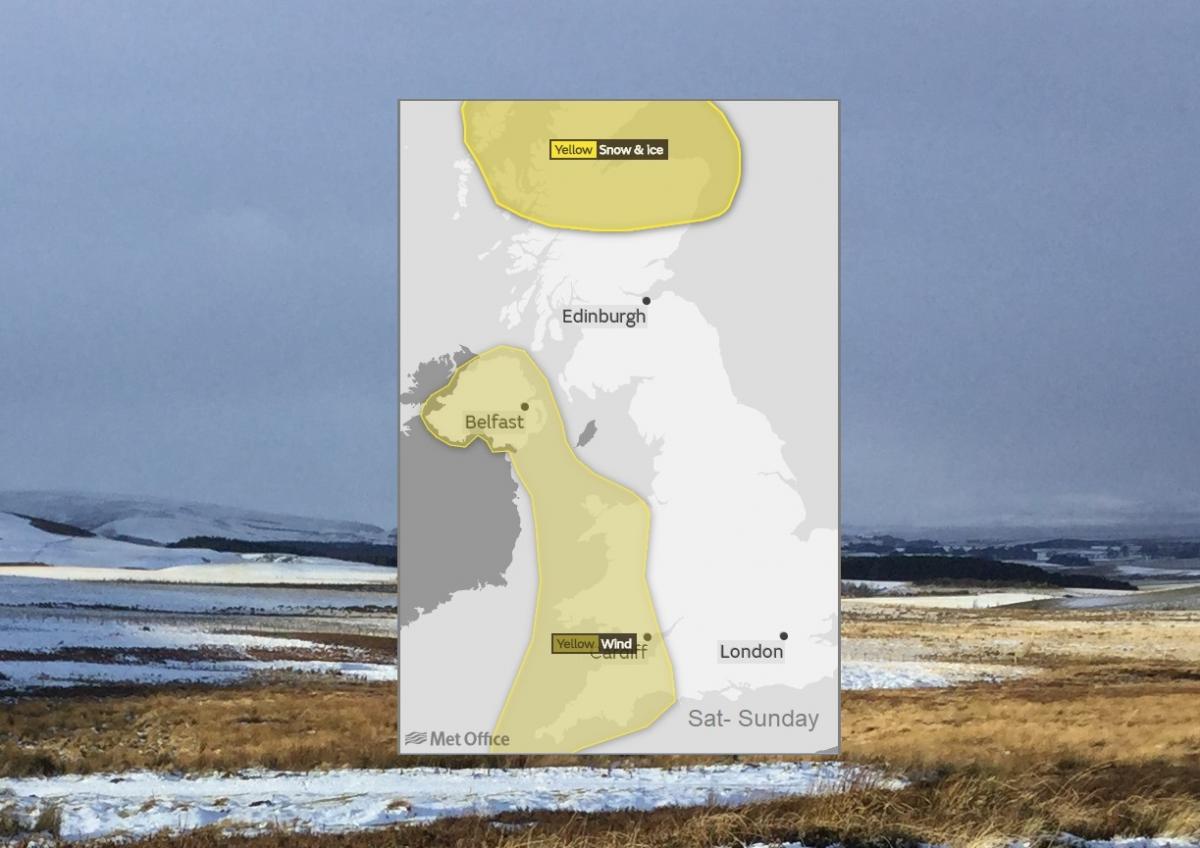
Met Office Yellow warning for Snow and Ice
Some transport likely to be affected by snow, leading to potentially longer journey times. Icy surfaces on roads and pavements could lead to an increased likelihood of accidents and injuries. Strong northerly winds will lead to blizzard conditions and drifting over high ground, where 10 to 15 cm of fresh snow may accumulate. At lower levels, 2 to 5 cm is possible, mainly inland and above 100 m.
Met Office Yellow warning for Wind
A spell of strong northerly winds is expected on Saturday night and Sunday bringing some transport disruption.
Next week looks cold and unsettled in a brisk NW wind.
More discussion on the Netweather community forum