Chilly weekend, with a wintry mix falling in places. Cold continues into next week, with risk snow in places. Potentially bitterly cold air arriving from the northeast by Friday.
Following weeks of anticyclonic weather dominating the UK, with some areas not seeing rain for over 20 days, which is unusual for deep winter, changes are happening in the weather patterns which will see colder conditions prevail until the end of the month and, at times, more unsettled conditions which could bring snow in places. There are signs that it could turn very cold towards the end of next week if, as recent model guidance has indicated, high pressure starts to build to the north and northeast, which will draw bitterly cold air from NE Europe.
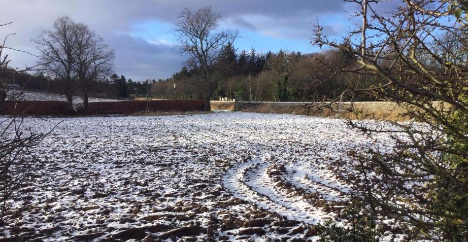
The week is ending on a colder note compared to when it started, thanks to a cold northerly flow coming down from the arctic yesterday. Wintry showers in the northerly flow yesterday brought some snowy scenes first thing across central and northeastern areas of Britain in the morning, while today, an Atlantic frontal system pushing in from the west bumping into the cold air is bringing more snow across the west this time, even to lower levels as shown by some videos on twitter of snow falling in Liverpool city centre. Snow unlikely cause any problems at lower levels, but over higher ground of northern England and the Midlands, such as the Pennines, higher routes maybe slippery from snow settling.
The weekend is looking cold, though not especially so. England and Wales rather cloudy Saturday with a messy mix of showery bits of rain, sleet and hill snow here and there moving slowly east or southeast. Not really amounting to very much and any snow generally confined to higher ground – where it’s unlikely to cause many issues. Scotland mostly dry and bright but cold.
Sunday seeing an occluding front moving east off the Atlantic, bringing a band of rain, sleet and hill snow across Scotland and western areas of England along with Wales, bright in the east. Any snow l generally light and unlikely to cause any major problems. The front fizzling out by the time it reaches the east.
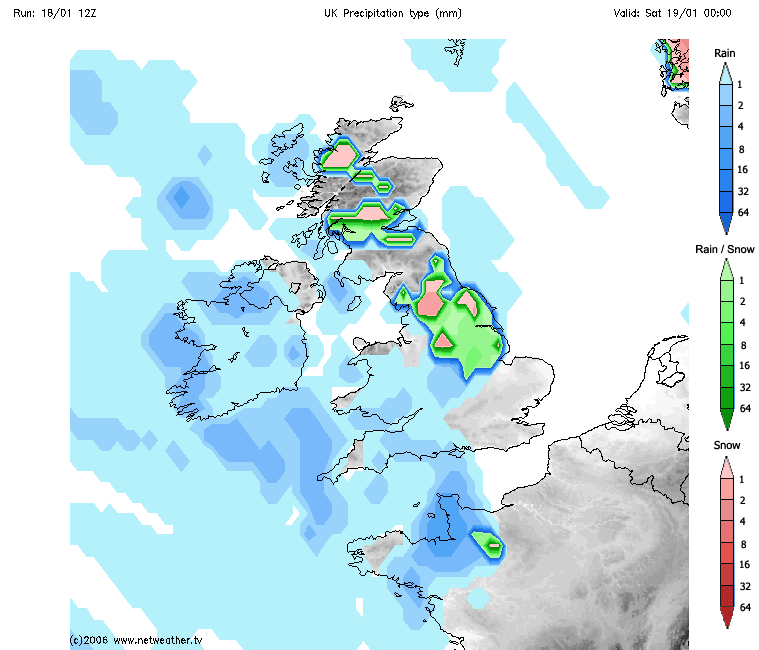
Following Sunday’s weakening front clearing east, clearer skies from the northwest could bring a widespread frost to start the day on Monday, a brief ridge of high pressure keeping most eastern areas dry but cold during daylight. However, out the northwest, a deep depression moving off the tip of Greenland towards Iceland will push an active frontal system across the west later in the day across then further east overnight and into Tuesday before clearing SE England early Tuesday. It will turn briefly ‘milder’ ahead of this frontal system, so the front initially bring rain for most, but colder cutting in behind from the northwest sourced from a very cold Greenland and NE Canada, could turn the rain to snow on the back edge as it clears SE. So this active frontal event with back edge snow Monday night needs carefully watching. 00z ECMWF was not overly keen on back edge snow away from more northern areas, 00z and 06z GFS show back edge snow all the way to southern England.
Risk of snow on back edge of cold front moving southeast Monday night
Wednesday onwards uncertainty has manifested from model guidance over the last few days, with quite a few scenarios being presented – especially from GFS model. However, after some uncertainty with regards to the track of a winter storm over the eastern USA this weekend and how far out into the far north Atlantic it will track and interact or phase with low pressure ahead of it near Iceland diving southeast towards the North Sea Tuesday, it appears the models are starting to converge on the idea of low pressure over North Sea Tuesday dropping southeast across mainland / central Europe into Wednesday, while pressure / geopotential height rises build in to the north of the UK and over Scandinavia
The buckling of the jet over the far north Atlantic ahead of that winter storm passing Nova Scotia on Tuesday and jet stream downwind over the NE Atlantic turning southeast as a result, allows low pressure to dive southeast from Iceland towards the North Sea then into mainland EU and looks to be the main trigger for pressure to build to the north and northwest of the UK later next week. This buckling of the upper flow is an example of anticyclonic rossby wave breaking and tends to be a precursor for high latitude blocking.
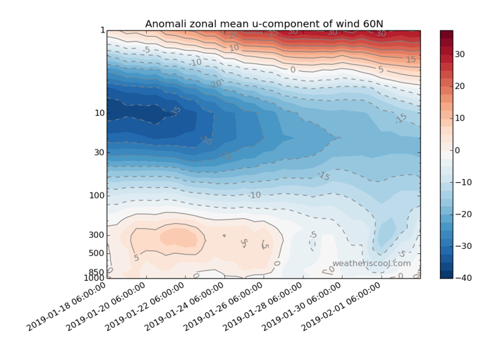
However, there are also signs, from the ECMWF high resolution, of an arctic high forming over eastern Greenland, perhaps in response to easterly winds starting to propagate down through the troposphere from the lower stratosphere – following the Sudden Stratospheric Warming (SSW) to start the year.
EC, with its better vertical resolution, probably get a better handle on the downwelling and how it will affect tropospheric patterns and yesterday's EC stratosphere charts on the Berlin site showing easterly winds finally reaching down into the troposphere by the middle of next week.
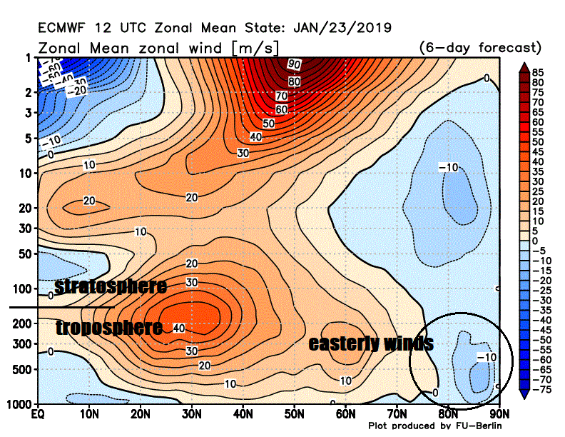
06z GFS also has the easterlies reaching down through the troposphere, perhaps a few days later
This arctic high has, on a few ECMWF runs now, been indicated to drop south to Scandinavia intensifying high pressure there, this and the sequence of events leading to the flow buckling northeast over the Atlantic portending to an easterly or northeasterly flow to develop towards the tail end of next week.
Such a flow from this direction would bring very cold air from Scandinavia and NW Russia, which would bring not only day time temperatures close to freezing, but also an increasing risk of snow showers or longer spells of snow – especially across eastern areas.
12z GFS this evening still showing potential for bitterly cold air to arrive from the northeast later next week
However, there is still a fair bit of uncertainty how the synoptic pattern will evolve in detail for now beyond Wednesday, suffice to say an increasing risk, say 70%, for very cold air and increasing snow risk to arrive from NE Europe by the end of next week or next weekend. This very cold pattern could be sustained into early February, thanks to the delayed downwelling of easterly winds in the stratosphere impacting circulation in the troposphere, i.e. high latitude blocking, for a few weeks at least.