A change to colder weather on the way as the rain in the northwest today, moves southeast overnight and into tomorrow.
If you're away from the northwest of the country, today won't be much different from the majority of other days lately - grey and mild. But changes are on the way, starting in the far north and northwest today, where the rain will last virtually throughout.
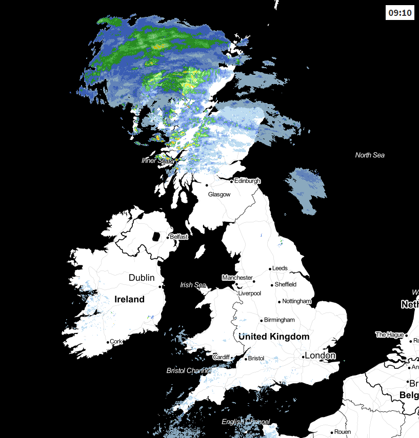
During the remainder of the week, we're going to be into a more mobile weather pattern, with that rain in the northwest sinking southeast tomorrow. Behind it, there'll be colder air to turn some of the showers to sleet and snow - mostly over the hills of northern Britain. Then we'll have to watch as an Atlantic depression moves in to end the week, bringing wind, rain and maybe also some snow as it moves in and meets the colder air.
All the while though, and despite all the media stories of late, still no beast from the east.
So, although for most today will be dry and grey away from the north of Scotland, there will be some exceptions. There'll be some mostly light showers affecting southern England and south Wales, drifting in from the west. There'll also be some brightness in places, especially to the east of high ground, where you may even get some sunny spells. Temperatures will typically range 7-11c countrywide, but will be tempered a bit by the wind - especially in the north where it'll be at is strongest.
Tonight, the rain finally makes its move, heading southeast, reaching northern England, northern and western Wales and perhaps clipping into the southwest of England by first thing. It'll keep trundling southeast through the day, finally clearing the southeast corner later in the afternoon.
As it moves through, it'll introduce colder air, sunnier spells but also a fair few showers. They'll be blown in on a fresh if not strong west to northwest wind - which'll swing more towards the north from the north later.
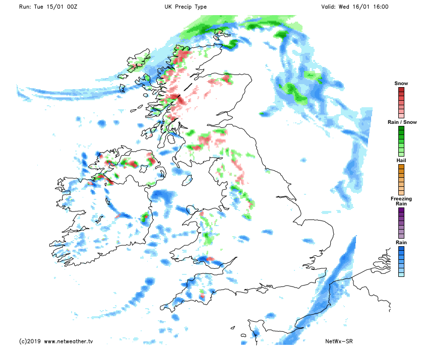 As the increasingly cold air arrives, those showers will readily turn wintry over high ground, and even to lower levels further north. Overnight, a few showers will keep going near to north facing coasts and across the north of Scotland but for many, it's dry and increasingly clear. That's going to lead to a widespread ground frost, so watch out for icy patches on Thursday morning.
Into Thursday, it'll be a crisp, clear day for many with plenty of wintry sunshine. There will still be a few showers here and there, falling as sleet and snow in the north and over the high ground still. Temperatures will struggle a bit, reaching 2-4c widely across northern Britain, 4-7c elsewhere.
Then we'll need to watch out to the southwest as an Atlantic system nears. There is some uncertainty over the timing, but away from the far west and southwest, Friday is likely to start dry and frosty before cloud builds and the rain and wind sweep in. As the wet weather arrives, it does look likely to bring a period of snow over northern hills, with wintry, chilly weather then lasting into the weekend as the low moves away.