


High pressure in control will mean dry conditions continuing but with colder flow from the north arriving yesterday it be colder with risk of widespread overnight frost and patchy freezing fog.
Most of the UK will experience a move away from the rather mild and well above average temperatures of the past week or more to temperatures closer or locally below normal for the time of year. This is thanks to colder and clearer air moving down from the north behind a cold front on New Year’s Day, allowing night time temperatures to fall close to or below freezing while high pressure and light winds by day allow little rise in temperature. High pressure will be in charge for the rest of the week, so staying mostly dry and bright or sunny by day, frosty overnight with local freezing fog patches forming. High pressure will relax temporarily this weekend, which will allow Atlantic fronts to bring more in the way of cloud along with some patchy rain in the north, with frost and fog becoming limited to the south.
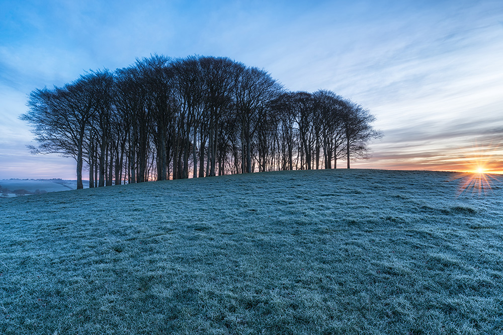
High pressure and colder air from the north will mean dry conditions continuing this week but colder than recently with widespread frost
For now, a generally cold start for many, with a frost in places – particularly in the north and west – where clearer skies have allowed temperatures to fall below freezing, as low as -7C at Braemar and -6C at Glasgow and Edinburgh. More in the way of cloud and northerly breeze across eastern England has held temperatures generally above freezing and bringing a few showers to North Sea coasts too.
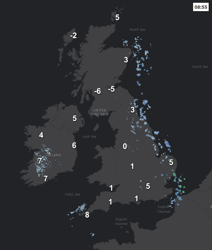
After the cold and frosty start for many away from the east, any early fog patches should soon clear to allow lots of wintry sunshine with light winds across the bulk of the UK, the exception will be more in the way of cloud across the far north of Scotland and down the east coast of England – where we will continue to see a few showers feeding in along coasts on a brisk northerly wind. Colder than of late, temperatures 2-4C across Scotland, central and northern England, 6-7C across southern England, Wales and N. Ireland.
Tonight similar to last night, with much of the UK under clear skies leading to a widespread frost, with temperatures falling well below freezing in some places, there could also be some freezing fog patches inland. More in the way of cloud across N. Ireland, western and far north of Scotland, also down the east coast of England with the odd shower here - which will likely hold temperatures above freezing.
A subtle shift in high pressure system over the UK on Thursday will allow more in the way of moisture and thus cloud to affect Ireland, N. Ireland and western Scotland and it will be cloudier across East Anglia and SE England, but inbetween these areas there will be decent spells of sunshine for much of the day. Temperatures coldest across central and eastern areas – where they’ll reach 3-6C, lower where any freezing fog patches linger across the Midlands, while less cold across the west where 6-9C more likely.
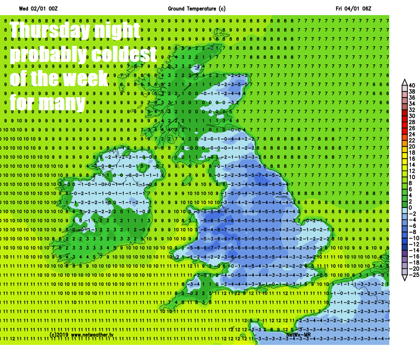
Overnight into Friday and it could be the coldest night this week across England and Wales, some freezing fog patches to watch out for in the west too – which could linger into Friday. After a cold start remaining cold during Friday, perhaps the coldest day of the week in the south, with temperatures struggling to get 3-4C, despite sunshine. Pretty much dry and bright or sunny across the board, best of the sunshine in the east.
The weekend looks to stay mostly dry in the south, with high pressure in charge, high pressure weakening though to allow weakening Atlantic fronts to move in across northern areas by Sunday, so cloudier and less cold across many areas compared to the next few days, with some patchy rain spreading in across Scotland, N. Ireland and northern England on Sunday, before fizzling out later in the day. Any frost and fog increasingly confined to the south as a result of the increasing cloud amounts.
High pressure looks like sticking around close by as we head through the second week of January, so staying largely dry and settled, perhaps turning colder and clearer again from the north by mid-week after a cloudy less cold start, with a return of widespread frosts.


