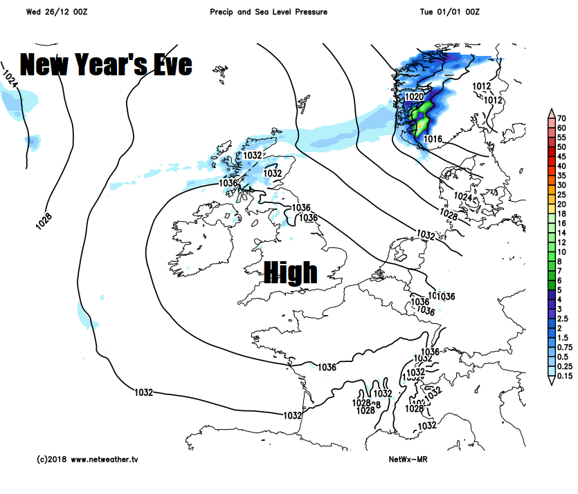
High pressure largely in control until early January, so many areas staying dry and settled, though Atlantic systems may affect the north at times.
High pressure will generally dominate our weather as we see out the year, bringing a lot of dry and settled weather with mild days and chilly nights in the south, though high pressure will relax south at times to allow Atlantic frontal systems to plague the north with some cloud and rain at times, particularly on Saturday - when it will turn wet and windy across the north. High pressure builds north next week, so New Year’s Eve and Day are looking dry and settled.
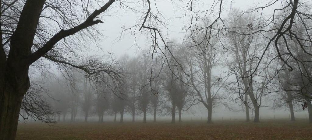
It’s a dull and grey but mild start for many of us this morning, a weather front close to Scotland is bringing some patchy rain across northern Scotland, but for most it’s a dry start, but rather cloudy and murky with some hill fog. Though there are some breaks allowing some early brightness across eastern Scotland, N. Ireland, NW England and far SE of England.
The cloudy and murky conditions with mist or hill fog will linger through much of the day across northern and western hilly areas along with across central areas too, patchy rain continuing across northern Scotland. But with shelter from higher ground across eastern areas of Scotland and England along with parts of NW England there will be sufficient breaks for some bright or sunny spells, also clearer skies will develop across southern England, so probably sunniest here.
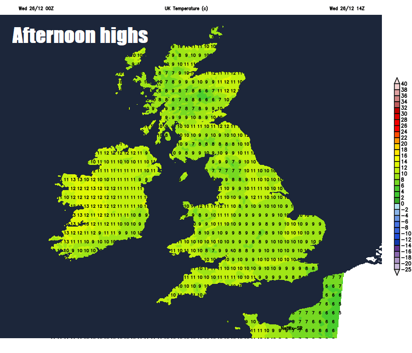
A fairly mild day after a frost-free and mild start to the day, temperatures widely reaching 9-10C, perhaps 11C across the southwest, above average for the time of year.
Remaining cloudy and murky with hill fog for Wales and parts of northern and central England overnight, clearer skies across southern and eastern England – allowing for some mist or fog patches to form. Further north, cloudy with outbreaks of rain across western Scotland, while eastern Scotland and N. Ireland see clearer spells. Generally a mild and frost-free night, but colder air feeding in across southern England from the near continent will allow temperatures to fall into low single figures under clearer skies here, which could allow a frost to form locally.
A chilly but bright start across southern England, with a frost locally, some thick fog patches here too which maybe slow to clear, but generally here and along south Wales, eastern areas of England and Scotland it will be a bright or sunny day. Cloudier across North Wales, NW England, N. Ireland and western Scotland. A cooler day across central and eastern areas of England, with the colder feed off the near continent, temperatures reaching 7-9C, but across northern and far western areas it be milder, reaching 9-11C.
High pressure still in control across the south as we head into Friday, so dry and bright across the south, though fog forming overnight may be slow to clear in places. A weakening frontal system moving in from the west will bring more in the way of cloud and some rain across Scotland and N. Ireland in the morning, before thicker cloud and patchy rain fizzling out reaches northern England and north Wales for the afternoon, this thicker cloud but little rain reaching the southeast by the evening. Another mild day, temperatures reaching 8-10C.
Heading into the weekend and an Atlantic depression will pass the north of Scotland on Saturday, bringing a spell of wet and windy weather across the north. High pressure over France will ensure southern areas remain largely dry and bright, though again, overnight fog may be slow to clear. Drier and more settled with brightness or sunshine for some on Sunday, as high pressure over France builds back north again, fog patches perhaps an issue across the south. Mild during the day over the weekend, temperatures reaching 10-11C widely, though nights turning chilly in the south and east, perhaps a frost locally.
High pressure looks like hanging around through much of next week too, so generally staying dry and settled for New Year’s Eve and New Year’s Day and also for much of the rest of the week, though overnight fog may form in places and could linger, frost may form locally too.