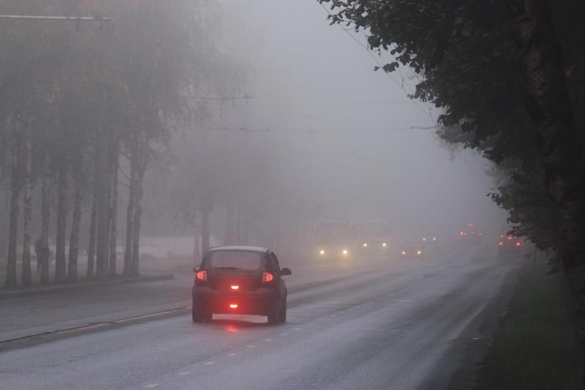
UK weather - Fog has brought tricky conditions on the roads and for the next few mornings, there will be rain and strong winds for rush hour traffic. Lots of low pressures heading our way.
The rush hour has fog included this morning, dense fog and freezing fog for a few. Overnight the winds have been light, there have been clear spells and so temperatures have dipped away and the fog formed. The Met Office has issued a yellow warning for this morning for inland central southern England but there is fog across more of Britain.
Last night was a transition time from the cold easterly flow which is still bringing showery rain and hill sleet into eastern Scotland, around to a milder SW flow with plenty of wet and windy weather.
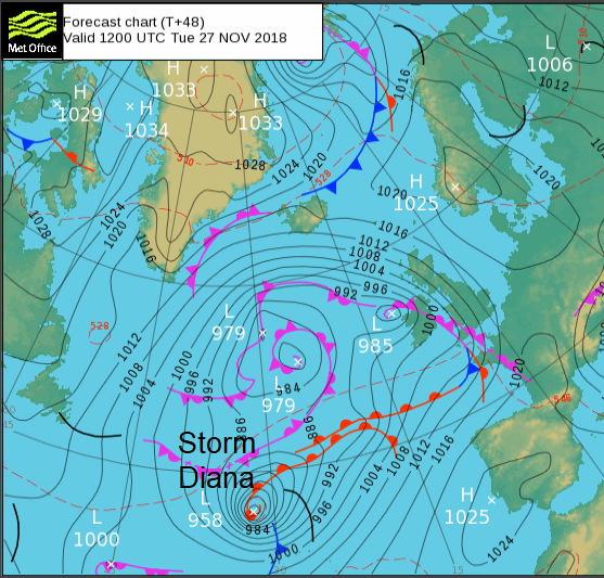
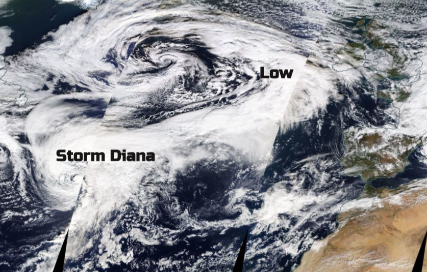
The Express has got very excited about a combination of Diana and severe weather. #StormDiana. Not named from the UK & Ireland list (next would be Deirdre) but by the IPMA Portuguese Met. Institute. Way out in the Atlantic is rapidly deepening low pressure which will move north of the Portuguese Islands the Azores. Schools and nurseries are closed there today. This is Storm Diana.
Afterwards, this same low will head towards Ireland and the UK bringing wet and windy weather on Wednesday and Thursday. The Met Office has already issued yellow wind and a small rain warning for this. It will have passed its most potent stage by then so quite a change from recent conditions but still just a more lively autumnal theme.
Before the Storm Diana low, there are others ahead, and other lows to follow. Once the High pressure over northern Europe loses its footing, these low pressures are going to keep piling in this week. Brought across by a strong jetstream thanks to the stark airmass contrasts over the US.
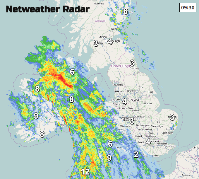
There is already rain and blustery winds over Ireland and SW Britain, this is from a low pressure ahead of Storm Diana. Several places have a had a chilly start this morning, with temperatures below freezing overnight. Behind the incoming rain is milder air, that will be a noticeable change midweek.
Strong SE winds will continue for Northern Ireland and the Irish Sea, veering to a southerly as the temperatures leap up for Devon and Cornwall this morning to 12C. Gales, even severe gales are expected through the North Channel. The winds pickup across Britain through the day and after a good deal of fine, bright weather, cloud and rain spread in from the west.
By tonight, the next band of rain appears in the southwest and this is linked to Storm Diana. This spreads NE through Ireland and the UK during Wednesday morning rush hour and further rain hits Northern Ireland and Scotland in the afternoon.
Strong southerly winds draw up more mild air with temperatures up into the mid-teens. South to SW gales move through the Irish Sea in the afternoon with strong winds and high gusts throughout the day. The UK Met Office has warnings for strong winds on Wednesday and heavy rain and Met Eireann also has wind warnings out for wind and rain during Tuesday with more to come midweek.
Then on Thursday night, another secondary low forms and brings more rain and blustery winds to southern Britain. That moves over England during Thursday morning rush hour. Friday looks brighter.