The cold wind stays with us this weekend but change will arrive next week as Atlantic low pressure systems break through to bring spells of wind and rain from the west.
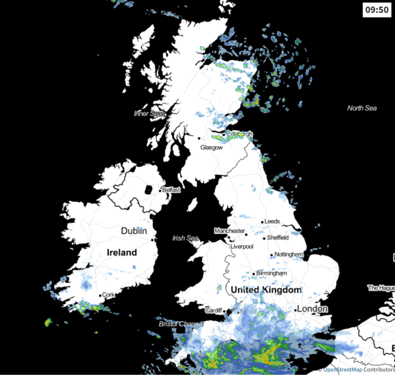
The cold weather continues this weekend, but beyond the chilly wind and uninspiring temperatures, it's differing fortunes depending on where you are. It's the south of England that'll be the wettest today. Further north, there'll be a fair bit of cloud, but some sunny spells should breakthrough, with a good scattering of showers in the northeast and a few elsewhere.
That rain in the south will come and go at times, but there will be some heavier bursts in the mix, gradually easing and breaking up after dark tonight. The reason for the rain is a weather front being pushed north by a small low just sat off of the southwest coast. It's not going to move far, and will eventually fade and be replaced by another one close by which will nip across into France tomorrow.
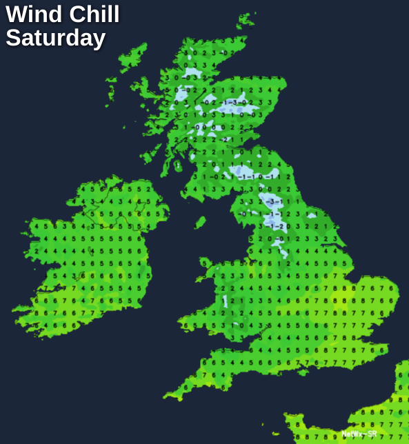
As well as bringing the rain in the south today, another thing both these lows are going to do is strengthen the easterly wind across much of the UK and Ireland. So, even in the drier, potentially sunnier spots today and tomorrow, the wind will definitely be knocking the edge off of the temperatures.
During the second half of the day, the showers running into eastern Scotland and northeast England will become more frequent and widespread. That trend will carry on overnight and into tomorrow too, and some of those will turn wintry with snow up over the mountains and highest hills.
Elsewhere tonight, it's mostly cloudy with clear spells and a touch of frost most likely in the west. The rain in the south will be slowly fizzling out, but there'll still be some left by morning.
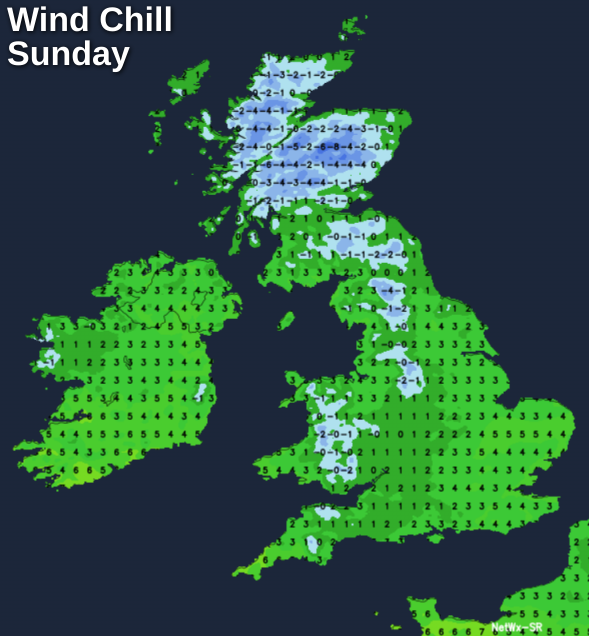
We're then left with quite frequent showers in the north and east, a scattering elsewhere and perhaps the chance of some more rain sneaking into the southeast corner during the day on Sunday. Sunshine will be at quite a premium, with western regions having the best shot of catching it. Like today, the wind will be a factor, so while temperatures will reach 5-8c, it'll feel a good few degrees colder than that.
To start, next week will be a continuation of the weather we'll see this weekend. So, we keep the Easterly wind on Monday, and there'll still be showers running into the east. Away from those, there should at least be a bit more sunshine around though.
The first sign of change will turn up later in the day though, as southeasterly winds strengthen across Ireland and through into western Scotland. That's ahead of an Atlantic low pressure system moving up from the southwest. It's going to bring gales in exposed western and southern parts, along with a spell of rain overnight and into Tuesday.
That'll just be a starter though, with the main course of a much deeper low, with stronger winds and even more rain on the way for Wednesday.
This one is likely to bring widespread gales, perhaps severe in places, along with a spell of heavy rain which will sweep right across the British Isles.