The wet, icy showers and cold east wind continues for northern Britain with blustery rain for Northern Ireland. Not as bad today further south and a improvement in the next few days.
It’s still cold out there, but there will be some improvement today for southern Britain after a bombardment of wet, slightly icy and generally miserable Monday weather with a nasty east wind. That is the picture this morning over Scotland and NE England with snow on the tops of the hills and rain across Northern Ireland. The cold east wind continues to blow across the northern half of the UK, so ignore the forecast air temperatures of +7C, in the wind it will feel more like +1C
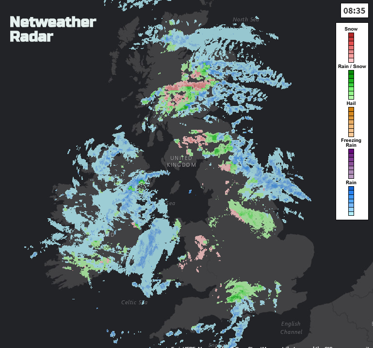
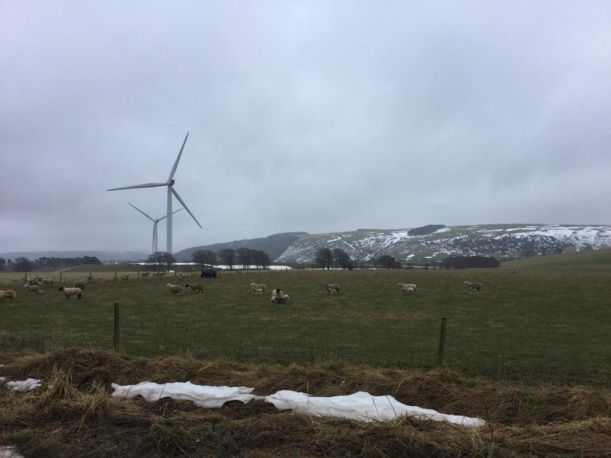
Down to -3C in Somerset and -2C in Cornwall overnight, southern England has seen the lowest temperatures with ice, frost and patches of fog about in the lighter winds. There was snow reported on Monday for inland Devon and Dorset on the hills. There are a few showers drifting up from the English Channel, associated with an area of low pressure forming to the SW. These are over central southern England heading north, a few reaching across to London, but the focus of these showers will be over Wales and the West Country this afternoon. Temperatures of 7 or 8 C in the south with a light to moderate SE wind making it feel cooler.
Across central Britain, the winds will be moderate to fresh, quite gusty at times as the showers rattle in. NE England up to the north Pennines, Yorkshire Dales and Cheviots will have horrible conditions, wet, cold, windy and wintry higher up. There will be some improvement through the day with the showers clearing and sunshine appearing but still a cold wind. The West Midlands could see a few rain showers from the low away to the SW.
For Northern Ireland, the brisk winds veer from the NE to SE and there is a grey wet picture this morning. Showery outbreaks of rain, sleet over the highest hills, continue to feed in from the east and it will feel cold.
It’s not very pleasant this morning for Scotland with driving rain, surface water and spray. Gloomy skies and a cold, cold east wind with sleet and wet snow for higher routes. The band of heaviest showers moves northwestwards during the day so there is some improvement for southern Scotland and then the Central Belt, so the drive home won’t be as horrible. The fresh to strong east winds only ease down this evening as skies clear and it turns colder and frosty.
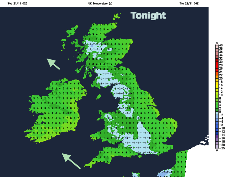
It will be a cold night with frost and also for northern and eastern Britain, fog.
The day will start off cold but with lots of sunshine. It will be windy for Cornwall, closer to that low but overall the UK will settle into a lighter easterly flow. Cloud will move in from the North Sea so still cool but not as cold by Thursday. There will be a lot of dry bright weather about but still damp for eastern Scotland with a few showery bits making their way further inland.

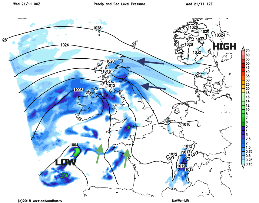
The high pressure which was over Scandinavia drawing the cold air from Russia, shifts later this week towards Iceland. Our UK airflow begins to turn more to the SE around the low pressures off southern Ireland and the Bay of Biscay.
So, an improvement through the week, winds easing off, not as cold, more brighter even sunnier skies but not completely dry and the wintry bits disappear. Sunday looks more unsettled and colder and windier in the north but there is some respite over the next few days if this wintry blast was a bit of a shock.