Easterly winds will keep coming throughout the upcoming week, bringing with them a cold feel and lots of showers - with some snow, but mostly over high ground.
We're looking east for our weather right through the upcoming week this week. It's no beast coming our way though, it's going to be cold, especially in the wind, with frost and ice overnight and even the chance of snow over the hills at times, but don't expect a repeat of earlier this year.
The reason for the change from our usual west or southwesterly wind direction is a blocking high pressure, which is setting up over Scandinavia. That'll keep Atlantic weather at bay, with the jet stream splitting in two, as one part dives to the south and another splinters off, goes around the top of the high, then wraps around and eventually becomes quite strong again coming in from the east across the UK. Our global jet stream map shows this really well.
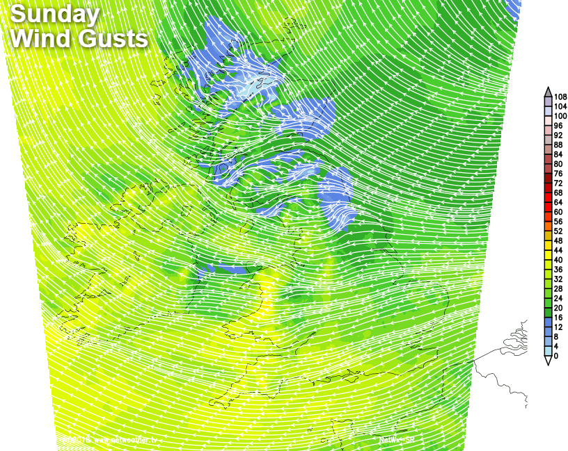
Today, you'll probably notice a bit more bite to the wind, which will become quite gusty to the west of high ground and across the southern half of the country. But like yesterday, there'll be lots of sunshine to be had at least. There is some low cloud and mist around to start the day, some of which will struggle to clear from the northeast of England and parts of Scotland.
Temperatures today will be tempered by the wind, but values on the thermometer will show 8-11c typically, which isn't too far off normal for the time of the year. Once you factor in the wind though, you'll need to knock a few degrees off, with most places feeling more like 5-8c.
This evening and overnight two things are going to happen. First, temperatures will fall away, especially in western and central parts with a frost forming quite widely. Second, cloud will be thickening from the east, that'll keep temperatures milder here, and it'll also spread further inland as the night goes on, lifting temperatures a touch in some central regions. The cloud will even be thick enough in some northern and eastern parts to bring some patchy rain and drizzle.
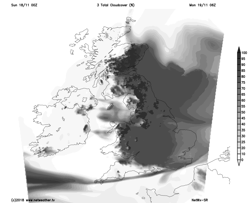
That takes us into Monday, and for many, it's going to be a cloudy, damp, chilly day. There will be some sunshine about, but it'll be at much more of a premium than we've seen over the weekend, with western fringes, northern Scotland and perhaps southern England best placed to see it. There'll be some patchy rain and showers at times too, mainly affecting eastern parts.
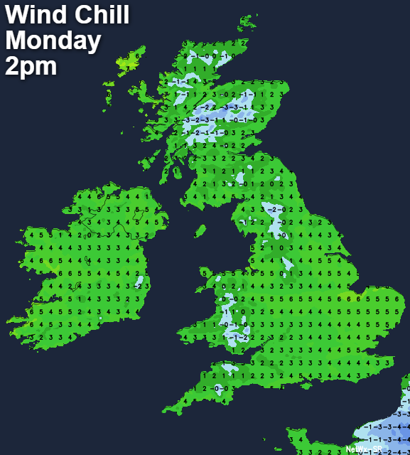
Temperatures will reach 6-9c for the majority, but with the easterly wind, it'll feel more like 2-5c.
Overnight, the cloud remains, and the showers continue to run in from the east. They'll be starting to become more wintry by this point, with some snow likely up over the hills.
Tuesday will see the showers becoming more widespread, falling as rain, sleet and hill snow. The far west and especially northwest will be best placed to stay out of trouble, with some sunny spells here too. It'll feel cold everywhere.
Some ice is then possible overnight, ahead of another showery, wintry, cold and drab day on Wednesday. With more snow up over the high ground. More cold nights follow as we move toward the end of the week too, with icy stretches on roads and pavements possible. The atmosphere will be a touch warmer by this point. So although it'll stay cold and the showers will continue, particularly in the east, they'll mainly be of rain away from Scotland, where further sleet and snow is likely, especially on the high ground.
As we move through into next weekend, we keep the easterly flow, so don't expect too much change - it'll stay on the cold side, there'll still be wintry showers in places, and the best of any sunshine will be reserved for western regions.