Temperatures will be up and down during the upcoming week, with Arctic air arriving in time for the weekend.
We're going to be seeing a few changes of airmass this week. Today sees cooler air sinking south behind a weakening front, then into next week we'll warm up again before a swing to Arctic sourced air with northerly winds as we end the week and move into the weekend.
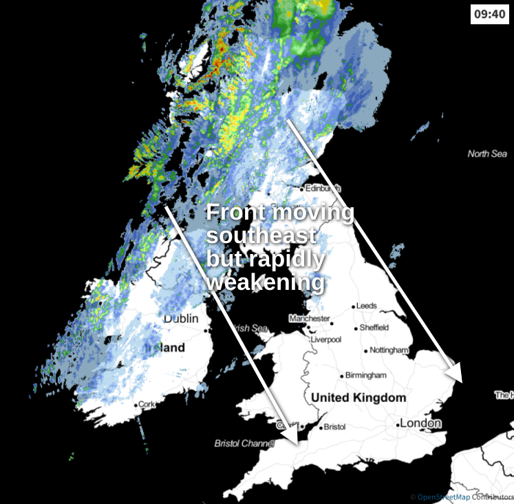
Today, we have a fair amount of rain across Scotland and Northern Ireland to start the day. The front bringing it will work its way southeast as the day wears on, but the rain itself will quite quickly fizzle out. So, by the time it crosses into southern England this evening, it'll be not much more than a line of cloud with just a few bits and pieces of rain.
 Keep track of the latest on the live radar.
Ahead of the front, there will be some showers affecting northwest England and perhaps also Wales, but beyond that, there's plenty of fine, sunny and warm weather. The cloud will fill in from the north through the day though, with outbreaks of rain affecting northern and central England as the front moves through.
Once the rain moves through, Scotland and much of Ireland will brighten up with sunny spells coming through and just a few showers in the north and west. It'll feel quite chilly in the wind though.
Tonight, the showers in the far north and northwest continue, and the cloud with patchy bits of rain will take its time to clear the south and especially southeast corner. That'll keep temperatures on the mild side here, but elsewhere with often clear skies, they'll fall away with a touch of frost likely in many places.
Into Monday, the southern half of the UK will enjoy yet another fine, dry and mostly sunny day. Further north, there'll be some showers in the west and some heavy persistent rain maybe getting into northern Scotland and certainly affecting the Northern Isles. But the really noticeable weather of the day will be the wind. Initially, it'll strengthen across the far north of Scotland, with gales, or maybe even severe gales in exposed spots. That risk then extends south during the second part of the day, with those in northern Scotland and to the east of high ground as far south as northern England, perhaps likeliest to catch the strongest gusts.
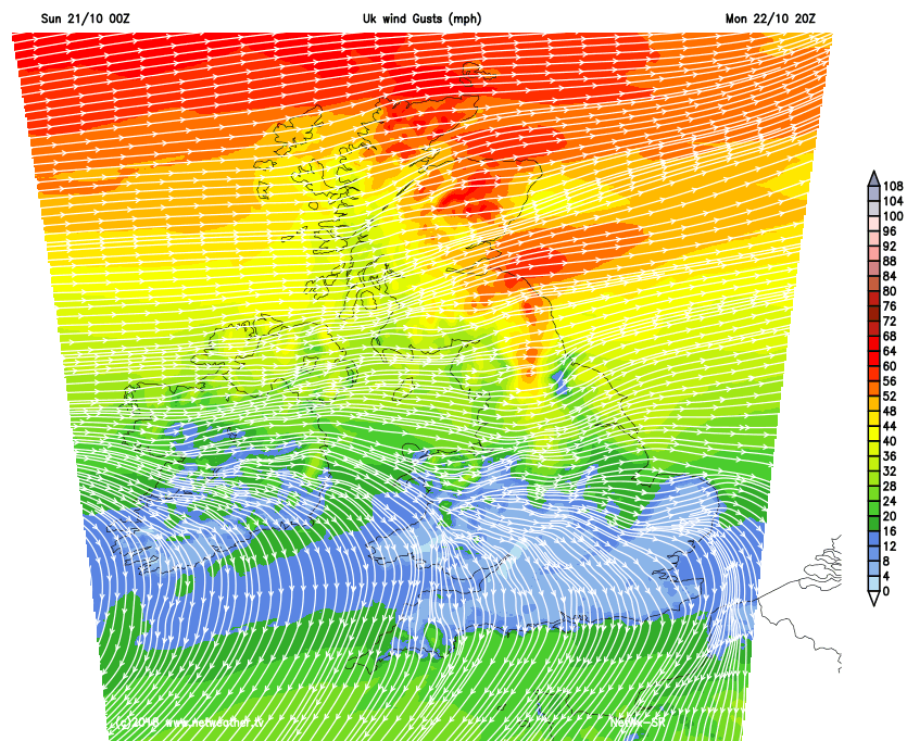
Temperatures Monday, won't be especially impressive, reaching 8-12c widely - quite the change after the very warm weekend for many of us.
The winds across the northern half of the country will take their time to ease down on Tuesday but eventually, they'll calm. There'll again be some showers affecting the far northwest but away from that, it's a dry day with sunny spells for many. Temperatures will be a touch milder than Monday as well, with maxes reaching 15-17c in central and southern parts, 12-14c elsewhere.
Wednesday keeps the warming trend coming with highs maybe even reaching 20c in the south. There could be some extra cloud lapping into the northwest of the country though, making sure it stays a bit cooler here.
Thursday sees the first signs of that Arctic based airmass arriving, with rain moving down into Scotland during the day, introducing a the colder air behind it. That heads south to end the week, with sunshine and showers following. Those showers will be wintry across northern Britain, with lying snow for the higher ground.
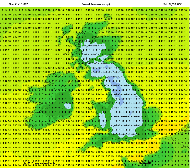
The pattern carries on into the weekend, with temperatures by day struggling to get to double figures, and by night dipping low enough for widespread frosts.