We keep the north-south split for the next few days with further spells of rain in the north, but drier and milder further south. Change arrives as a cold front moves southeast on Friday and Saturday though.
Our split week of weather continues, with another spell of rain clearing the northern half of the country today, while further south it's dry and mild but with a fair bit of cloud.
Tomorrow will see more rain moving into Scotland, Northern Ireland and Northern England with two fronts making a pincer movement, one from the northwest, one from the southwest. Eventually, the cold front will win, pushing southeast across all parts during Friday and Saturday, introducing much cooler air behind it.
Temperatures today will reach the high-teens to low twenties across a good part of England and Wales, with southern England at the highest end of the scale. Further north and west, 14-17c will be more typical, cooler, but still mild for the time of year.
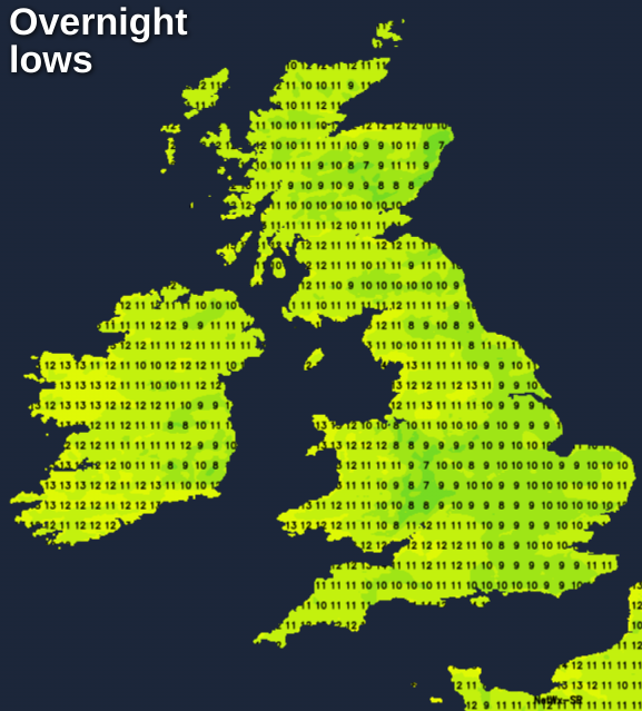
This evening and overnight, a few showers continue in the west, but it's otherwise dry but mostly cloudy. That'll make for a frost-free night, with lows just dabbling with single figures in places.
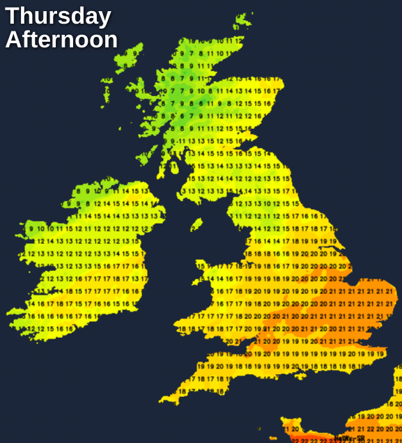
Into tomorrow (Thursday), we have those two bands of rain arriving into the north, which will join together later in the day over southern Scotland and northern England. The north of Scotland should dry out into the afternoon, with some sunny spells and a few showers. Away from all that, it's another dry day further south with, but sunshine will again be at a premium.
Despite the cloud, it's still mild with maxes into the high-teens or low-twenties. The colder air will have arrived into the far north by this point though, with some places struggling to make it as high as 10c during the afternoon.
The rain across southern Scotland and far north of England will tend to stick overnight, before starting to make a move southeast into the early hours. To the north of it, a chilly night with a ground frost in places. To the south, still mild and often cloudy.
Friday sees the initially weakening band moving further southeast, with cooler temperatures heading south behind it. For southern, central and especially southeastern England, it'll be another mild day, with an improving chance of seeing the sunshine.
Overnight, and into Saturday the cold front carries on its journey and having weakened to not much more than a band of cloud with some drizzly bits of rain on it, you'd be forgiven for thinking that's it. But no, it looks likely to pep up and bring a quite wet, windy, chilly start to the weekend for a good part of central, southern and eastern England.
To the north of it, there'll be some sunny spells and just a few showers in the far north and west. But everywhere will be cool, for those in the south it'll probably be a bit of a shock to the system after such a mild week.
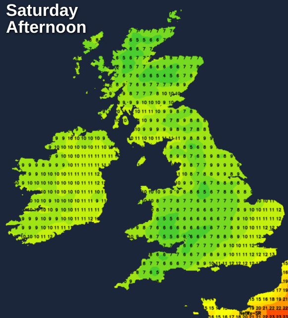
A widespread frost follows overnight and into Sunday - although the cloud and rain will linger in the southeast for a time. Then Sunday stays on the cool side, but with plenty of sunshine and just a few showers in both the far northwest and far southeast.