Warm start to next week in the south, perhaps 25C on Tuesday, but changeable conditions in the north spreading south from mid-week.
Saturday saw a rather wet day for parts of Wales and northern England in particular, with 34mm of rain falling at Capel Curig in north Wales. Today will see a dull and wet start in the north, but it will brighten up with a mixture of sunshine and showers, drier and warmer in the south. The new week looks to start with a north – south divide, with rain or showers in the north, dry and warm in the south, temperatures perhaps peaking around 25C in the southeast on Tuesday. Then Wednesday onwards turning more changeable and cooler for all, often breezy and sometimes windy conditions across all parts for the rest of the week – as a strong jet stream straddling the UK brings frontal systems east with spells of rain or showers for many.
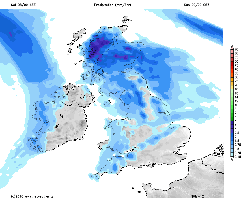
For now, it’s been a grey and damp start across the north so far this morning, with bands of showery rain moving across Scotland, N. Ireland and northern England, while further south the cloud is more broken, with some sunny spells, but also with a few showers passing through across Wales, central and southern England.
Through the morning and into the afternoon, it will turn brighter across the north, as early showery rain clears east, but the sunny spells developing will trigger some heavy showers – these most frequent across western Scotland, northwest England and Wales, drier towards southern and eastern England. The Great North Run from Newcastle to South Shields could well catch a heavy shower or two blowing in from the west though.
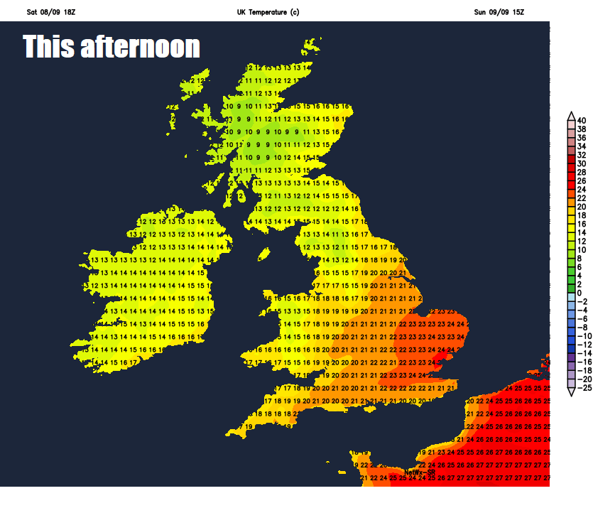
Temperatures fairly respectable across the south and east of England this afternoon, reaching 20-24C, cooler towards northern and western areas thanks to a generally brisk westerly wind and showers, reaching 15-18C.
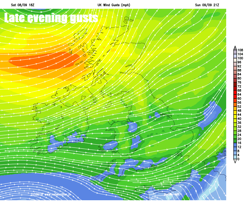
Showers across England and Wales generally dying out through the evening which will lead into a mostly dry and mild night with clear spells, however showers continuing across Scotland and Northern Ireland and becoming more frequent across the northwest, as an area of low pressure passes close to northern Scotland, windy too, with gales around coasts and over hills, gusting to 40-50mph.
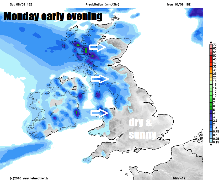
So, a wet and windy start to Monday across western Scotland, before showery rain and strong winds ease through the morning here. However, further outbreaks of rain arriving across Ireland late morning will spread across Scotland, northern England and north Wales into the afternoon. Further south across Wales and England it’s looking mostly dry and fine with warm sunny spells, though cloud increasing from the west. Temperatures ranging from highs of 13-16C across Scotland and N. Ireland to 17-23C across England and Wales.
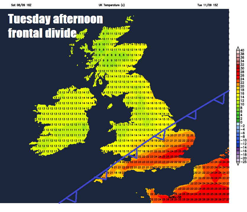
On Tuesday, a cold front will straddle central areas, separating warm air to the south and cooler air to north, the front will move little during the day, bringing a band of cloud and rain across Wales and northern England. Warm and sunny to the south of the front – where we may see temperatures reach the mid-twenties Celsius, cool and bright with western coastal showers to the north with temperatures in the teens.
Turning changeable and cooler across all parts Wednesday to Friday, cloud and rain lingering before clearing across the south on Wednesday – sunshine and blustery showers in the north. Thursday likely seeing showers in the north, drier and brighter in the south, sunshine and showers for all on Friday.