The change to Autumn is slowly gaining some momentum at the moment, with a messy weather picture over the next few days.
The change to Autumn is slowly gaining some momentum at the moment, with a messy weather picture over the next few days.
Today we have two areas of showery rain to watch. One in the northwest of Scotland, moving southeast. And one crossing from Ireland into Wales and the southern part of northwest England, also moving southeast.
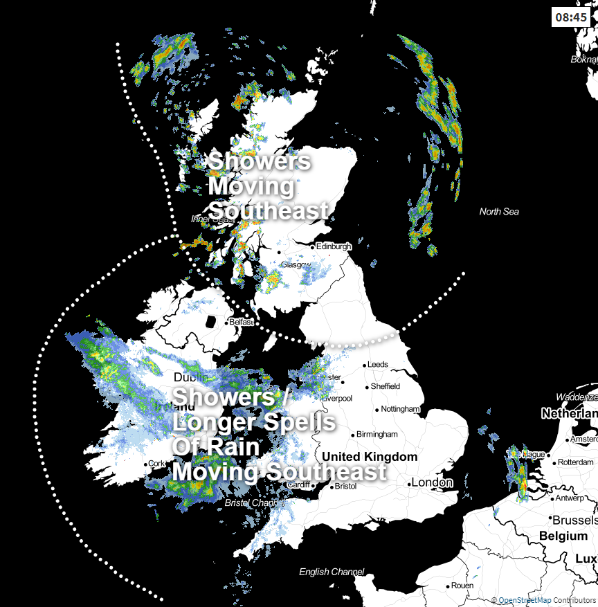 Check the latest weather radar here.
Not everyone will catch the wet weather though. The southeast of England will stay dry until later on, and a few slots in northern and northeastern England could be well placed to miss both areas of showers and rain, to get away with a dry, sunny day.
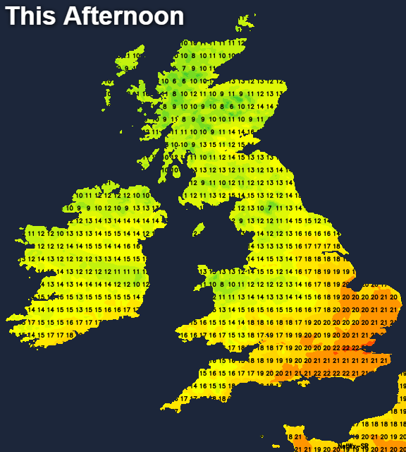
There'll be a fresh west to northwest wind blowing today, so feeling quite cool in that. Temperatures will range from 12-15c in the north, 15-18c in central and southern regions, peaking at 21-23c in the southeast.
Overnight, the last of the two batches of rain and showers clear east. Then we're left with a few showers running into western parts, but in the main, it's dry with clear spells. It'll be cool too, with lows dipping away into single figures for many, and low enough for a touch of ground frost in parts of Scotland and maybe also northern England.
Tomorrow, we'll have low pressure nearing the east of Scotland from the North Sea, which is likely to bring some showers into Eastern Scotland, perhaps also northeast England.
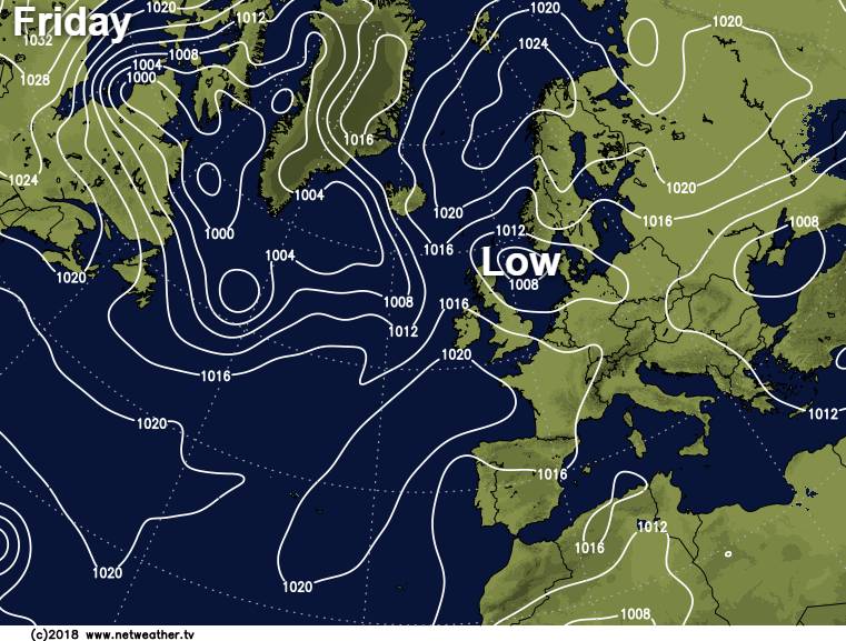
To be totally honest, this system has been messing the forecasts about all week have appeared out of the blue earlier on, and there's still some uncertainty with it. So it may be the showers barely make a dent, but on the other hand, some models bring a good rash of them inland into coastal counties from Yorkshire northward.
Elsewhere, there'll be plenty of sunny spells and just the odd light showers perhaps affecting western parts. It'll be a blustery day in the north and east of the country in particular, with a keen westerly wind blowing. But further south and in some western parts, it'll be calmer. Temperatures will reach 16-19c in southeastern and central southern regions, otherwise 14-17c.
The weekend starts with that northeastern low still in the mix, and we'll have some more general rain reaching up across Ireland and through into central and northern England, along with southern Scotland. As we had on Friday, there's a bit of uncertainty here, with the potential for the rain to be a little further north or south than currently expected. Away from that, there'll be some showers, but also some brighter spells, with the southeast corner best placed for both the sunnier and warmest weather.
Sunday looks a more straightforward day, with the last of any rain clearing the southeast corner early on. Then for many, it'll be dry and bright, with a scattering of showers in the west - especially the northwest. Temperatures will be back into the twenties in the central and southeast England, but cooler further northwest at 11-15c in a stiff westerly wind.
Looking ahead into next week, there's likely to be a spell of wet, windy weather affecting some parts on Monday. Then it's a mixed bag again, with southern areas already best placed to stay drier and warmer, with high pressure not too far away. Whereas, further north and west will be more prone to wetter, windier conditions moving through from time to time.