
All a bit mixed this week with cooler nights, sunny spells but also bands of rain and a low to the NE by Friday. Low 20sC the high .
It’s a rather messy picture for this week’s forecast. High pressure out west brings some settled weather midweek but still with showers in the far SE this morning and a weather front from the NW. Later in the week, a low pressure spins up over the North Sea which will swirl rain in from the NE while new weather fronts appear from the SW. Weather from all sides on Saturday, but the Atlantic flow wins out on Sunday and sweeps everything away.
It feels cooler this morning with a few spots down near to zero. There is a north to NW wind feeding in the cool air. A pocket of warm air remains over SE England but not as warm as earlier in the week, just into the low 20sC. This remains for Thursday even as cooler air floods down from the NW, but this will reach all parts by Friday. Temperatures from 13 to 19C by then.
The cooler nights remain with patchy mist giving some picturesque starts in the mornings.
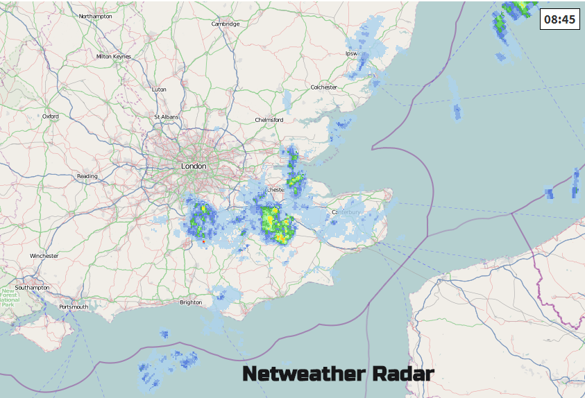
The line of showers over SE Britain will clear eastwards and fade slowly today. This is from the same frontal band which has been around all week. An occluding front brings a band of rain into the Western Isles and NW Highlands. In-between these there will be fine and sunny weather or bright and fair bits. There is cloud already over Northern Ireland and western Scotland from the front and more cloud over eastern and SE Britain from the showery area.
Overnight the NW front will move down through northern England with more cloud and a few showery bits. Behind this will be a cooler night again, with the cloud moving southwards through Ulster, leaving clear skies. By dawn, the front could produce some rain along the Irish border and across into NW Wales, even Merseyside. There will be more cloud over Wales and high cloud for SW England to begin the day. The front then feeds in more rain during Thursday across more of Wales, into the Midlands, later Anglia and southern England. The rain will turn showery, so rather mixed as the front pushes southwards during the day. Behind this will be clearer skies and sunshine but also sharp showers particularly for Scotland.
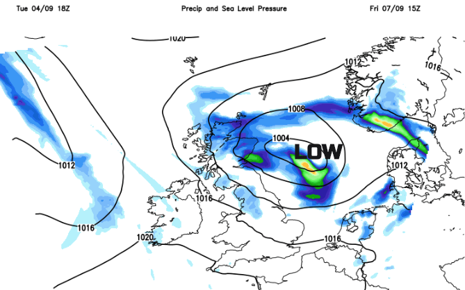
Friday will feel colder everywhere with the wind turning back to the NW. The winds strengthen around the North Sea low pressure for Grampian and eastern England. There will also be bands of heavier rain, but we’ll have to wait to sure up the position of these. More western parts including SW England could see more cloud and damp spells but overall there will be fair and bright conditions away from the main wet and windy areas in the NE. This will be the cool feeling day.
Saturday does look rather mixed but with temperatures up a notch. Sunday looks blustery, windy in the north but bright and pleasant for SE England with lighter winds and the low 20sC with sunshine.


