


The weather forecast for the week ahead, with cooler, fresher air spreading southeast from tonight.
East is best again today for the sunshine, as those further north and west see more cloud and a few outbreaks of rain. A cold front will swing south during Monday and Tuesday to introduce some cooler air, but overall a settled week ahead.
We have a mild, quite humid airmass across much of the UK at the moment and temperatures will widely get into the high teens or low-twenties, with some eastern and central parts peaking at 24-25c. Even in the cloudier areas, it'll be a mild, close feeling day, although cooler temperatures will be starting to work into the far northwest of both Scotland and Ireland.
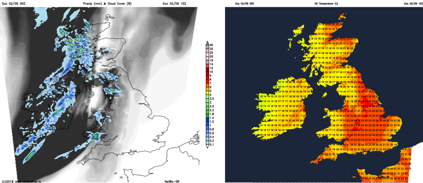
This evening and overnight, the cold front, with a few heavier bursts of rain on it at this stage, will work its way down from the northwest, to cross Scotland before dawn. Behind it, clearer skies, a few showers in the west and a much cooler, fresher feel.
The front will start the day across northern England and Wales, just beginning to edge into southwest England and the Midlands during the first part of the morning. The further southeast it gets, the more fragmented any rain on it will become, and the slower it will start to move.
Temperatures on Monday will peak at a fresh feeling 14-18c, away from the southeast corner, where maxes of 23-25c are likely.
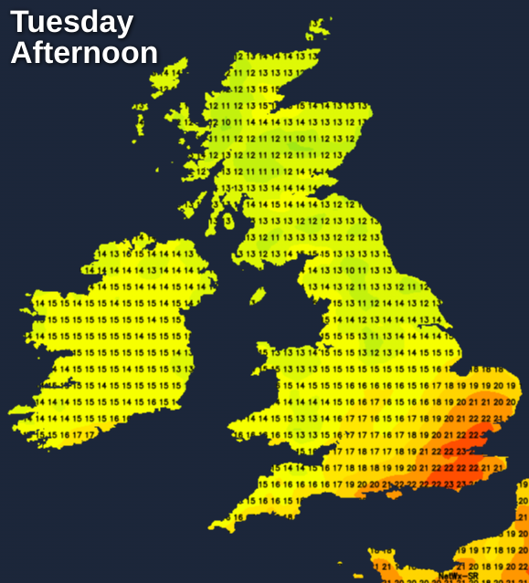
Still warm with highs into the twenties and sunny spells in the southeast on Tuesday, as the weather front continues to move at a glacial pace. That'll mean a band of cloud still affecting parts of the midlands, eastern, central southern and southwest England. Further north, lots of sunshine with temperatures rising into the mid-high teens after a chilly start. A few more outbreaks of showery rain will move into western Scotland through the day though.
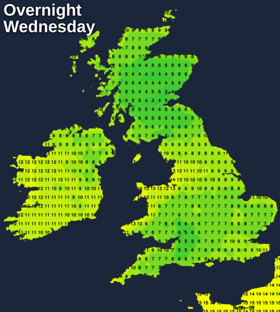
Finally, midweek will see our longstanding weather front get into the southeast, meaning more cloud here than of late during Wednesday. Elsewhere it's a very similar day to Tuesday, with sunny spells for most, but still a good scattering of showers affecting the west of Scotland, perhaps with a few getting down into northwest England.
By Wednesday evening, at last, the front will clear to leave the whole country in that fresher, cooler air flow. Just about everywhere will see temperatures dip down into single figures overnight.
A cooling north to northeast wind will be blowing during the latter part of the week, so there'll be some chilly nights with mist and fog patches forming in places. By day, there'll be sunny spells but also a scattering of showers. Temperatures will be warmest in the south, with the low-twenties here, further north it's cooler with the low-mid teens in Scotland, the mid-high teens elsewhere.
Just about anywhere could catch a shower, but unless you're in the north and west of Scotland on Thursday or the north and east of Scotland and northern England on Friday, you'll be fairly unlucky to catch one.


