


A real change in our weather today as air from a polar origin moves across the country.
We have a Polar Maritime air mass moving down from the northwest today, quite the change. It means an end of the humidity which has been affecting much of England and Wales all week; it'll also bring with it some rain, hefty showers and a distinctly autumnal nip in the air overnight.
Despite all that, it's still summer, so there'll still be some pleasantly warm sunshine to be had. And although there will be some interruptions, that applies as we head through the bank holiday weekend (away from Scotland) too.
Today, we have a couple of weather fronts in play, both moving northwest to southeast. One which is slowly clearing through southeast England, having spent the last 24 hours or so moving southeast out of Scotland. The other is moving out of southern Scotland and into northern England this morning, and is definitely the livelier of the two, with plenty of heavy rain on it. It will fragment the further southeast it gets though, but it will be introducing that much cooler, fresher air behind.
That leaves us with a 4-way split in terms of weather. Under the fronts, it's raining, to the north of the Scottish front, it's cool and fresh with sunny spells and showers. Between the fronts, it's drier, with some sunny spells. But as everything moves southeast through the day, the showery rain will spread further. The southeast corner then sees the best of the fine, dry weather this afternoon, but the showers arrive there into the evening as the next front comes.
Temperatures today, warmest in the southeast at 23c or so, elsewhere the mid-high teens. This evening and overnight many parts will see lows into single figures, eastern and central parts stay mostly dry, but there'll be showers affecting many western regions.
Into tomorrow, there'll be a good rash of blustery showers blown through on a fairly strong west to northwest wind. Some will be heavy and thundery with hail mixed in, but between them, there should be some sunny spells to be had.
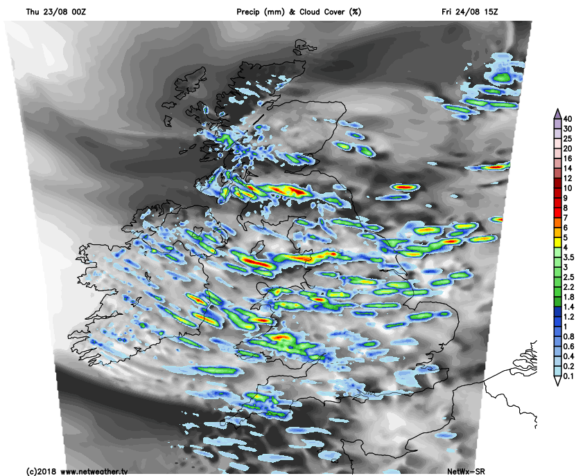
Temperatures will struggle to make it to 20c anywhere, with maxes of 14-18c typical. Another cool, fresh night follows with the showers easing back a touch but not totally dying out.
Saturday then dawns bright with just a scattering of showers. The odd shower will continue here and there, perhaps most particularly in the east but in the main, it'll be a much quieter day than Friday. Winds will be lighter, so not feeling quite as fresh either, but even so, highs of 15-19c will be typical, perhaps squeezing to 20c in the southeast.
Beyond Saturday there's some real uncertainty, there does look likely to be a weather system bringing a spell of wet, windy weather moving in from the Atlantic, but the timing is a tricky one to call. Some models bring it in late Saturday, clearing through Sunday to leave Monday mostly dry, bright and a touch warmer. Others slow everything down to bring it through later on Sunday, eventually making way to sunny spells and a few showers during Monday. We'll keep you up to date on this over the next couple of days.


