
Cool & changeable weather for all over the coming days, with the Atlantic jet stream in charge.

The jet stream will be close to or over the UK over the coming days bringing our weather off the Atlantic. So the rest of the week is looking to stay changeable with showers or longer spells of rain, on the cool and fresh side, certainly compared to the heat and humidity that those in the south have become accustomed to. The weekend will continue to stay on the cool side and will feature more general rain affecting many parts, moving in across the west on Saturday before spreading east across most parts on Sunday, followed by showers in the west.
For now, starting across SE England and East Anglia where it is off to an overcast and damp start, as outbreaks of mainly light spreads up from the south. While towards the west coast of Scotland there are frequent heavy showers. But elsewhere, it’s generally a drier and brighter start, chilly across northern and western areas where temperatures fell into low single figures in places, at Aboyne in eastern Scotland falling to 0.6C at 5am this morning.
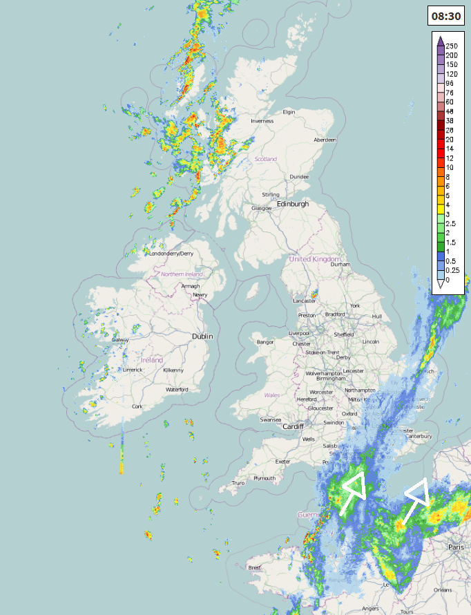
Across SE England and East Anglia it will stay cloudy and cool with further outbreaks of rain, turning heavy at times, spreading up France. Elsewhere there will be sunny spells, staying mostly dry across central and eastern areas away from SE England and East Anglia, some showers across Wales and western England, while across Scotland and Northern Ireland there will be widespread showers developing from the west after a dry start, locally heavy and thundery.
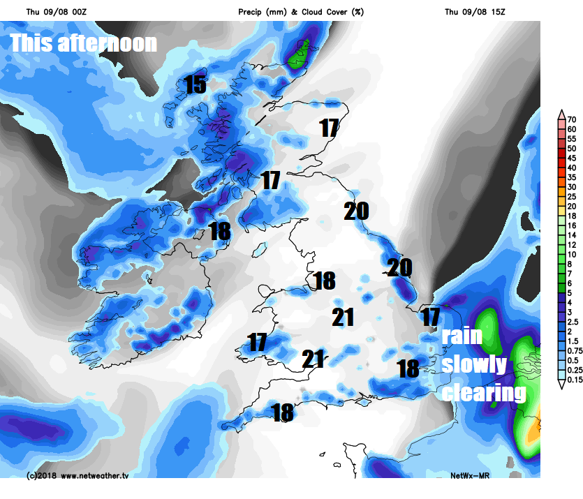
A cool day generally, particularly under the cloud and rain across SE England and East Anglia – where temperatures may not get higher than 18C, elsewhere across England and Wales we are looking at 19-21C in the sunshine, 15-18C across Scotland and Northern Ireland.
Rain across SE England and East Anglia will clear through late evening, though windy for a time as low pressure bringing the rain deepens to the east. Showers continuing over western coastal areas, otherwise becoming dry with clear spells overnight. Another cool night, temperatures in rural areas falling into low single figures in the north and west.
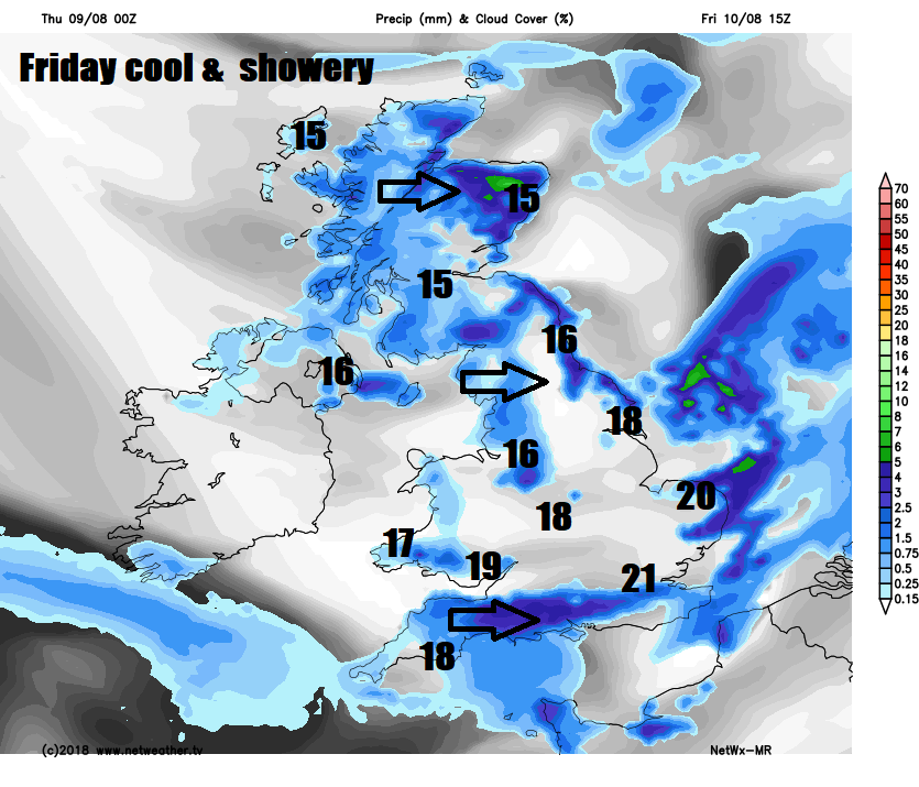
Friday is looking cool and breezy across the board with sunny spells and a scattering of showers spreading east, after a dry start in the east, some of the showers will be heavy with thunder. Temperatures reaching 15-18C in the north and west, 18-21C across central, southern and eastern England.
Then in time for the weekend, the jet stream will bring a low pressure system in off the Atlantic across northern Britain by Sunday. So, remaining fairly cool and breezy throughout with rain likely for most at some point. Some uncertainty over exactly where and when rain will affect parts of Britain, but for now outbreaks of rain look to arrive from the southwest across Wales and SW England initially, then after a mostly dry morning and afternoon spreading further east by late evening, though perhaps staying dry in the far north and northeast. Outbreaks of rain, locally heavy in the north and west, spreading northeast across most areas on Sunday, though southeast England and East Anglia may stay dry and bright. Brighter weather with blustery showers following across the west by the evening.
The weather continuing to come in off the Atlantic to next week, some showery rain around perhaps at first on Monday, then becoming drier and increasingly warmer across the south, temperatures perhaps rising into the mid-twenties Celsius, more changeable and breezy for the north, as Atlantic fronts bring areas of cloud and some rain at times.


