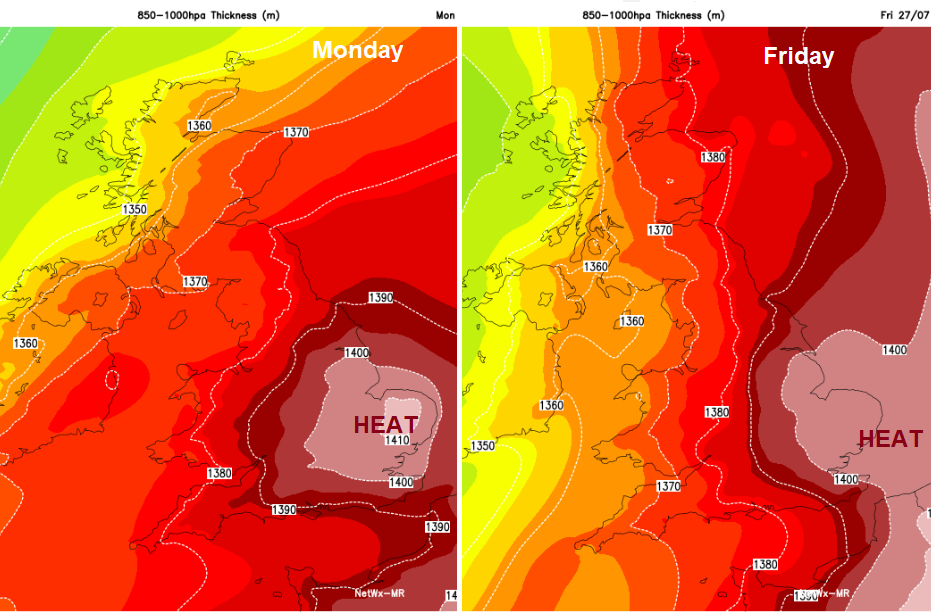
The heat will build this week for the SE half of the UK. Temperatures into the low thirties Celsius, around 90F and hints of 34 to 36C, maybe a touch higher before July ends.
We’ve already had weeks of dry and very warm weather, think back to when it started and how often you’ve had to bother with a coat over recent months. There is some more unsettled weather managing to tilt in from the Atlantic over NW UK bringing fresher air too but closer to the continent the heat and humidity remains. Parts of eastern and SE Britain will stay at 30 or 30+C for several days this week. That’s hot!
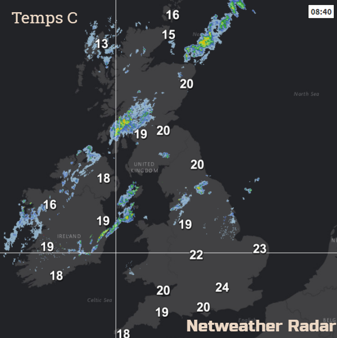
This morning there are sunny skies and it is warm over much of England and inland Wales. There are also sunny spells for Scotland but more cloud especially in the west and over Northern Ireland, with breaks along the east coast. SW Britain also has some low cloud lurking this morning.
Temperatures in the SE are already into the low twenties Celsius as the heat begins to build.
We do have a cold front reaching from Grampian across Scotland to Northern Ireland. This is bringing more cloud and outbreaks of rain. There are other bits of rain over NW UK and it feels cooler and fresher to start the working week, as SE Britain gears itself up for several muggy and uncomfortable nights to come.
If you are looking for rain, there will be weak weather fronts from the NW for the start of the week and then a sturdier system heading towards Ireland Wednesday night into Thursday. That should bring some proper rain to western counties of Northern Ireland and western Scotland and should then bring patchy rain over more of Britain on Friday. Still not for everyone though. Away from this Atlantic frontal rain, there will be the risk of thundery storms, particularly for eastern England in the heat with the risk of isolated hefty downpours.
Don’t rely on these; you’ll need to keep watering the plants. Even if you weather App shows a thunderstorm symbol, remember that is just the potential for a storm, not that you will get one at that time interval. Once they start appearing, keep an eye on the Netweather Radar to see where they are and which way they are moving.
The winds stay very light until the western rain arrives on Thursday. Then a brisk southerly wind will pick up, strong around the North Channel by evening which will be quite a change.
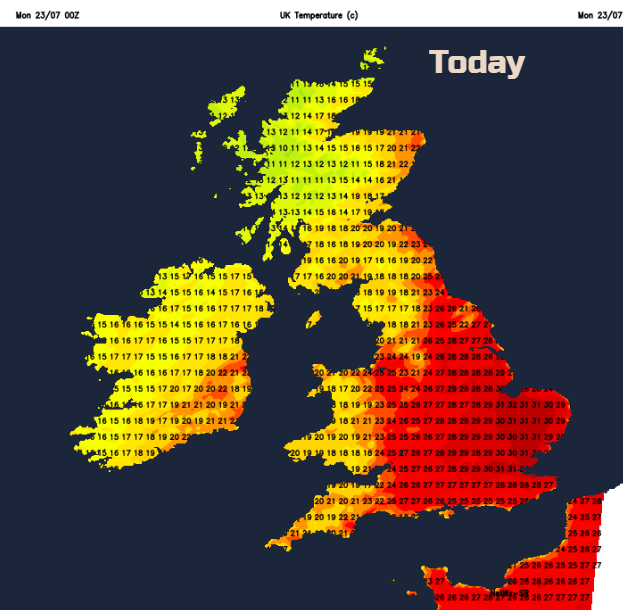
Top temperatures this week Scotland could see 25C, Northern Ireland 23C, Northern England 29C, Wales 25C southern England 32C, possibly 34 to 36C. The all-time UK record is 38.5C back in 2003. Temperatures MIGHT creep up near to that value later in the week. So far this year, the top temperature was 33C in NW Wales at the end of June. The highest July temperature was 36.7C in 2015 at Heathrow airport, that will be worth watching over the next week or so. Japan just recorded their highest temp at 41.1C, imagine that! In Japan's hottest city; they have dry mist at train stations, cool scarves for the elderly, snow cones and a real problem with heatstroke.
Here in the UK, the intense heat subsides for the weekend, still very warm in the SE but not as hot and then the heat returns next week. Oh la la, what a summer!