More of the same for the UK. It's warm, sunny, dry overall. Just a few showers, bit of low cloud and a brisk breeze today. Dry but not hot or humid for #COLENG tonight in Moscow
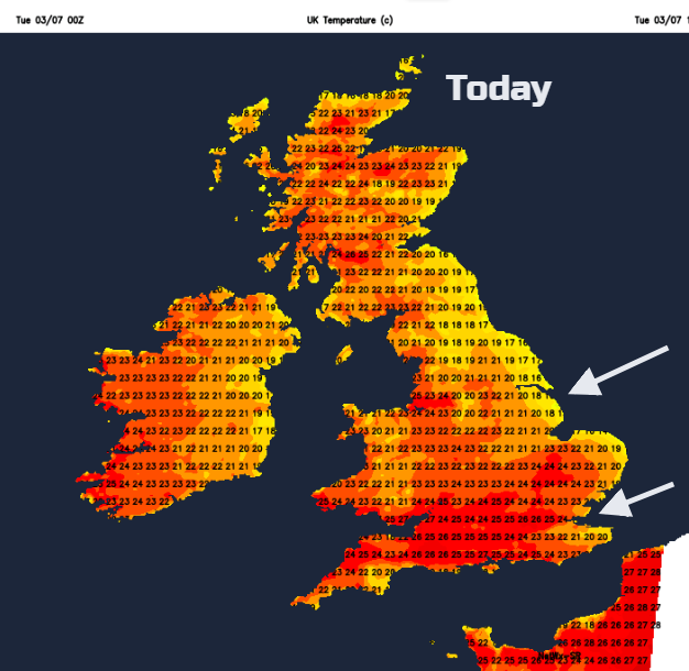
More heat, sunshine and dry weather across the UK. Not quite into the 30s Celsius today, with Dorset seeing 31.1C on Monday. The far north of Scotland dipped to 4.3C overnight and there will be fresher air to end the working week here. Elsewhere, the high pressure holds on, there will be a few scattered showers but for most the dry warm them continues. Fine this evening as England play Columbia at Spartak Moscow's stadium, 7pm kick off and not as hot and humid as #BELJPN thankfully.#WorldCup.
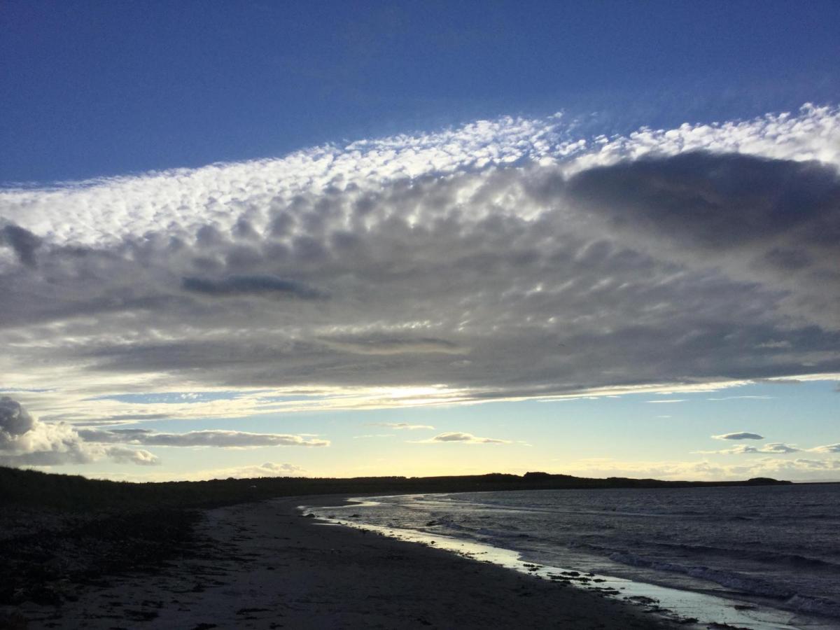
There will be a noticeable east to northeast wind over eastern /SE/ and central England. Moving the air so that it won’t feel quite as stifling or humid today. This breeze has once more drawn low cloud off the North Sea over Aberdeenshire, through the Forth, the Borders, NE England with patches of murk around the Humber and parts of Yorkshire. This will break up and retreat to the coast, taking its time in places. There is more cloud over the Northern Isles but much of the UK is clear, dry and sunny.
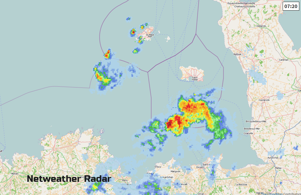
There are already showers lurking near to the Channel Islands and more of these will appear through the English Channel by this afternoon. Most places will miss them, but there is a risk of a shower from the Isle of Wight across to Pembroke and south-westwards.
Overnight there will be a few more hefty showers, bringing a thunderstorm risk for Wednesday. These will be isolated with southern counties looking more prone and southern Ireland.
The very high pollen levels continue, do take care of your skin and eyes with high UV levels and as the risk of wildfires is now high after the long dry spell, please obey the advice from countryside agencies and the fire teams.
Again, low cloud will have moved in off the North Sea over eastern England by Wednesday morning. Winds will be lighter everywhere with temperatures in the low to mid-twenties. There could be the odd hefty shower pop off over Highland Scotland and there will be more cloud in the far south of Britain.
A cold front skips towards the High pressure during Wednesday night. It is a rather naive young thing, trying to interrupt our established high but there will be a kick to a north-westerly wind
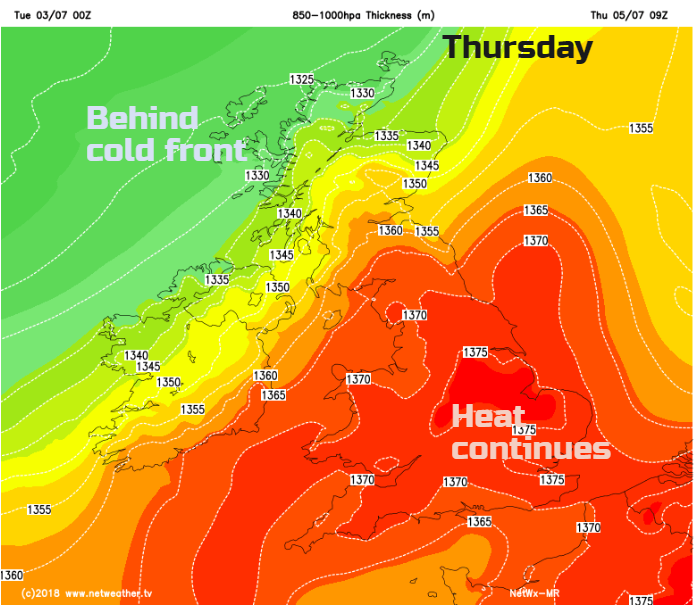
It brings more cloud, and early dampness to north and western Scotland but this fades. More of Scotland and the north of Northern Ireland will feel fresher through Thursday. With a change in wind direction, it will shift any low cloud and the threat of scattered showers will be over southern and SE England. Heat again for inland England up into the high 20s Celsius
End of the week
Looking settled, hot and sunny. There may be some early morning mist and fog, but overall it is looking summery. Temperatures will creep into the low 30S C.
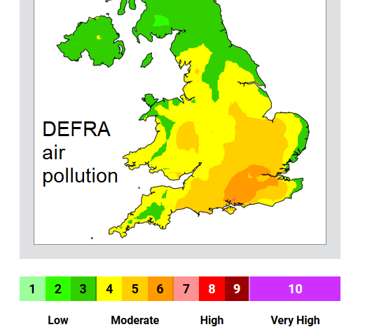
Air pollution levels are forecast to rise in SE England. Staying low in Scotland.
Outlook
The high holds on, so more fine, dry and warm weather. Maybe a blip for next weekend 15th but that’s a fair way off and forecast interruptions to high pressure often fade. Enjoy if you can; keep cool and put on that sunscreen.