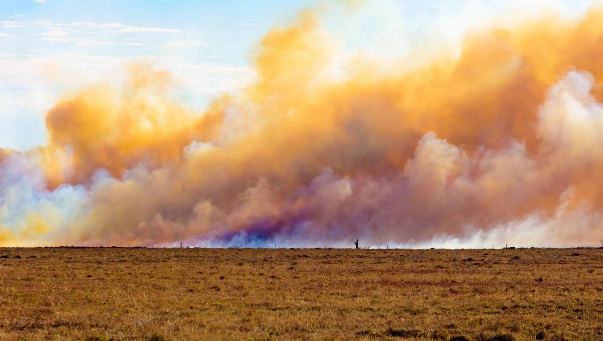
31 Celsius looks likely today and tomorrow. Firefighters continue to battle with the wildfires on Saddleworth Moor as a major incident is declared. 30.8C to beat in Northern Ireland. UK Heatwave
Hotter still today with 30 or 31 likely for NW England inland Scotland, maybe Northern Ireland. On Tuesday Cheshire saw 30.7C, Gwynedd 30.6C, and Devon 30C. There is a bit of a change for eastern counties heat wise. The only signs of rain begin at the weekend with the threat of heavy thundery showers moving up from the SW.
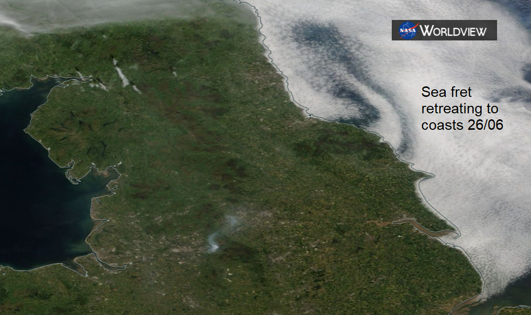
For now, the high pressure holds on, withthreat more dry weather, light winds, a lot of hot sunny weather away from the low cloud which creeps in overnight and slowly retreats to the east coast.
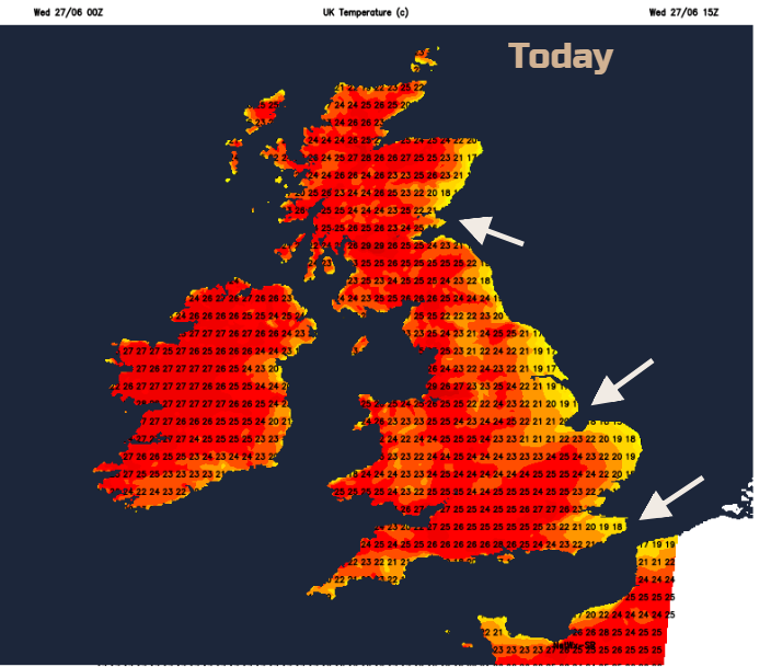
With this light easterly flow, western parts of Britain and also Northern Ireland will see the highest temperatures starting the day with bright sunshine. Northern Ireland is close to beating their all-time June record, Co Fermanagh 30.8C 1976. Pollen levels are very high, UV levels are high too. There have been some problems for transport already this week with buckled rails and broken paving in the heat.
We have three more days of practically no rain as the heat continues. Saddleworth Moor continues to burn. Firefighters continue to tackle the blaze with pleas for people not to block roads and routes up there to take photos. Now declared a major incident with over 30 homes evacuated. For all areas care is needed for the dry land, not dropping cigarette ends, using BBQs on the ground, leaving glass bottles.
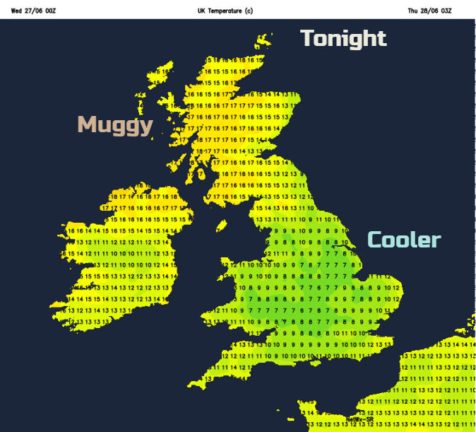
Tonight, fresher air digs in from the North Sea over England, with temperatures dipping away but it remains very warm for Scotland and Northern Ireland overnight with hardly any breeze.
Tomorrow will be a similar day with heat and sunshine, especially in the west. Not as warm but cloudier along eastern counties in the morning but further west 30C is likely, maybe higher Glasgow is showing 31C on Thursday. Eastern Britain low to mid-twenties C.
By Friday the NE wind off the sea will be more noticeable and able to draw in fresher air over more of the north-eastern half of the UK. For the SW half of Britain and Northern Ireland, it stays very warm.
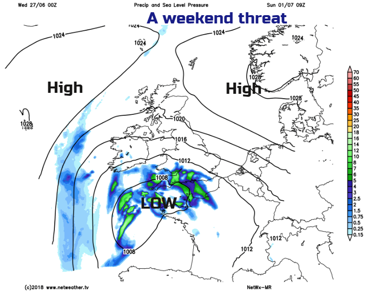
By the weekend, there is still heat around and temperatures well up into the twenties Celsius but the wind off the North Sea becomes more pronounced especially by Sunday. Also, an area of low pressure begins to spin up from the south, introducing instability in the air and the potential for heavy thundery showers. If your app says, rain or thunderstorm don’t take that as a certainty. It shows a risk; it will be worth keeping an eye on the Netweather Radar to see if showers are developing away to the SW as the weekend progresses. If they do, then the band looks like it will fan NE over more of the UK for the new week and Wimbledon does start on Monday, so there has to be some threat of rain. However, if you are desperate for rain, don't rely on these showers. Often the high pressure just quashes the threat or they are well scattered and miss many areas.