


Change is on the way, with low pressure moving in off of the Atlantic from tomorrow to bring a spell of rain and even severe gales in places.
It's been a while since a forecast has included the words 'severe gales' but this one does, as our extended spell of blocked weather finally draws to a close. The change will start to arrive from tomorrow, as low pressure nears from the Atlantic, bringing with it a spell of wind and rain later in the day, lasting into Thursday.
As the animation shows though, it's the north and especially northwest of the country which'll see the bulk of the rain, as it'll rapidly fizzle out as it moves southeast during Thursday. The winds will be strongest in the wetter regions too - with gales, maybe severe gales possible in exposed parts of Ireland (both North and South), Northern and western Scotland, Northern England and perhaps also North Wales.
That's all to come, today keeps the quieter weather coming, and for the bulk of the country, tomorrow will too. For many, it is a cloudy start today, but some are already seeing the sunshine and those breaks in the cloud will spread as the day wears on, to bring some decent spells of warm sunshine quite widely. There is a flipside to that though, as a few showers are liable to be triggered by this afternoon, they'll be isolated but could be on the heavy side should you catch one. Keep an eye on the radar to see where they develop.
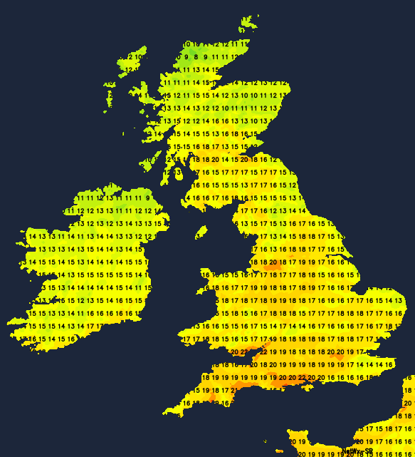
Temperatures today will range from 17-21c typically, cooler close to east and north facing coasts though, where the breeze will be quite noticeable and fresh.
You probably know the overnight drill by now, with the showers dying out and low cloud tending to fill in, but this is the last one just like this for a while anyway. For the eastern and southern half of the UK, tomorrow will play out similarly to today as well, with the cloud breaking, sunny spells developing and a few showers firing up. It'll be a touch warmer than today as well, although the southwest wind will increase into the afternoon.
The main story tomorrow will be in the west and north of the country, with wet, windy weather arriving as low pressure moves closer. The rain will cross into Ireland and the Northwest tip of Scotland during the first part of the morning, with the wind at this point already gusting up around 40mph in exposed spots. By mid-afternoon, those gusts could be up around 50mph, with the rain getting a good way into Ireland, and affecting the northwestern half of Scotland.
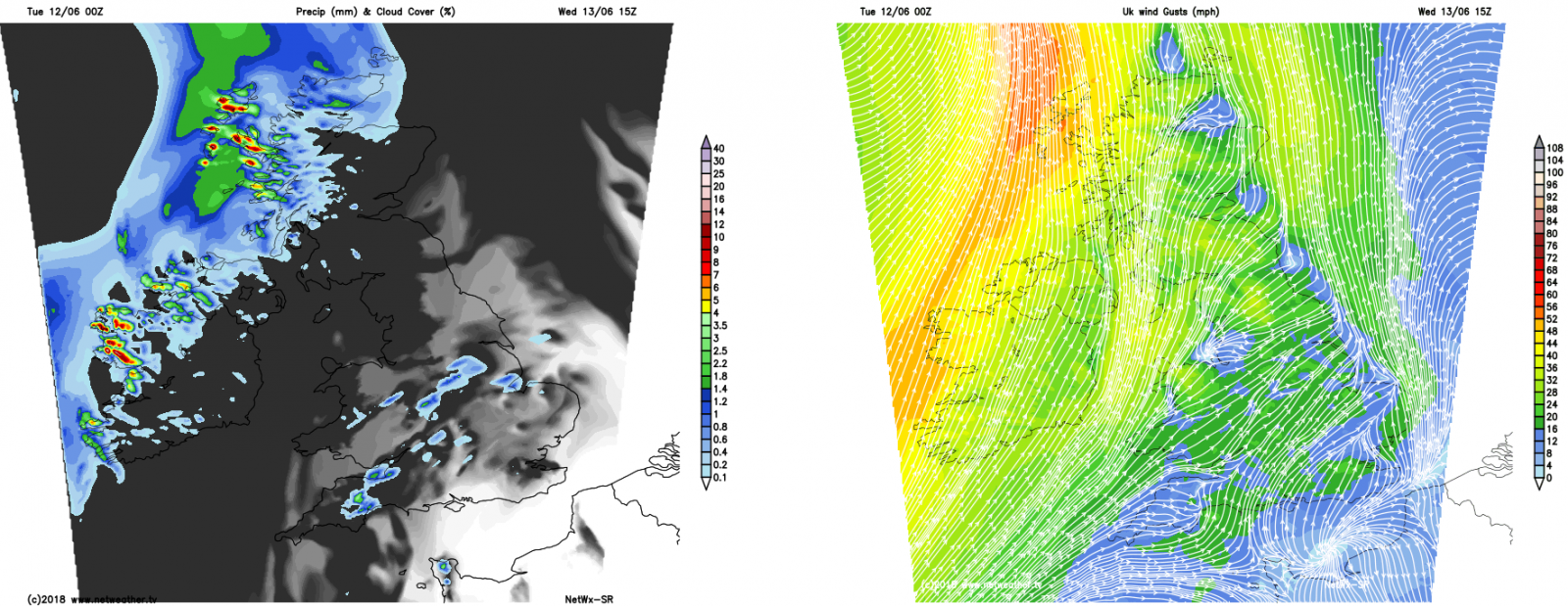
During the evening and overnight, the rain carries on spreading further east and south, and at the same time, the winds will start to peak. Gusts of 60-70mph are likely in exposed parts of Northern Britain and Ireland, which is quite unusual for the time of year and worth bearing in mind if you have to travel. They'll then ease back during Thursday morning.
The rain will also clear southeast during Thursday, with the wind swinging from the southwest into the west behind it. The heavier rain will peter out once it moves away from northwest Britain, with the southeast of England seeing little to no rain as the weather front slides through during the afternoon and evening. Behind it, there'll be sunny spells, but also some showers making their way into the northwest.
Ahead of the rain, eastern, southern and central parts will see highs of 18-22c, but once it's moved through 15-18c will be more like it with a distinctly fresher feel. Overnight lows will then dip quite widely down into single figures.
Friday then picks up where Thursday left off, so sunny spells and showers, with the showers most frequent in the northwest but potentially affecting other northern and also western regions. A nose of high pressure will be moving up toward the south during the day, so some good sunny spells getting going here, where temperatures will rise to 19-23c. Elsewhere, 16-20c.
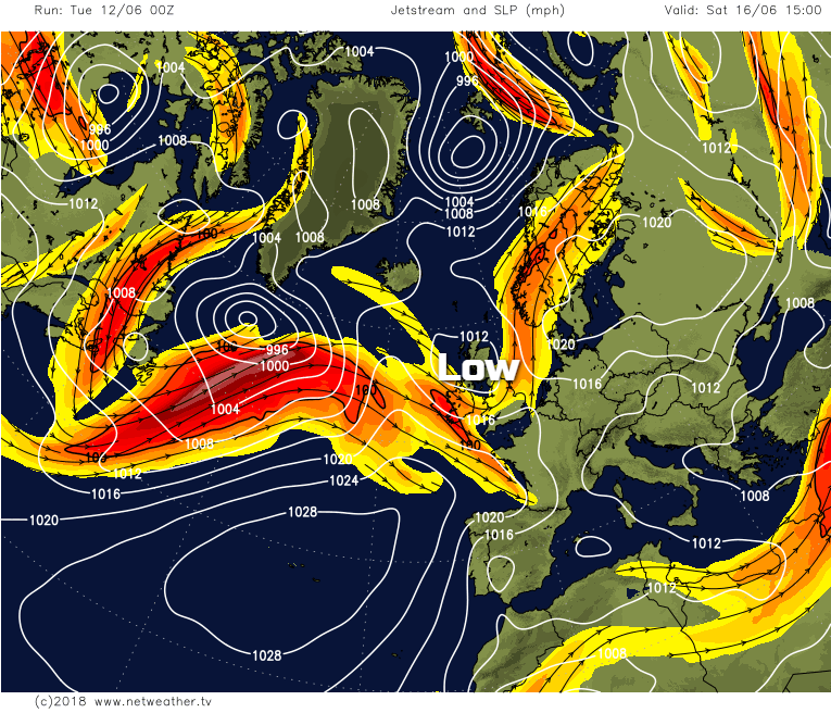
The jet stream will be over us to start the weekend. And that'll help to feed another low our way on Saturday, bringing with it a day of sharp, thundery showers. Between them will be some warm sunshine though. Sunday looks set to see the showers ease in central parts, with some lingering in the east, and a new batch moving into the west.


