Continuing warm and humid into the weekend, some sunshine for many, but also risk of thundery showers in the west.

Thursday brought another warm day, Portmadog saw the highest UK temperature of 27.5C and the warmest day in Wales of the year so far, though sunshine was in short supply in the south where we also saw some showers. These cloudier skies with showers will edge north a little today across England and Wales, allowing more in the way of sunshine across southern areas than we saw yesterday, there will be further showers developing in the far northwest too. The weekend is looking generally dry, warm and sunny but humid for many, though thundery showers will affect more western areas and perhaps the far south in the afternoons.
Early next week continuing in a similar vein, with warm sunny spells and some afternoon showers. Later in the week it looks like turning cooler, cloudier and windier from the west across northern areas - as the jet stream revs up and brings Atlantic low pressure systems brushing the north, with a chance of rain or showers. However, high pressure looks to hold on across the south, bringing mostly dry and warmer weather.

For now, it’s been a dry night for many though humid in the south. There is more in the way of cloud across central areas with a band of showery rain across Wales, central and northern England, while low cloud or haar rolled back in from the North Sea across eastern Scotland and NE England overnight. Otherwise for many it’s a bright or sunny start.

The band of showery rain across central areas will continue for a time, before tending to die out, with most areas staying dry, warm and bright or sunny. However, like yesterday, there will be a risk of heavy and perhaps thundery downpours developing across western Scotland, Ireland and Northern Ireland through the afternoon, perhaps also across the SW of England too. Perhaps staying grey and cool along North Sea coasts of Scotland and NE England.
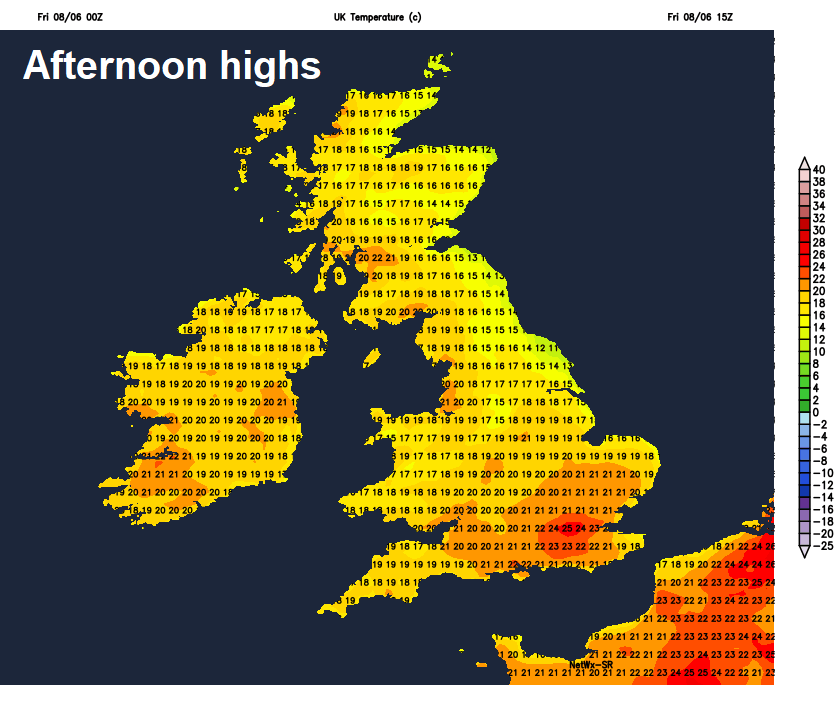
Where the sun comes out, feeling warm, humid in the south too. Temperatures reaching widely reaching 19-22C inland across the UK, cooler around the coasts – where 15-18C is more likely, perhaps 13-15C under the cloudy eastern coasts.
Any heavy and thundery showers across western Scotland and Northern Ireland should fade through the evening, otherwise a fine end to the day leading into a mostly fine, warm and humid night. Clear spells away from eastern coastal counties, where low cloud will return inland from the North Sea.
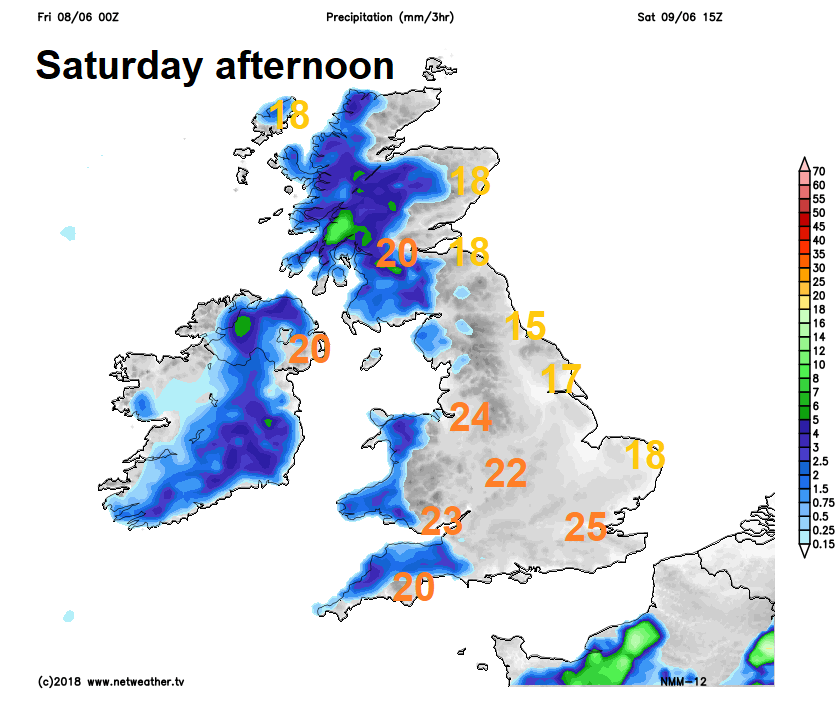
Any low cloud across eastern areas burning back to the coast Saturday morning, then for most it will be another warm, sunny and humid day – temperatures inland reaching the low-to-mid twenties, cooler around the coasts. However, there will be a risk of torrential downpours developing across western Scotland and Northern Ireland, also some isolated showers developing across southern counties of England.
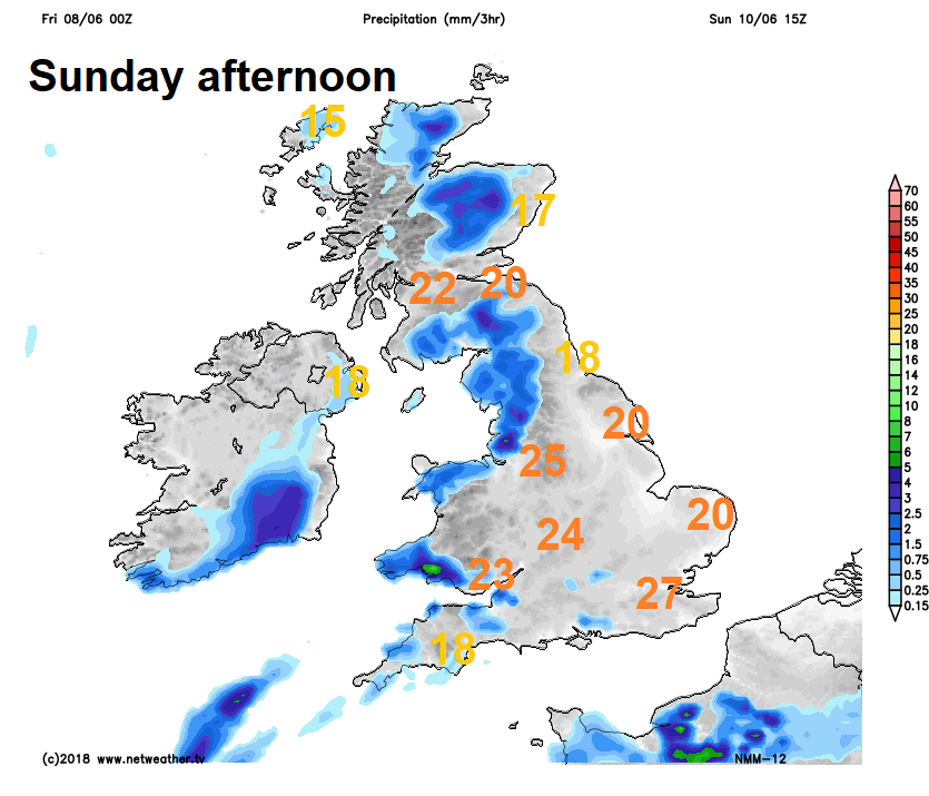
Sunday warm, humid and sunny again for many, but again a risk of thundery downpours developing locally across northern and western areas, but they will be hit-and-miss. Also, a risk of thundery showers perhaps moving in across the far south. Temperatures reaching 20-24C widely inland, perhaps 27C in London area, cooler around coasts.