Heavy downpours and thunderstorms could pop-up just about anywhere today. The showers will ease from the south during the weekend though.
A popcorn showers type of day is on the way for the first day of (meteorological) Summer, with showers and thunderstorms liable to pop-up just about anywhere across the country. Between them, and despite the grey start in many places, there'll be some sunny spells to be had.
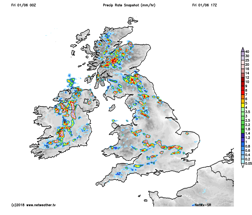
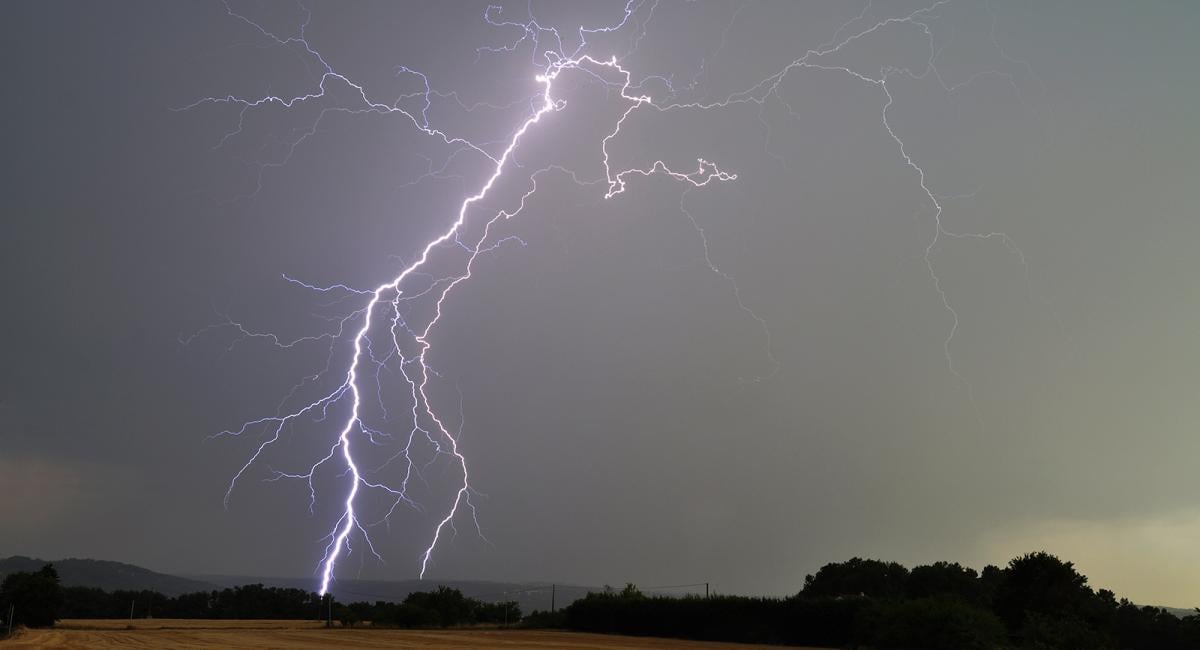
It's going to be another warm, muggy, close feeling day too, with highs reaching up into the low-twenties in many regions. If you do catch one of the showers or storms today, there is going to be some torrential rain, gusty winds and frequent lightning associated with some of them, so more flash-flooding and tricky conditions out and about are likely. The downpours will peak mid-afternoon and into the first part of the evening, before slowly dying back overnight.
We see a bit of a change this weekend, as the showers ease away from the south. For Saturday, it's Scotland and eastern England still in the firing line for the majority of them, and once again they will be torrential with thunderstorms at times. There'll be a scattering of showers still likely in Wales and northern England, but they'll be lighter and far less frequent. Further south, with broken cloud, there'll be some warm sunshine.
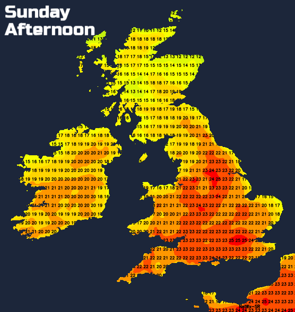
 Sunday sees the drier weather spread further, with just Scotland in the main risk are for some continued sharp showers. Don't rule out the occasional shower close to the coasts in particular for other parts of the country, but in the main, it's looking like being a dry, sunny, warm day with temperatures up into the mid-twenties for England and Wales. A touch cooler in Scotland, and cooler still, with low cloud often affecting eastern coastal parts.
Ahead into next week, the drier pattern continues for the start of the week at least. Monday may well see a fair bit of cloud running in from the east of the country so that the west will be best for sunshine and warmth. Tuesday should see more sunshine for much of the country, although as has so often been the case of late, eastern coasts will be cloudier and cooler at times. On both days there's the chance of an isolated shower here or there, but not on the scale that we've seen this week.
Beyond that, the warm, even very warm weather carries on, with the west and especially northwest often the warmest, sunniest parts of the country with eastern coastal parts often cooler and cloudier. The thundery shower risk does look set to increase again from the south from midweek though.
Don't forget that Michael Fish will be online later today with his weekly forecast, looking in detail at the weather over the weekend and through next week.