More downpours and thunderstorms in places today, with western Scotland again enjoying the best of the sunshine. Tomorrow sees another bout of thundery downpours arriving into the south.
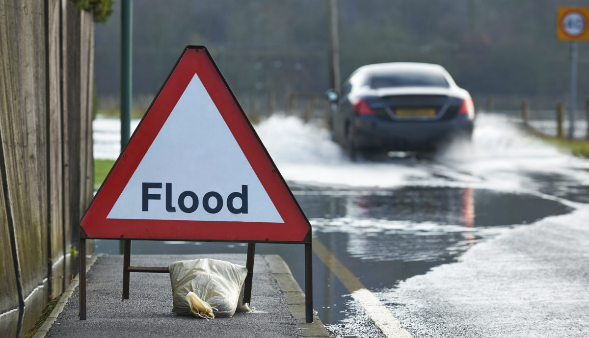
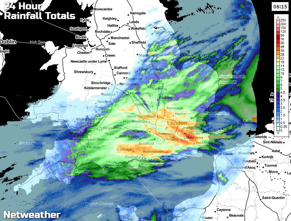
There's more heavy rain around today, following hot on the heels of another serious soaking, this time for parts of southeast and central Southern England, where 60mm+ fell in places yesterday. The average rainfall for the whole of May in that part of the country is closer to 50mm.
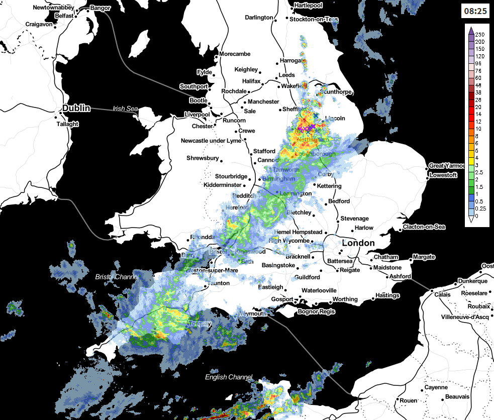
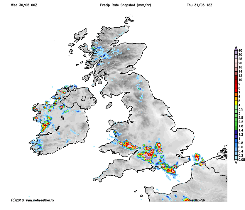
Today, the wet weather is on the move further northwest, with more thunderstorms bringing plenty of rain in a short space of time which may well lead to flash-flooding. The main bulk of the rain is in a line from southwest England up through the Midlands and into eastern England currently and will continue to edge further north and west through the day. It's in parts of Lincolnshire and Yorkshire where the heaviest bursts are liable to be through the morning, with some potent downpours and thunderstorms.
As the rain continues on its path, during the rest of the day, it will tend to fragment, but that doesn't rule out some further downpours as it moves across Wales and Northern England later. Elsewhere, and much like the last few days, northwest is best with the best of the sunshine and warmth across western Scotland again. To the south of the rain, there'll be a lot of cloud but with a few breaks coming through this afternoon, along with the odd, isolated shower.
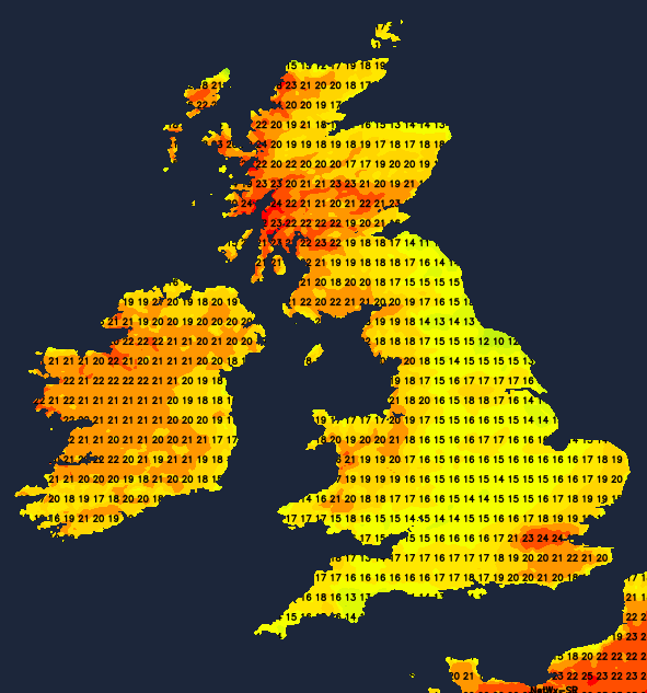
Temperatures today will struggle under the rain, and also along the east coast where that east wind will make it feel quite chill once again. Elsewhere 19-22c will be pretty typical, with western Scotland leading the pack at 24-26c.
This evening and overnight, the main bulk of the rain will ease back, with just some bits and pieces making it up into Scotland - even the west won't be immune from a sprinkling at least, the first rain here for a while.
Tomorrow will start grey for a good part of the UK; the cloud should break up, away from those prone eastern coasts at least. There'll be a few showers affecting northern England and Scotland, but in the main, it's another dry, increasingly bright, sunny day. Further south, there'll be some more intense downpours and thunderstorms to look out for, these developing from the south through the day, working their way up into the Midlands and Wales as well. As ever, not all will catch a shower or a storm, but affected parts are liable to see more flash-flooding, along with frequent lightning.
Friday still doesn't bring a respite, with further heavy, thundery showers expected, virtually countrywide. In between them, there'll be some warm, sunny spells. Temperatures will peak into the mid-twenties again in the northwest, elsewhere 19-23c.
Then into the weekend, we finally see a slight change, with the shower risk migrating further north, giving the southern half of the country a bit of a breather. There'll be some decent sunny spells here - especially on Sunday, with just the outside chance of an isolated shower. From northern England northward, it's a different story, with more cloud and an increased likelihood of seeing a shower.