
Plenty of cloud to start the day, away from favoured western shores where the sunshine and heat continues. A brisk NE Wind will bring a fresher feel for some today. Thunderstorm risk continues.
It maybe back to work after a long weekend or still on half term but there is still plenty of warmth across the UK, away from the breeze off the North Sea.
Cumbria, Hampshire and the Scottish Highlands saw temperatures over 27C yesterday (81F) and we could see similar today for a few western spots. There is a cool NE wind digging further inland for eastern and central Britain, affecting the temperatures and bringing more low cloud.
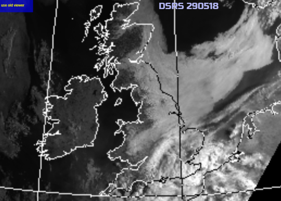
More parts have a grey, murky start this morning, damp for some. The satellite picture shows the extent of the cloud that has drifted in from the North Sea with a whole store still out over the water. Western parts of Britain and much of Ireland appear darker, no cloud (although a bit of early mist and fog in places) and so are bathed in sunshine once more and hotting up.
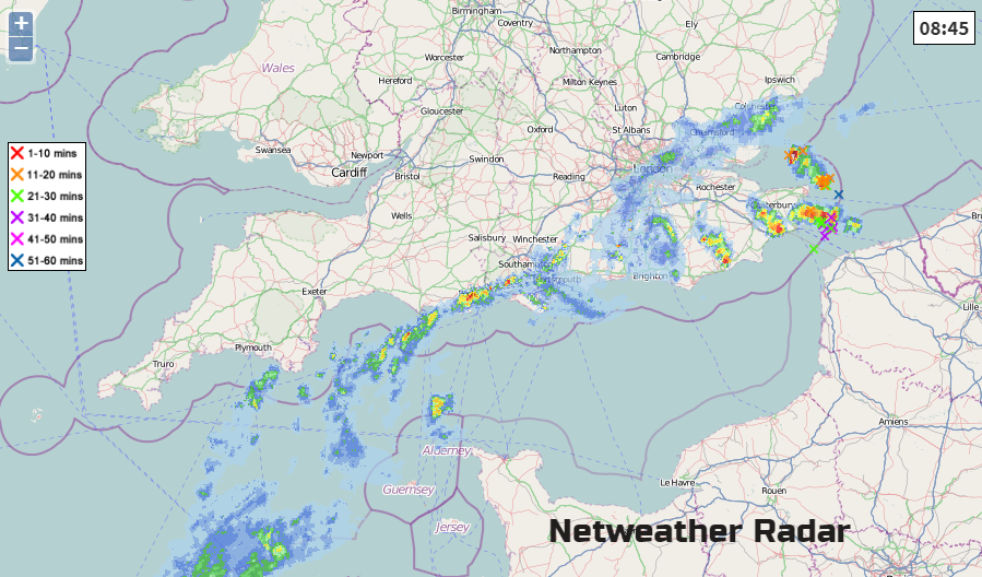
Click Radar image for uptodate data. There has been rain this morning in the far SE of England, a distinct band and swirl with sferics (lightning strikes) in the southern North Sea. High pressure to the north of the UK wanders off to Scandinavia as a low pressure remains in place to the south. This will continue to rotate cloud and showers in from the east with the downpours pepping up in the day as they move westwards and temperatures rise. This leads to a more mixed few days still with some areas having fine, sunny and very warm weather mainly in the west but others becoming grey with a higher chance of showers.
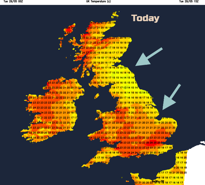
Western Scotland will again see low to mid 20s C. Where the cloud breaks up there is the potential for England and Wales to reach well into the 20s too but a fresher feel. 22C, 72 F for Northern Ireland.
Northeast England into Yorkshire will struggle with a feed of low cloud and the heavy showers in the far south will move westwards this morning. At risk, anywhere south of the Watford Gap. That feed of cooler air moves over more of Britain tonight, if the heat is all too much for you and heavy showers lurk along the south coast of England. Hard to pinpoint where will get rain but Devon and Cornwall look quite likely.
Midweek
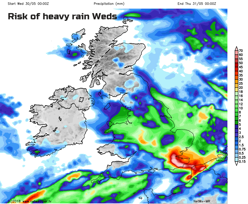
By Wednesday the winds back to a northerly and bands of cloud and showery rain sweep in from the east. Again, there will be heavy and thundery downpours, but this rain will be more widespread, and temperatures will be subdued for more parts. Just the far west of Britain and still Northern Ireland having fine, sunny and warm conditions. By the afternoon there will be thunderstorms to watch for in a few parts of England and Wales, again with the risk of localised flooding and lightning.
Slightly fresher air edges in from the SW, so not quite as hot and humid here. The weather picture is quite messy by Thursday with more cloud, showery rain, the risk of thunderstorms and NW Scotland, northern England down to London still warm and humid with lighter winds.
To watch this week, the humidity and UV values once the low cloud breaks. The risk of heavy thundery downpours with flooding and lightning issues. That the fine detail of the forecast this week is hard to pin down, whether that is where the low cloud will retreat to, or where will get a heavy thundery shower beyond nowcasting on the radar.


