Bit of a dip in the temperatures midweek with a band of patchy rain. Pressure is rising, and the warmth will return ready for the weekend with UK sunshine.
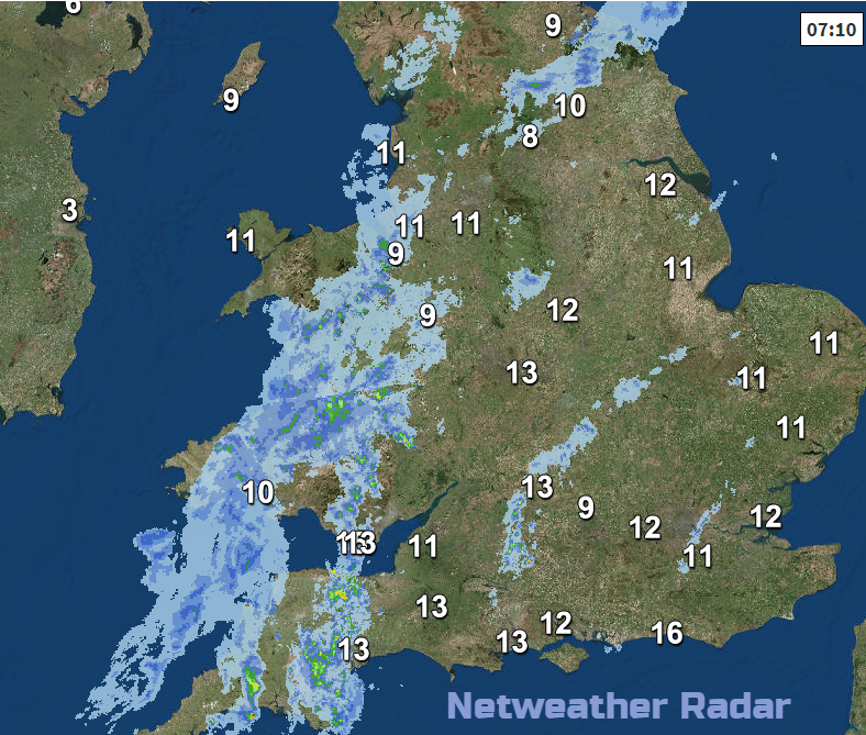
We have a very slow moving cold front which is still bringing patchy light rain as it trundles southwards with brisk north winds. This was over Northern Ireland and Scotland yesterday and will pivot over Wales, the Midlands and southwest England today. This band of rain and cloud is set against an area of high pressure which will bring the UK plenty of fine weather over the next few days and eventually return the warmth. However, today will be noticeably cooler with temperatures of only 12 to 15, higher for southern England.
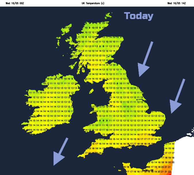
The high pressure is building in from the NW, so there will be very light winds for Northern Ireland and Scotland. Further south a brisk NE wind will make it feel even cooler. Cool air is being drawn around the top of the high, as the far south manages to stay a bit more sheltered and reach 17C. This cooler feel to things will last for the next few days before we pick up a warmer SW flow and temperatures rise at the weekend.
There will be a lot of fine, dry even sunny weather within the high pressure, but Atlantic weather fronts begin to push in from the west, piling up in a queue for Sunday.
Today
Sunshine for Scotland and Northern Ireland and this afternoon for northern England. The frontal cloud will break and lift further south especially for eastern areas. Wales looks to keep more cloud as will parts of the West Country.
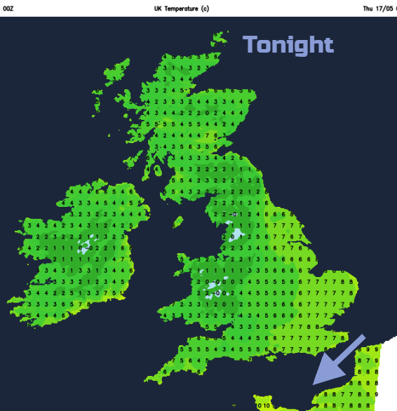
Tonight
It will be clear, calm and chilly.
Thursday and Friday are mostly calm, fine, with blue skies and sunshine. Still not that warm but the sun is strong and UV levels will be moderate. We are in the transition stage with pollen from tree pollen season to grass pollen. So moderate oak pollen levels and the first signs of grass pollen in the south.
Temperatures remain in the mid-teens for many, high teens for some but still a brisk NE wind catching SE Britain on Thursday.
As the high drifts eastwards on Friday, there will be lighter winds for London and the Home counties and cloudy, damp conditions reaching the Western Isles, the first hints of incoming unsettled weather.
Weekend
Saturday looks lovely. Plenty of sunshine, light winds for much of Britain and also warmer. Temperatures will be widely in the high teens with some spots into the low twenties Celsius. A brisk southerly wind will pickup for Northern Ireland and much of Scotland so becoming blustery.
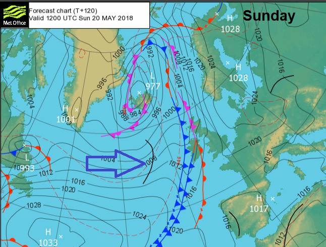
The models diverge for Sunday; will the fronts to the NW stall even retrograde back into the Atlantic, leaving Sunday fine for most, or will the fronts make progress over the NW half of the UK but fade against the high.
For much of England and Wales it looks like another fine, sunny day which could be even warmer, into the mid-twenties with a light SE wind. Northern Ireland and western Scotland do look at risk of more cloud and outbreaks of rain, so lower temperatures but not as windy. For the rest of Scotland and northern England there is a good chance of it staying fine.
Next week, the warmth looks to linger over Britain, with still a good deal of fine weather but the threat of scattered hefty downpours.