Lots of sunny, warm weather on the way for the UK this week, we will have a front bringing some rain, moving through on Tuesday and Wednesday though.
As Nick said in his update yesterday morning, west was definitely best to start the weekend, with a good part of the eastern half of the country getting a pretty decent soaking. That's still ongoing as well, mostly over Scotland but it's all set to clear away by the end of the afternoon to leave virtually everyone with a dry, bright end to the weekend. Fine, sunny weather will often be the theme for the upcoming week too.
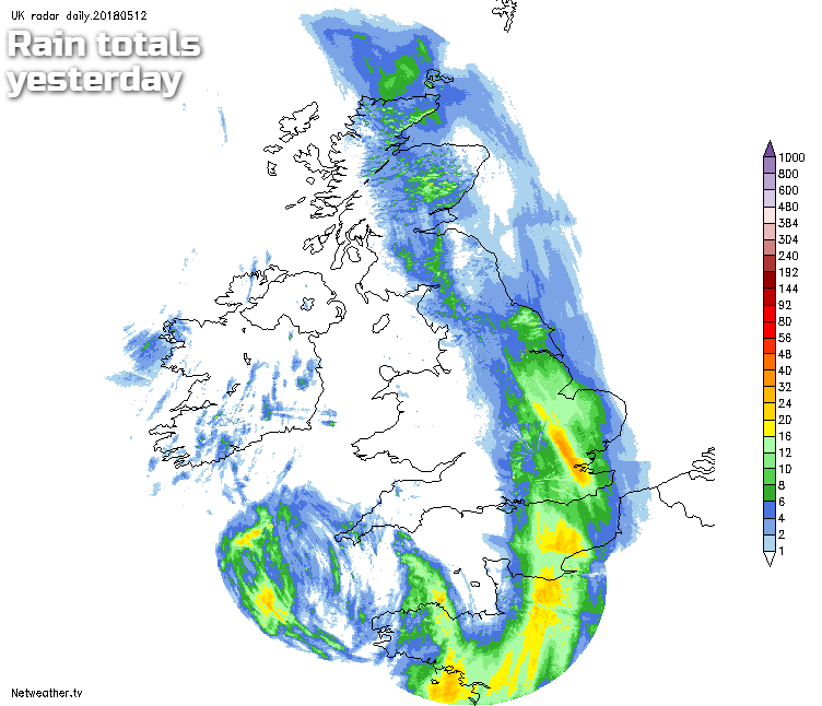
The wet weather will take it's time to clear northeast out of Scotland today though, with the far northeast perhaps keeping the rain going until much later this evening. There's also some showery rain still affecting the southeast of England, along with East Anglia, but that should move away fairly soon this morning. Out west, it's an entirely different picture with lots of sunshine to start that day, and that'll continue throughout. The sunnier skies will spread east as the day wears on, but eastern fringes are likely to cling on to plenty of cloud.
In the sunshine, it should feel pleasantly warm today, with highs of 14-18c, not so far off of the norm for the time of year. There may be a few showers here and there through the afternoon to spoil the mood a bit, but they should be very few and far between.
With clear skies overnight, it's going to be a chilly one with a touch of frost in places, especially western and central regions. So if you do have delicate plants or crops growing, you may need to protect them. Further east there'll be a bit more cloud and maybe even some showers moving into the southeast during the early hours and into Monday morning.
For most though, the week starts on a dry, bright note. There'll be some cloud drifting into both the west and the east of the country, and those showers in the east may take a while to ease off. But in between, after a chilly start, it'll be a warm day with temperatures creeping up a touch higher than today - we may even reach 20c or so.
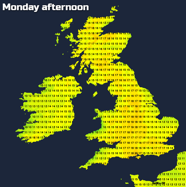
Tuesday then brings a very similar day for a good part of England and Wales, with temperatures by this point perhaps edging up over 20c with plenty of sunshine. A cold front will be arriving onto the scene from the northwest through the day though, bringing with it some heavy bursts of rain - especially across the west of Scotland. The front will weaken dramatically as it moves further southeast during the second half of the day and into Wednesday so that by the time it crosses the southern half of the UK, it'll mostly just be a band of cloud. But, what it will do is introduce cooler temperatures behind it. On Tuesday, highs of 21-23c are likely, by Wednesday it'll be more like 13-16c.
As we finish up the week, we'll start to lose the chillier air which arrived behind the front on Tuesday and Wednesday, with some increasingly warm sunshine likely. Thursday will see highs mostly peaking into the mid-high teens, then Friday and into the weekend could see them heading back up into the low twenties quite widely. Temperatures will dip away overnight though, with the risk of further frost in places.