After a very soggy Monday, SE Britain is back in the sunshine and the rain is coming off the Atlantic. A midweek chill then warming up for long weekend.
Back to the usual weather service today 1st of May, frontal systems feeding in from the Atlantic. And it is still looking warmer and more settled for the long weekend.
Yesterday, Glasgow nearly reached 15C with 14 hours of sunshine whereas Goudhurst in Kent managed a paltry 5.5C as a maximum and villages nearby recorded nearly 40mm of rain. A truly grim Monday for SE England and East Anglia.
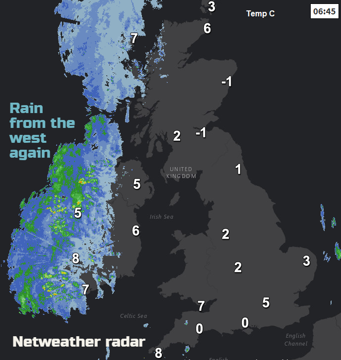
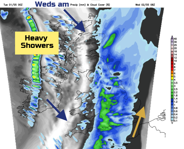
All change for today. It’s been clear overnight for Britain and so chilly but with more cloud for Ireland. The rain is already reaching Fermanagh, Tyrone and Derry. Also, across the Western Isles and damping the west coast of mainland Scotland. The rain will edge across the rest of Northern Ireland and the Irish Sea this morning with a freshening S to SW wind. In the sunshine ahead of the rain temperatures will reach 12 to 15C and it will be a pleasant day. The wind will pick up and a few showery bits will appear ahead of the main rain band.
Through the evening and overnight the rain clears from Ireland and with heavier bursts, moves across Scotland, NW England, Wales and SW England. Along western coasts the SW winds will be strong before they veer to a colder NW.
So, another wet, cloudy start for England but mild enough. This rain band will be moving SE’wards but still a fair wet spell midweek. Behind the frontal rain will be clear skies, with hefty showers, including hail and thundery. There will; be a decent dry slot in between with sunny spells. A chill in the air and a cold wind, so temperatures of only 8 to 12C.
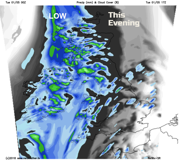
The rain band will finally clear away from the Thames by Wednesday evening. This leaves another clear and cold night with pressure beginning to build in from the SW
Thursday looks less cold with showers for the NW and a band of rain from the west later. For many, it will be a fair day.
High pressure does take hold slowly for the Bank Holiday weekend. North-western parts of the UK are more likely to see more cloud with damp, blustery weather. There will be a fair amount of cloud flowing in from the west. For much of England and Wales, there will be plenty of fine weather with sunshine, especially by Sunday. For Northern Ireland and Scotland, it’s a bit more mixed.
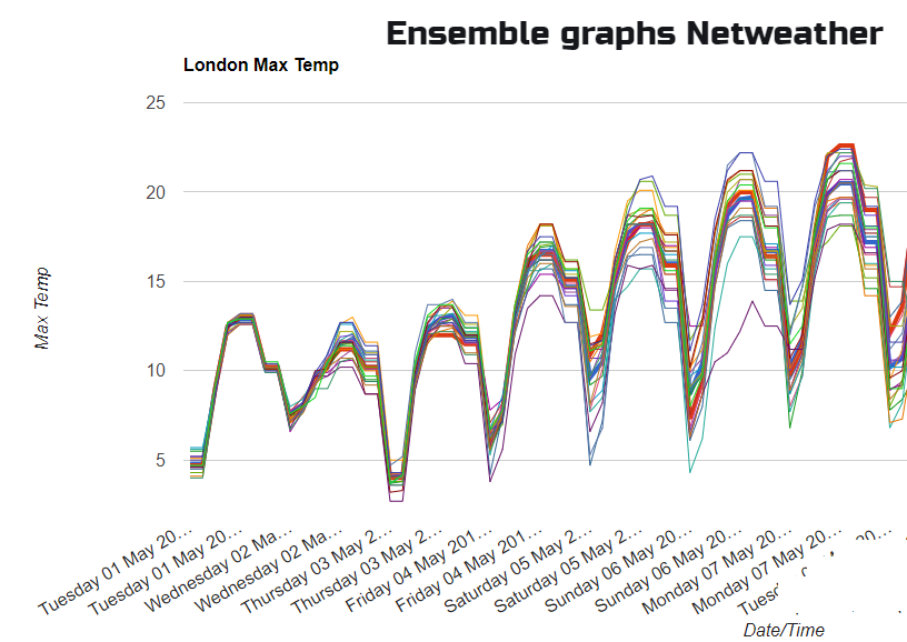
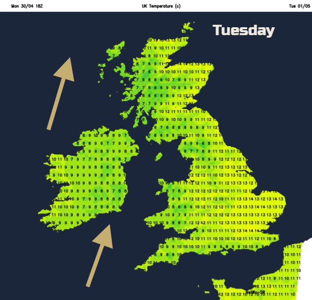
Everywhere will be warmer. Temperatures in the high teens, low twenties, maybe even mid 20sC . The fine weather and warmth should last for southern Britain on Monday, further north there is a front to keep an eye on. It’s never simple for a Bank Holiday forecast but at least there is hope for warmth.