Grey & murky for many today & tomorrow, some rain around too. Warmer & sunnier from the weekend. We could see 24-25C next week.
The longer term outlook is of an improving picture of turning warmer, drier and sunnier from the weekend and into next week, as we import warmer and drier air from southern Europe, by the middle of next week we could see temperatures reach 25C. But in the shorter term, easterly winds off a rather cold North Sea will continue to bring misty and murky conditions with some patchy rain or drizzle in places. Yesterday temperatures only reach 6C under leaden skies across eastern areas of England with the onshore easterly breeze off the North Sea which is unsually cold at around 5C. Though where we have seen some sunshine in the far south and west -temperatures have lifted into the teens.
Thursday dawns as another misty and murky morning for many away from the far south and far northwest, where there are clearer skies. Low cloud or extensive hill and coastal fog across central and eastern areas bringing some poor visibility, so it may be worth leaving a little extra time for the morning commute here. There is also some patchy light rain or drizzle across central parts of England and Northern Ireland, but for many it’s a dry if dull start this morning.
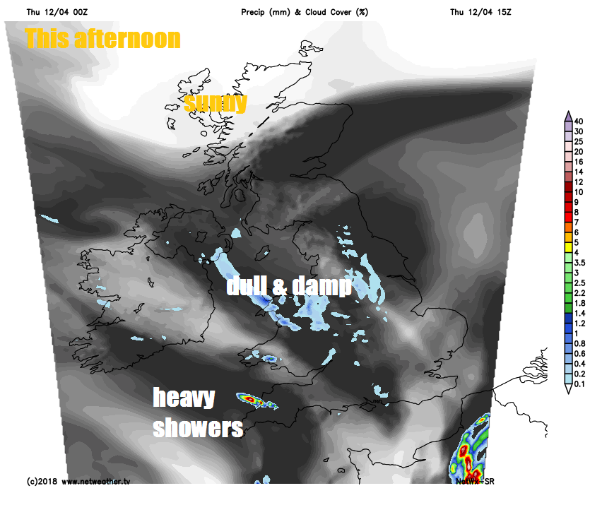
Staying cloudy across many areas for the rest of the day, with mist or fog over hills and eastern coasts along with some patchy light rain or drizzle for parts of Wales, central and northern England – along with eastern Scotland. Most will stay dry today though and there will be some breaks in the cloud across the far south and southwest of England, west Wales and western Scotland – allowing some sunshine, which may trigger a few sharp showers across Devon and Cornwall. Northern Ireland likely staying grey and drizzly in places with the breeze off the Irish Sea.
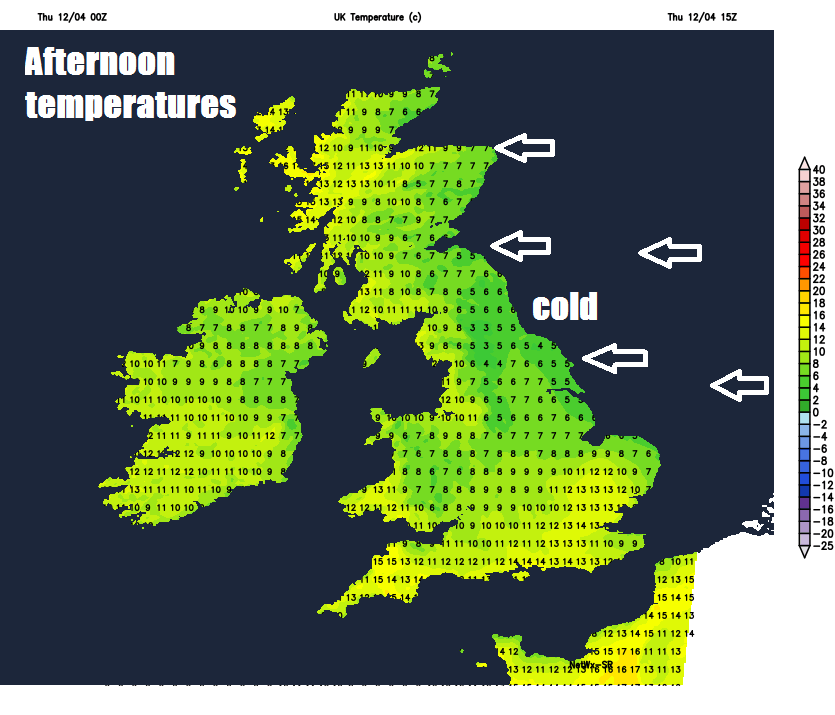
Temperatures could reach 15C across western Scotland, 12-14C across the far south and west further south, 7-10C under the cloud inland and yet again only 6-7C along North Sea coasts.
Not a great deal of change as we head into the evening and overnight, central, northern and western areas generally cloudy with some patchy rain or drizzle, more organised rain coming in across NE England and eastern Scotland. Clearer spells in the south, but a risk of some heavy and perhaps thundery showers spreading up from France across SE England initially, before developing or spreading up across the Midlands and eastern England through the night.
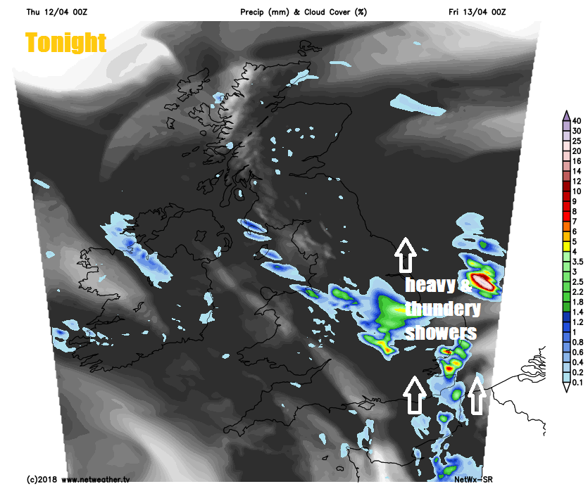
Friday seeing outbreaks of rain, locally heavy and thundery, over the Midlands, northern and eastern England and eastern Scotland clearing northwest through the morning. Drier conditions with warm sunny spells developing across southern and eastern England into the afternoon. Cloudy across the west with some patchy rain, cloudy for Scotland, with rain slow to clear the north through the day – where there will be a cold southeasterly wind. Temperatures reaching 16-17C across SE England and East Anglia, 12-14C elsewhere across England and Wales, 9-10C across Scotland and N. Ireland, though perhaps only 7C across east coast of Scotland.
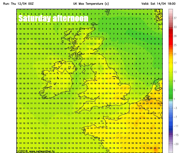
The winds switch direction over the weekend, we lose the easterly winds off the cold North Sea and pick up a southerly wind, which for many of us, especially North Sea coasts, will mean it will warm up. Although for many it will stay dry and bright or sunny on Saturday, the warmth will trigger some heavy showers across central and southern areas. Perhaps cloudier across the northeast, with some rain later grazing the coast. Sunday’s looking dry and bright in the east in the morning cloudier in the afternoon, cloudy with patchy rain arriving in the west. Saturday perhaps the warmest day of the weekend, with temperatures reaching 17-19C towards eastern England, low to mid teens elsewhere. Sunday warmest in the east, where we could see the mid-teens with some sunshine.
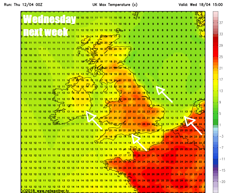
After perhaps a cloudy and damp start on Monday, an improving picture of drier conditions and increasing sunshine for the rest of the day. Tuesday and Wednesday looking predominantly dry, settled and sunny, as high pressure builds close to the east, with southerly flow sending temperatures to around 19-20C across eastern England in the sunshine on Tuesday, then on Wednesday we could see 20-22C as far north as Scotland, perhaps 23-25C across eastern England. However it will be cloudier with some rain across Ireland and the far west.